On Sun, Dec 29, 2019 at 8:02 AM Alexander Audet <alexander.c.audet@xxxxxxxxx> wrote:
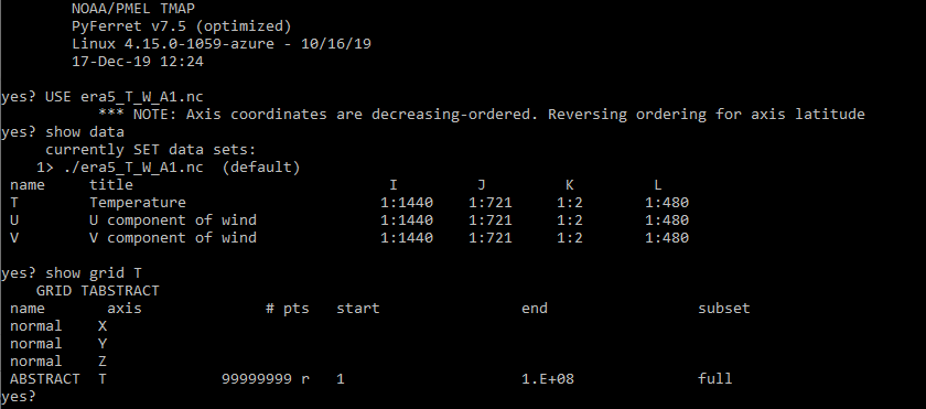
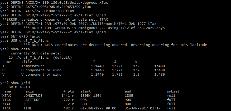
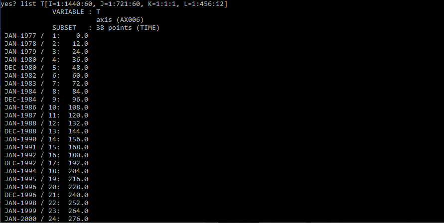
Hello,I recently tried downloading and using portions of ERA5. However, it appears that ferret only recognizes ERA5 as a time series instead of as 4D data.I have experimented a little bit with show grid and even setting a grid. This has revealed that while Showing the data suggests that there is data in 4 dimensions, showing the grid for one of the data variables shows that the grid is abstract and entirely in the T dimension.Setting a grid then use(ing) the dataset seems to give it a grid structure, but when I try to list a subset of the dataset (doesn't allow me to list the whole dataset) the Lat-Long coordinate spaces on the grid don't seem to have data (the data points listed seem to only be listed with time).I both tried downloading directly from the Copernicus Climate Data Store and importing the data into my Windows 10 bash Ubuntu which created a file with a .nc extension, and downloading the data using cdsapi (Climate Data Store Application Program Interface) to download it directly into my bash environment. The second method gave me product with a .netcdf extension. Except for some issues getting all the desired variables using the second method, both products acted identically in terms of the problem outlined above.Thank you!Alexander Audet