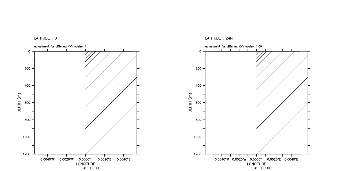
I'm testing how Ferret scales vector components when the
horizontal and verital axes use different units. I'm doing
this just to feel good. I'm pasting the code I'm using.
I'm testing the most common case: the horizontal axis is
longitude (or latitude) in degrees and the vertical axis is
depth in meters. For simplicity I plot (u,w) vectors with u
= w = 1 m/s everywhere.
Sure enough, Ferret does the right thing. That is, when
the geographical sizes of the vertical and horizontal axes
are the same (for example both 1200 m) and the aspect ratio
of the paper (screen) coordinates is 1:1, the (u,w) vectors
make exactly a 45-degree angle from the horizontal.
Perhaps does Ferret always assumes equator when scaling
length (meters) to degrees?
FERRET v6.82
Darwin 9.8.0 -
08/06/12
on Mac high Sierra.
Best regards,
Ryo
! Just test Ferret if it scales (u,w) correctly
set mode grat:dash
define view/axes/x=0.1:0.7/y=0.1:0.7 myview
let depdata = {0, 10, 20, 40, 80, 120, 180, 300, 450,
650, 900, 1200}
let totaldepth = 1200
let halfdepth = 600
define axis/x=-1:50:1/units=degrees_east xax
define axis/y=-40:40:2/units=degrees_north yax
define axis/depth/z/units=meters/from_data zax = depdata
let u = 1 + 0*(x[gx=xax] + y[gy=yax] + z[gz=zax])
let w = 1 + 0*(x[gx=xax] + y[gy=yax] + z[gz=zax])
!let lat1 = 0
let lat1 = 24
let rad_earth = 6371.e3 ! [m]
let pi = 4*atan(1)
let x_of_deg = rad_earth * cos(pi * lat1 / 180) * pi /
180
let deg_of_x = 1 / x_of_deg
let dellon = deg_of_x * halfdepth ! m -> degE
set view myview
vector/aspect/xskip=1/vlimits=0:`totaldepth`\
/hlimits=`(-1)*dellon`:`dellon`\
/length=0.1/y=`lat1` u,w
exit/script