On Mon, Jan 8, 2018 at 7:26 AM, saurabh rathore <rohitsrb2020@xxxxxxxxx> wrote:
Dear Ferreters,I am using the attached script but facing several issues1) viewport command is not working2) ppl shakey command is not working3) how to put latitude and longitudes on the map4) I want to put dots over the significant locations but it is showing error as **ERROR: dimensions improperly specified: unequal line lengths:
First _expression_ has 1260 points.
_expression_ 4 has 21 points:
"plot/vs/OVER/sym=21/size=0.02 p95*mp_mask, p95*mp_mask, x_page, y_page"go multi_view 3,2,.43,0.070,0.052,.26,.064,0.058,a use file1.nc!!! file containing the variable !!!!! use file2.nc!!! file containing the probability !!!!
let ohcg1=ohc_new[d=1]
let sig=pvalue[d=2]
let p=t[gt=ohcg1]
let q=ohcg1
go regresst
let nx = `pvalue,return=isize`
let ny = `pvalue,return=jsize`
let lon = x[gx=trend,i=1:`nx`:6] + 0*y[gy=trend,j=1:`ny`:6]
let lat = 0*x[gx=trend,i=1:`nx`:6] + y[gy=trend,j=1:`ny`:6]
let p95 = if pvalue[i=1:`nx`:6,j=1:`ny`:6] gt .95 then 1 else 0
set mem/size=3000
set viewport a11
SET REGION/X=19.5:380.5/Y=-63:63
GO mp_mcbryde_fpp
SET GRID slope; GO mp_aspect
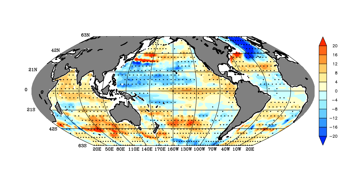
fill/NOLAB/NOAX/NOKEY/lev=(-inf)(-20,20,4)(inf)/pal=blue_ orange slope*12, x_page, y_page
ppl shakey 1, 0, 0.14, , 6, 6, -2.8, 3.8, .29, .50
GO mp_graticule 20 380 30 -63 63 `126/6` 1
GO mp_fland 120 gray overlay detailed
GO mp_land thick
GO mp_grid p95
plot/vs/OVER/sym=21/size=0.02 p95*mp_mask, p95*mp_mask, x_page, y_pageThanks in advance for valuable suggestions.regards, saurabh
--REGARDSSaurabh RathoreResearch Scholar (PhD.)Centre For Oceans, Rivers, Atmosphere & Land Science TechnologyIndian Institute Of Technology, Kharagpurcontact :- 91- 8345984434
--
Saurabh Rathore
Research Scholar (PhD.)
Centre For Oceans, Rivers, Atmosphere & Land Science Technology
Indian Institute Of Technology, Kharagpur
contact :- 91- 8345984434