There are tools for translating files, which might be an even better solution. Looking around the Unidata NetCDF site, here is a list of tools that work with netCDF data.
http://www.unidata.ucar.edu/software/netcdf/software.html
This software,
http://www.unidata.ucar.edu/software/netcdf/software.html#GDAL
has a tool to translate arcAscii files to netCDF. I do not have this on my system and have not tried it, but it might be worth looking at. The link from the Unidata software page is out of date. It should be http://www.gdal.org/gdal_translate.html
In any case, once you have the data in a netCDF file you can use
yes? USE/order=x-y treecover.nc
to reverse the Y coordinates
Ansley
On 10/21/2011 12:14 PM, Sam Rabin wrote:
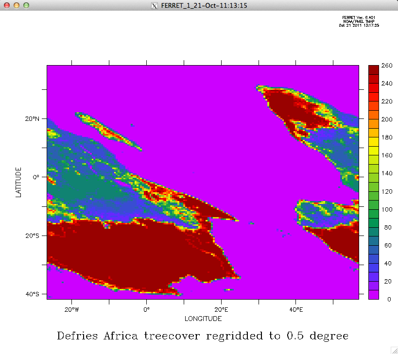
I need to use the AVHRR tree cover classification data available at http://glcf.umd.edu/data/treecover/data.shtml, and so I downloaded the ASCII file for each continent. I have tried all day to import them, but the best I've been able to do is a severely distorted map. The good news is that all continents seem to be distorted the same way. I'll use Africa as an example (ftp://ftp.glcf.umd.edu/glcf/Continuous_Fields_Tree_Cover/Africa/af-latlong-treecover/af-latlong-treecover.grd.gz).
Here is the header to the Africa ASCII file:ncols 9955nrows 9561xllcorner -26.375000000000yllcorner -41.500000000000cellsize 0.008333333333NODATA_value −9999
(It looks like they actually use 0 instead of −9999 as a missing value.)
Here is the script I used for the Africa file… I calculated the endpoints of the axes as endpoint = beginning + (#cells)*0.008333. (You may need to increase available memory.)
define axis/X=26.375W:56.584E:0.0083333333/unit=degree xlongdefine axis/Y=41.5S:38.175N:0.0083333333/unit=degree ylatdefine grid/X=xlong/Y=ylat defries_africa_gridfile/grid=defries_africa_grid/var="TREECOVER"/columns=9955/skip=6 af-latlong-treecover.grddefine axis/X=26.375W:56.584E:0.5/unit=degree xlong2define axis/Y=41.5S:38.175N:0.5/unit=degree ylat2define grid/X=xlong2/Y=ylat2 defries_af_05griddefine variable/title="Defries Africa treecover regridded to 0.5 degree" africa = treecover[d=1,g=defries_af_05grid@ave]save/clobber/file="treecover.nc" africa
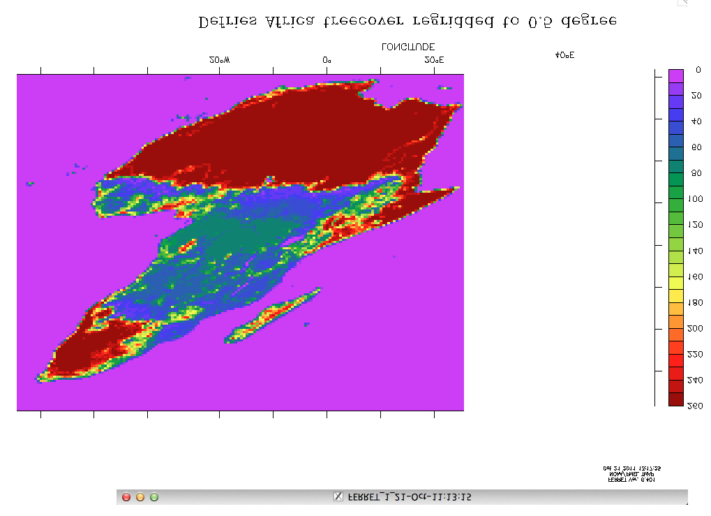
The result is attached (africa_1.jpg). Playing around with the image reveals that (a) the left border should actually be around where it says 30ºE (i.e., if you cut out everything right of that and paste it onto the left side of what remains, you get something that looks better), (b) it should be flipped vertically (i.e., over the horizontal axis), and [c] that even doing those transformations, it's still pretty distorted (see africa_2.jpg, attached).
I've tried several different permutations — including adding order=yx into the fourth command — but they all ended up looking worse. This may be an issue with the dataset, but I'm more willing to believe the error lies with this end-user.
Thanks in advance.
Sam Rabin
Graduate student
Princeton University
Ecology & Evolutionary Biology