Carlos Román Cascón wrote:
> I have a question. I have a output from WRF, I would like to plot
> "qcloud", x-axis with longitude from -4ºW to -5ºW (points 50:70 of the
> grid for example). I want to put height in y-axis and I want a fixed
> latitude of 40ºN (point 60),
>
> But I would also like to plot the topography below this plot..
That's a fairly tricky combination, but it can be done.
1) height of the model levels in m is computed as (PH+PHB)/9.81
2) use a 3-argument shade or fill command to make your plot, e.g.
let height=(PH+PHB)/9.81
shade qcloud, xlong, height
3) set a region to limit yourself to the right x and y coordinates.
Unless you regrid the data, you'll have to select a single model
"row", which doesn't have a true constant latitude. For example
set region /i=50:70
set region /j=60
4) also set a region for the time axis if you have multiple output
time steps.
set region /l=3
5) topography is in the "hgt" variable, which you can overlay with a
plot (line) command. Check out the /vs option to plot hgt versus
longitude.
I would recommend using a postprocessing tool to regrid your data to a
lat/lon grid, it will make WRF output a lot easier to handle in
Ferret. Otherwise always use the 3 argument shade/fill commands and
the 4 argument vector command to pass the xlong and xlat fields as
coordinates.
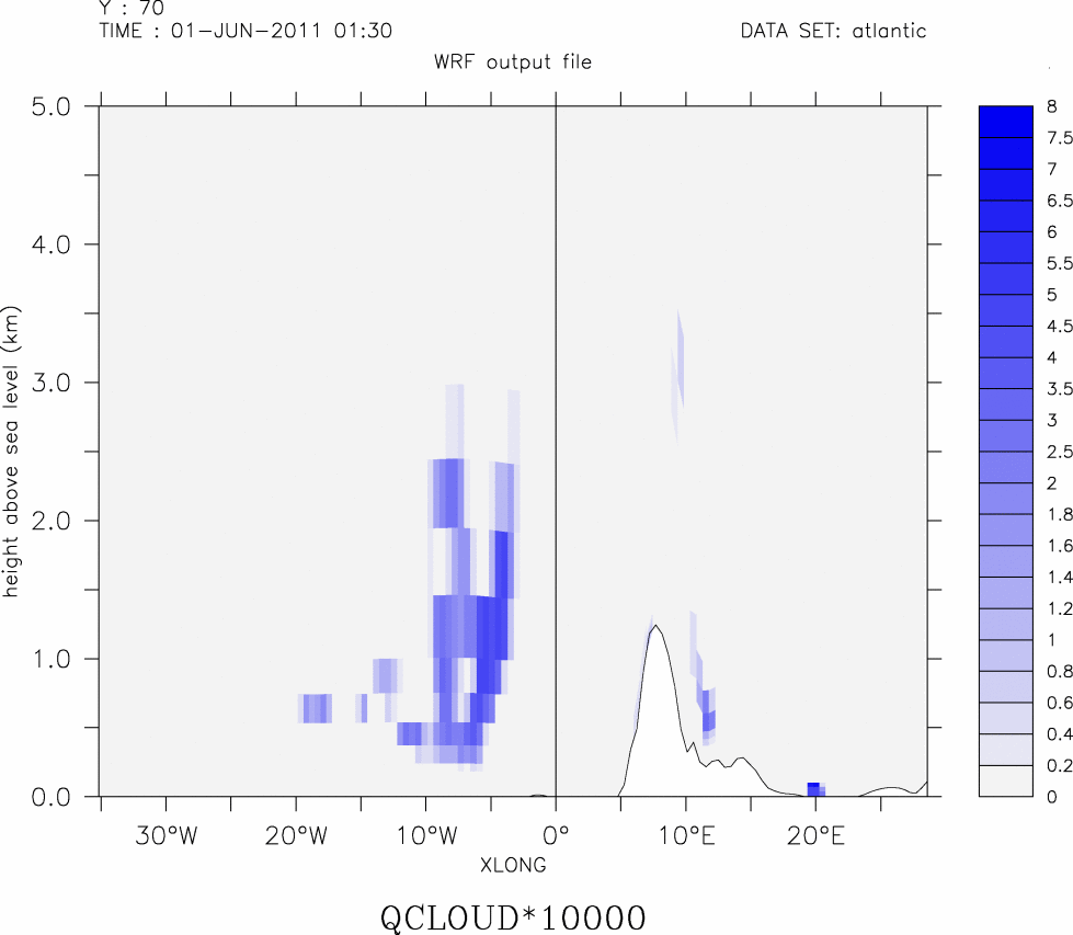
The attached picture was made with these commands:
shade /vlim=0:5 /pal=inverse_bluescale /lev="(0,2,0.2)(2,8,0.5)" qcloud*10000, xlong, height
plot /nolab /over /line /vs xlong,hgt/1000
Kind regards,
Hein
--
Dr. Hein Zelle
Advisor Meteorology & Oceanography
Tel: +31 (0)527-242299
Fax: +31 (0)527-242016
Email: hein.zelle@xxxxxxxxxxxxx
Web: www.bmtargoss.com
BMT ARGOSS
P.O. Box 61, 8325 ZH Vollenhove
Voorsterweg 28, 8316 PT Marknesse
The Netherlands
----Confidentiality Notice & Disclaimer----
The contents of this e-mail and any attachments are intended for the
use of the mail addressee(s) shown. If you are not that person, you
are not allowed to read it, to take any action based upon it or to
copy it, forward, distribute or disclose the contents of it and you
should please delete it from your system. BMT ARGOSS does not accept
liability for any errors or omissions in the context of this e-mail or
its attachments which arise as a result of internet transmission, nor
accept liability for statements which are those of the author and
clearly not made on behalf of BMT ARGOSS.
Attachment:
cloud_test.png
Description: PNG image