Hi Bill and Ansley,Coincidently I've been looking at a related problem recently for use in the tsunami program here at PMEL. I needed to represent the coastal marine forecast areas and found a wealth of material in GIS shapefile format at http://www.nws.noaa.gov/geodata . I've converted the west coast and Hawaii subset of these without too much difficulty into ASCII and netCDF versions suitable for use within Ferret.
Included in the NWS catalog is a shapefile of US county and territory boundaries, which I'd also like to convert for Ferret use, particularly the counties along the coast (there are over 3000 counties when you consider the whole country!) I had hoped that someone would respond to you that they had already done this -- it is not too hard, just a bit tedious.
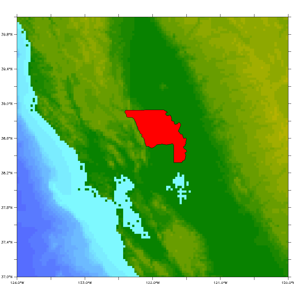
Attached is a sample of the first county "polygon" in the NWS shapefile which is Yola County CA. Take a look and see if the resolution is appropriate for your purposes -- it uses 246 points, and the graphic was created by "shade/x=.../y=... rose" using smith-sandwell, followed by "poly/o/line=1/pal=red lon,lat" where lon,lat are the coords of that particular polygon.
The tools I use to go from GIS to Ferret-suited ASCII are "shpdump" and "dbfdump" which convert two of the files included in a GIS representation, plus a couple of fortran programs. The output of dbfdump is needed to figure out the ordering of the polygons in the ASCII file produced by shpdump which holds the actual lat.lon coords. This may be something you want to explore/experiment with yourself since, given the wealth of material out there in GIS format, I can see other ferret users and myself doing this regularly. Given the # of counties involved, a single file spanning the entire country would be large, and I will probably proceed by state. If you wanted a limited number of counties, and if the resolution suggested by the sample is adequate, I could extract those for you while doing my own selection.
Regards,
   Mick

=======

Ansley Manke wrote:
Hi Bill,The data we download to create the datasets containing outlines is from the "pscoast" tool in the GMT software, as outlined in the Ferret FAQhttp://ferret.pmel.noaa.gov/FERRET_17sep07/FAQ/graphics/coastlines.htmlThat source does not include data for outlines of counties, and I'm not aware of any source for that data. The coastline-extractor mentioned in our FAQ page contains political boundaries, but I believe that consists only country and state boundaries as well.As you say, it must be available somewhere. The data consist of (lon,lat) pairs, separated by a missing-value where the pen should pick up, so the Ferret command to plot them is justplot/vs/line lon_data, lat_data. Ansley Gustafson, William I wrote:Hi,I did a quick search of the Ferret archives but did not see anybody asking about this before. Has anybody generated a file that could be used to draw U.S. county lines on a map similar to land_detail for the states and rivers? The data must be out there somewhere.I've looked at how land_detail handles the state boundaries. I'm assuming it is not trivial to get the lat/lon pairs setup so that all the lines connect at the right places.Thanks for any suggestions. -Bill _______________________________________________ William I. Gustafson Jr., Ph.D. Scientist ATMOSPHERIC SCIENCES AND GLOBAL CHANGE DIVISION Pacific Northwest National Laboratory P.O. 999, MSIN K9-30 Richland, WA 99352 Tel: 509-372-6110 William.Gustafson@xxxxxxx http://www.pnl.gov/atmospheric/staff/staff_info.asp?staff_num=5716 http://www.researcherid.com/rid/A-7732-2008