Somehow it didnt get through, i try it now.
----------
Hello Users,
i have an ASCII data set and a coordinate file in the same format as well. I want to have the data in loat-lon coord system.
During creating a map with curv_to_rect_map, a strange thing has happened: some added dimensions just appeared.
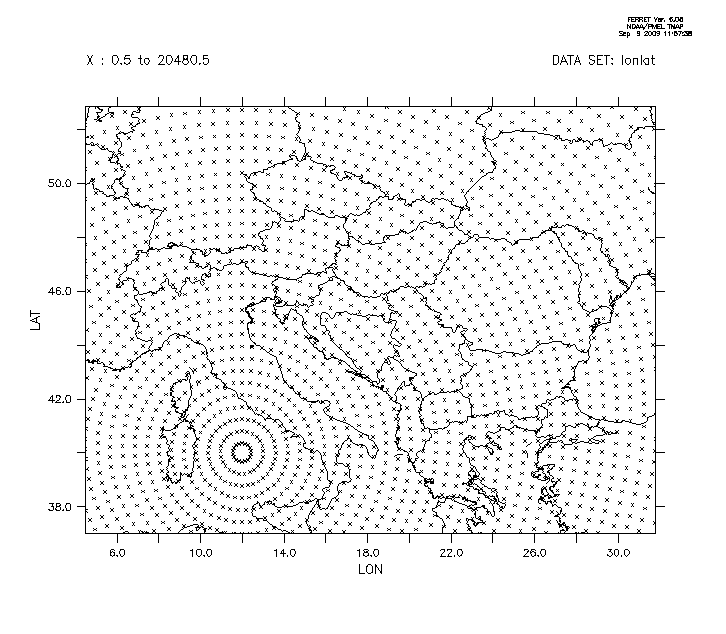
set data/ez/var="lon,lat" "/home/szabop/ARPEGE/coords" !i guess, these are the curvilinear coordinates. i attach a pics about the x-y coords (coords.gif)
def axis/x=4.5:31.78:0.44/mod/units=degrees xax
def axis/y=37:52.84:0.44/units=degrees yax
let llvar=y[gy=yax]+x[gx=xax]
let arpmap=curv_to_rect_map(lon,lat,llvar,0.88)
save/file="ARPEGE/
arpmap.nc" arpmap
quit
After this, if i list the grid of arpmap, i see that a Z and T dimension is added.
use "ARPEGE/
arpmap.nc"
sh grid arpmap
GRID GQW1
name axis # pts start end
XAX LONGITUDE 63mr 4.5E 31.78E
YAX LATITUDE 37 r 37N 52.84N
ZAX1_4 Z 4 r 1 4
TAX1_3 T 3 r 1 3
Why is that?
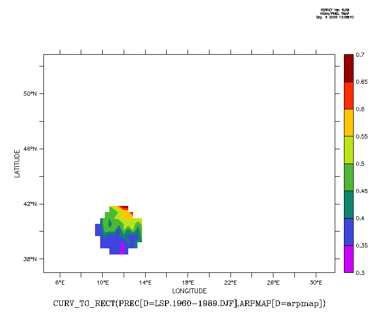
When i applied the curv_to_rect function for this creted map, i get a strange result as well (see the attached strangelonlat.gif):
def grid/x=xax/y=yax gridxy
set data/ez/var="prec"/grid=gridxy "/home/szabop/ARPEGE/pre/LSP.1960-1989.DJF"
let newpre=curv_to_rect(prec[d=2],arpmap[d=1])
fill newpre
This is quite strange for me as i already used this function without any error.
Thanks for any help,
Peter