[Thread Prev][Thread Next][Index]
[ferret_users] Why polygon fills unexpected regions?
- To: ferret_users@xxxxxxxx
- Subject: [ferret_users] Why polygon fills unexpected regions?
- From: "Yu, Hao-Cheng" <danish.url@xxxxxxxxx>
- Date: Sun, 07 Sep 2008 01:22:38 +0800
- Dkim-signature: v=1; a=rsa-sha256; c=relaxed/relaxed; d=gmail.com; s=gamma; h=domainkey-signature:received:received:message-id:date:from:to :subject:mime-version:content-type; bh=0VKZ77cQmbU/I9TuEi92rXH+7KEWwBov48rFYegxc/Q=; b=ewUga64yFAh4YR2eM77WFeE4wuECaoWigBCTy3AHlxZuEIdgGCpOz637y7RMUlfXSJ ZIeYYVD31MPJP2+OlapiPjD2OOyAyFZJf+zsRQBt5lgLpYkD/kuQ5FfCRA9wp3DWy8tb uEIjN4gLFh9uWloL79H0ler8ZD6Fofpq/OdyI=
- Domainkey-signature: a=rsa-sha1; c=nofws; d=gmail.com; s=gamma; h=message-id:date:from:to:subject:mime-version:content-type; b=mH9mUW/Z7uzX4wjZ5vn1cOSGD/AsdfpyiBuKm5gxlkoDHuFFDZzBDdW/b9oQ0c0Lj+ uiJ013dwJb/BMNWCr5mpcSo2QO+CXw26HOAATPQQrskqd9PsmpUu+YlNpojVjN+javAn FmJtTGVT7UprKv/UrGgu3xvn3p0PEPuxtLdME=
- Sender: owner-ferret_users@xxxxxxxx
Dear ferret users,
I try to use polygon command as land region to cover the interpolated variable to avoid misunderstanding.
The scripts works fine when I use normal mode (which shows on the screen with X env.)
However, when I try to produce gif file with gif mode (ferret -gif),
scripts still works fine but polygon cut unexpected regions in my plot.
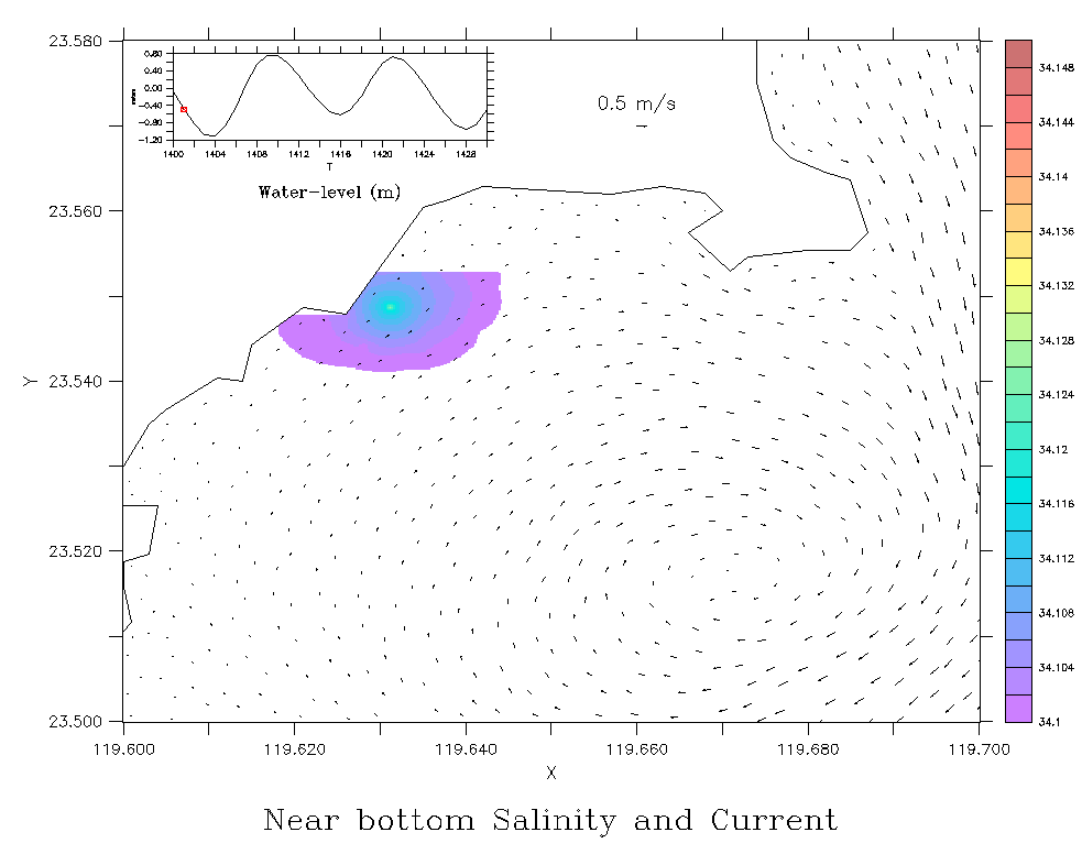
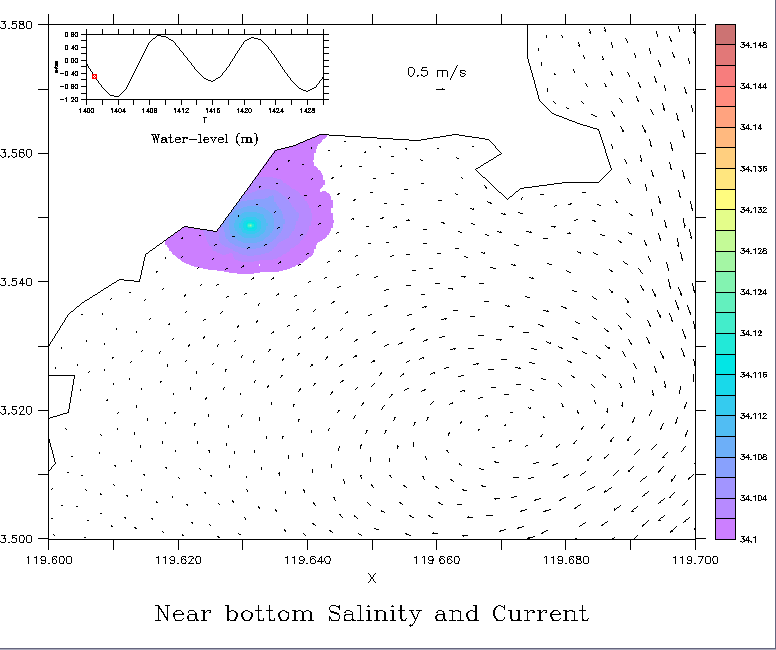
I attach 2 figures to show the difference, first one is site1_01.gif which is produced by ferret -gif mode,
can easily found the salinity field was cut by polygon which suppose only to overwrite the land region.
normal.bmp is under normal mode ferret and extracted by print-screen.
Any suggestions?
Dan
Attachment:
site1_01.gif
Description: GIF image
Attachment:
normal.bmp
Description: Windows bitmap
[Thread Prev][Thread Next][Index]
Contact Us
Dept of Commerce /
NOAA /
OAR /
PMEL /
TMAP
Privacy Policy | Disclaimer | Accessibility Statement