|
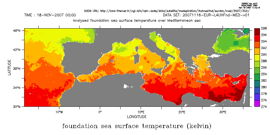
Hi Martin, I'm not seeing what you describe. The modulo behavior of the longitude axis of the dataset shouldn't affect the land overlay. Does the same thing happen if you use one of the coarser etopo datasets, say go fland 20 several of the datasets we release with Ferret have X axes that run from 20 E to 380E so that they split along a line that runs mostly through continents for convenience when working with oceanographic data. etopo20 and etopo60 are like this; but etopo05 has its x axis starting at 0, so even if something funny were happening with the modulo x axis, it shouldn't be happening with etopo05. I'm perplexed about what's causing the line you see. yes? use etopo05Ansley Martin Schmidt wrote: Hi, with ferret 6.07 I get a disturbing white line at 20 E in my plots. use "http://www.ifremer.fr/cgi-bin/nph-dods/data/satellite/medspiration/l4uhrsstfnd/eurdac/med/2007/322/20071118-EUR-L4UHFnd-MED-v01.nc" can axis/modulo lon set win/asp=.5 1 shade SST_FOUNDATION go fland 5 Saving the data and making the same plot with old 5.41 (AIX), the plot is correct. ferret adds the modulo flag to the x-axis (lon). This is the reason to cancel axis/modulo, but this does not help. Changing the aspect ratio to .51, the error disappears. One could live with this workaround, but something seems to be wrong here. Greetings, Martin |