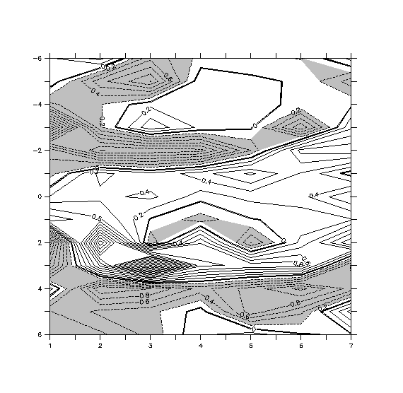
This is just a quick answer, but one might have trouble with a FILL plot near the edges, as Ferret has no way to extrapolate from the coordinate location to the edge of the region you selected. If you're drawing a region that is a subset of the entire region that there is data for, you can send the plot command more data around the edges and then use /HLMITS and /VLIMITS to trim the plot back to the size you want to see. This might look something like
yes? FILL/vlim=-6:6/hlim=1:7 var[x=0:8,z=-7:7]Here is another thread on this topic, with a bit more background information.
yes? CONTOUR/OVER var[x=0:8,z=-7:7]
http://www.pmel.noaa.gov/maillists/tmap/ferret_users/fu_2005/msg00156.html
Ansley
nguyen@xxxxxxxxxx wrote:
Hi ferreters

I intend to do shading and contour of a same variable on the same plot
(see attached figure). But, as shown in fig, contour and the shading are
different, while they should be the same. For instance if one look at
around the right top corner, or the location of (x=5.5,y=-2) and
(x=3:5,y=1.5) where shading doesn't match with contours. Any help?
Thanks

Hanh