The Ferret documentation calls this kind of data "curvilinear data", so you can read more about this in the Users Guide. Because your nc file contains the lon, lat coordinates of the data, you can use this to plot with the "curvilinear" coordinate graphics commands in Ferret
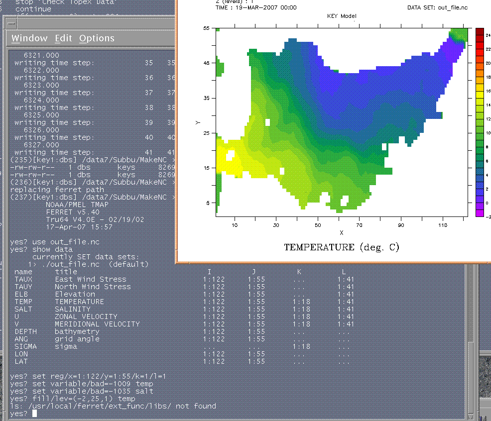
yes? fill/lev=(-2,25,1) temp, lon, lat
Ansley
Prakya Shree Ram wrote:
Dear Ferreters,

I have generated an nc file with my model results and
tried to use it in ferret. Attached figure shows the
image and commands I am using. The actual latitude and
longitude values are different, if I change the range
it is not accepting. The region of my study is
East/Japan sea and I am using inclined grid.

Any help in this regard is highly appreciated.

Thanks in advance,
Sriram


__________________________________________________
Do You Yahoo!?
Tired of spam?  Yahoo! Mail has the best spam protection around
http://mail.yahoo.com
--

~>   ~>   ~>   ~>   ~>   ~>   ~>   ~>   ~>   ~>   ~>

Ansley Manke, NOAA/PMEL   ansley.b.manke@xxxxxxxx
7600 Sand Point Way NE, Seattle WA
Phone 206-526-6246,  FAX 206-526-6744