[Thread Prev][Thread Next][Index]
[ferret_users] how to change the projection and read the actual lat lon data
- To: Ferret Usergroup <ferret_users@xxxxxxxx>
- Subject: [ferret_users] how to change the projection and read the actual lat lon data
- From: Prakya Shree Ram <srprakhya@xxxxxxxxx>
- Date: Tue, 17 Apr 2007 00:33:23 -0700 (PDT)
- Domainkey-signature: a=rsa-sha1; q=dns; c=nofws; s=s1024; d=yahoo.com; h=X-YMail-OSG:Received:Date:From:Subject:To:MIME-Version:Content-Type:Content-Transfer-Encoding:Message-ID; b=KBVQCUwNbrlzqOM4IuFF8zWudNK0zfOPU2Ko1p8KqH05WMhjCaOj7mU+NY6H6TuSMVwX10IqiPYZ9F7lfVIg8qljJL5JT0T+Q7XOUpktqNt9cNSIBwU8lPMRQ4hRczMO63ZAGXvxnThvGDT8ryNnjLE9GwdWB+zBLg7ORZOOjUw=;
- Sender: owner-ferret_users@xxxxxxxxxxxxx
Dear Ferreters,
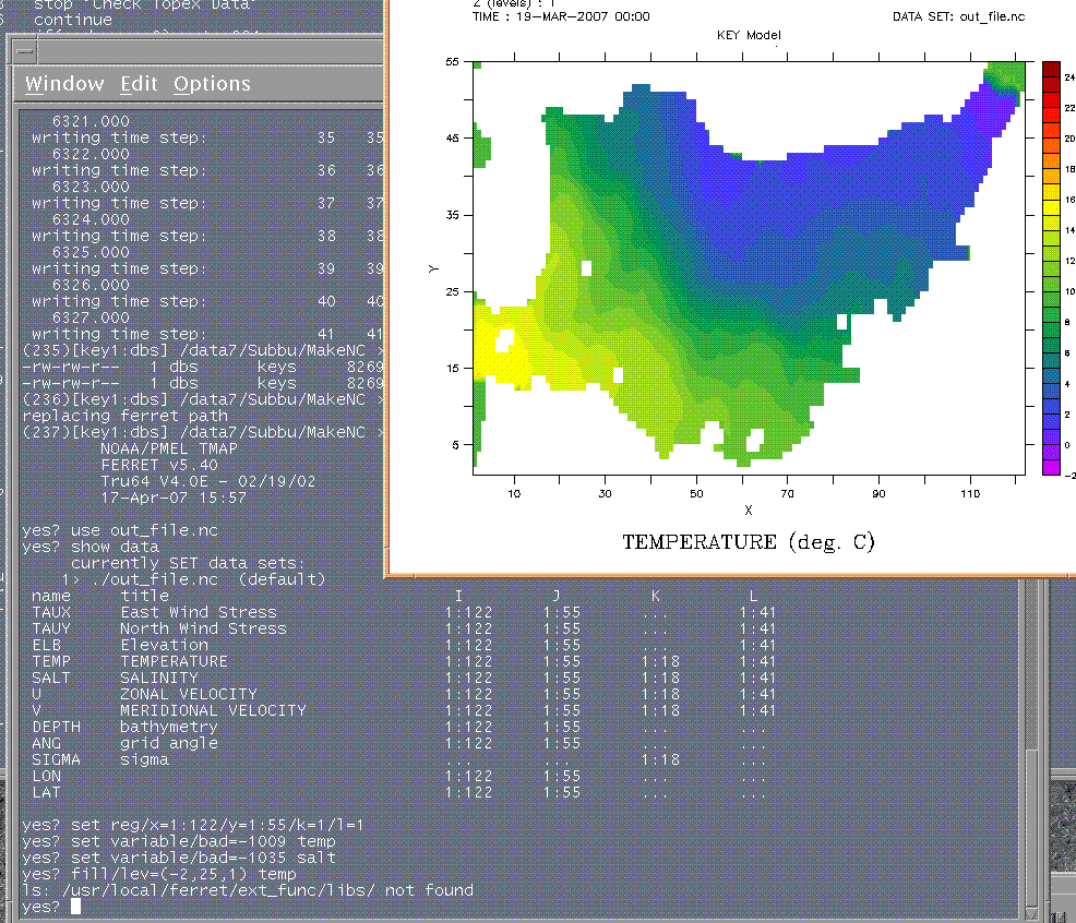
I have generated an nc file with my model results and
tried to use it in ferret. Attached figure shows the
image and commands I am using. The actual latitude and
longitude values are different, if I change the range
it is not accepting. The region of my study is
East/Japan sea and I am using inclined grid.
Any help in this regard is highly appreciated.
Thanks in advance,
Sriram
__________________________________________________
Do You Yahoo!?
Tired of spam? Yahoo! Mail has the best spam protection around
http://mail.yahoo.com
[Thread Prev][Thread Next][Index]
Contact Us
Dept of Commerce /
NOAA /
OAR /
PMEL /
TMAP
Privacy Policy | Disclaimer | Accessibility Statement