[Thread Prev][Thread Next][Index]
[ferret_users] Trouble Displaying Curvilinear Data
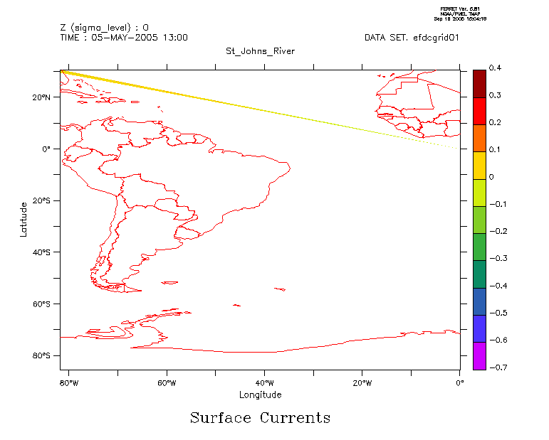
Hi All,
I am trying to display some curvilinear model data and I am getting some
unexpected results. You can see the results of a shade/title="Surface
Currents" u,lon,lat command in the attached gif file
(st_johns_river.gif). The data should have been for a stretch of the
Eastern coast of Florida (
http://www.csc.noaa.gov/csp/images/fl_region.gif ). Does anyone have a
suggestion on what might be going wrong or how to diagnose this
problem. If you would like to see the netCDF data, it is available via
the following DODS URL or I could e-mail it to you offline.
http://205.156.4.56/cgi-bin/nph-dods/st_johns/efdcgrid01.nc.info
In advance, thanks for any help you might provide.
John
[Thread Prev][Thread Next][Index]
Dept of Commerce /
NOAA /
OAR /
PMEL /
TMAP
Contact Us | Privacy Policy | Disclaimer | Accessibility Statement