Hi everyone,
I try to use the external function to interpolate
data from a curvilinear to rectilinear
latitude-longitude grid. I used the simple Ferret
script in Appendix A Sec11 (see attached).
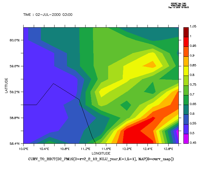
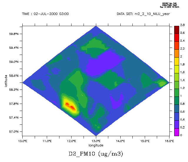
I create two plots one before using the external
function curv_to_rect (fig2.gif) and one after using
the function (fig1.gif) (see the attached).
The problem is the center of maximum and minimum
in the figures 1, 2 are not the same. I'm feeling
something wrong happened.
My data is netcdf and the variables on polar
stereographic (projection_params = "90.0 -32.0
0.933013"). and i = 51 ; j = 51
Another question, If I would like to draw my variable
on index x=0:51 and y=0:51 for the polar stereographic
projection and land map .. Who I can do that?
Looking to your help!
All the best
Ashraf
''~``
( o o )
+------------------.oooO--(_)--Oooo.------------------+
| |
| Ashraf Saber Zakey |
| Department of Chemistry |
| Atmospheric Science group |
| Universty of Gothenburg |
| SE 412 96 Gothenbrg |
| Sweden |
| e-mail: zakey@chem.gu.se |
| ashraf_saber123@yahoo.com |
| |
| .oooO |
| ( ) Oooo. |
+---------------------\ (----( )--------------------+
\_) ) /
(_/
__________________________________
Yahoo! Mail - PC Magazine Editors' Choice 2005
http://mail.yahoo.com
Attachment:
post1.jnl
Description: 364719509-post1.jnl