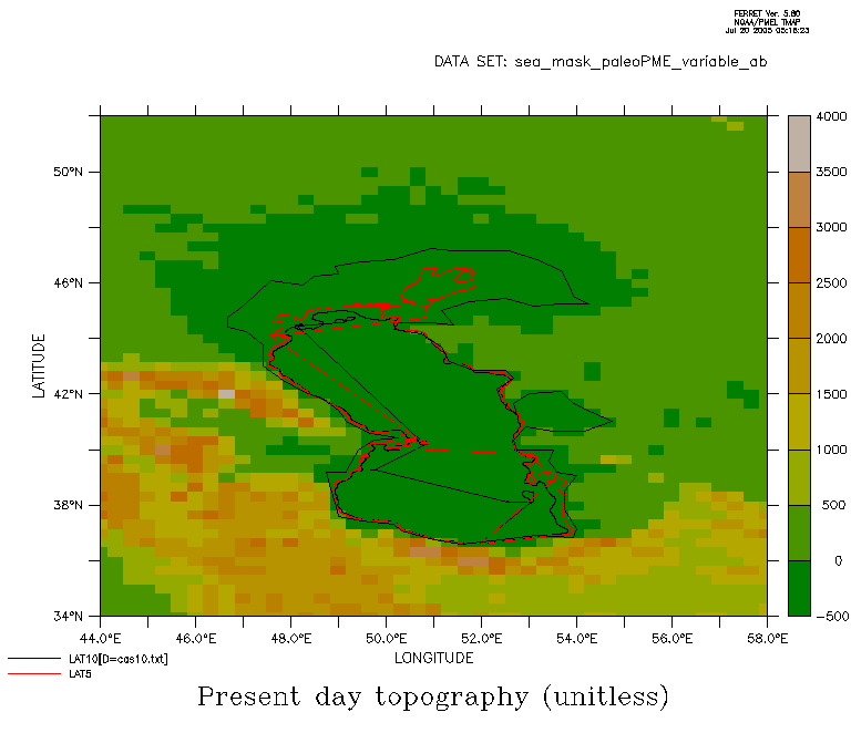
Hello Ferreti,

My question could be slightly out of topic, but some time ago I saw here
similar (more general) question concerning various bathymetry datasets, so I
decided to give it a try myself.

I have bathimetry data of the Caspian Sea, available from
http://www.caspianenvironment.org/dim/menu5.htm
Indeed, this data (GIS data... lon, lat pairs)  are contained in several ascii
files representing various isobaths (5, 10, 20, 50, 100...)

However, when I plot them (as suggested in the faq for plotting borders and
coastlines), altough figure seems to correctly capturing bathymetry of the
Caspian Sea, it has some unwanted features (see attached gif).

On the other hand ETOPO data, as far as I know does not contain any
information about Caspian Sea, except that is 28 m below present sea level.

Therefore, I would like to supersede ETOPO data for the Caspian Sea with this
GIS data and to produce one netcdf file containing ETOPO topography for the
area surrounding Caspian Sea and GIS bathimetry for the sea.

Has anybody already done something similar? or Does anybody have idea how to
do that? Or even better does anybody knows about the dataset containing
bathymetry of the Caspian Sea in the netcdf format?


Any suggestion would be the most appreciated!

Goran

--
Goran Georgievski
ICBM, Physical Oceanography (Theory), University of Oldenburg
PO Box 2503, D-26111 Oldenburg, Germany
Tel: +49-(0)441-798-4061, Fax: +49-(0)441-798-3404
Attachment:
cas_bath.gif
Description: GIF image