[Thread Prev][Thread Next][Index]
Satellite Gridding Problem
Hello:
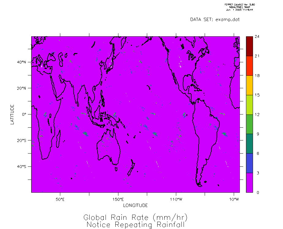
I am having troubles plotting satellite derived rain rate data from
NASA. When I plot the data, there are three distinct "swaths" that
repeat across the global domain. I checked the values from the file and
they do not repeat, so it must be in the way I have set the grid for the
data. I have attached the plot so you can see what I am referring to.
The data has 0.25 deg resolution with 1440x480 points (0-360 deg. E and
60N-60S). The first grid box center is at (0.125 deg. E,59.875 deg. N).
The code I used to make the plot is as follows:
define axis/x=0.125E:359.875W:0.25/units=deg lon
define axis/y=59.875N:59.875S:0.25/units=deg lat
define grid/x=lon/y=lat mygrid
file/var=rr/grid=mygrid test.dat !reading in ASCII file
data to define grid
fill/levels=(0,25,3) rr
Thanks for any help
Stephen R. Guimond
Graduate Research Assistant
Center for Ocean-Atmospheric Prediction Studies
[Thread Prev][Thread Next][Index]
Dept of Commerce /
NOAA /
OAR /
PMEL /
TMAP
Contact Us | Privacy Policy | Disclaimer | Accessibility Statement