CRUISE REPORT
FOCI
Number: 6MF02
NOAA
Ship Miller Freeman
Area of Operations: Coastal
Itinerary:
Seward to
Participating Organizations:
PMEL/FOCI
Chief Scientist:
Nancy
B. Kachel, PMEL/FOCI
Personnel:
Nancy
B. Kachel, PMEL
David
G. Kachel, PMEL
Sigrid
A. Salo, PMEL
Antonio
Jenkins, PMEL
David
Weisgarver, PMEL
Objectives of Cruise:
FOCI’s goal is
to understand the effects of abiotic and biotic
variability on ecosystems of the
The principle
objective of this leg was to make a CTD/Chlorophyll/Nutrient survey of Portlock
bank, then, as time permitted, survey the northern portion of Albatross Bank
and Chiniak Trough (Fig. 1).
Summary of Operations:
Operations:
Mooring
Deployment 1
CTD
Stations 103
Satellite
drifters deployed 4
Samples Collected:
Chlorophyll
samples ~600
Nutrient
samples ~850
Summary of Cruise:
The
NOAA Ship Miller Freeman departed
The
SeaBird 911+ CTD was equipped with dual temperature and conductivity sensors as
well as a WetStar Fluorometer and a Photosynthetically Active Radiation sensor (PAR). At each
station, water samples were collected for analysis of chlorophyll and nutrients
concentrations, in addition to a salinity sample for calibrating the CTD
sensor. The chlorophyll samples were filtered through a 0.45-micron filter,
frozen, and stored in a –80º C freezer. The nutrient samples collected in the
top 50 m were also filtered though 0.45 micron filters as soon as they were
collected. All samples were flash-frozen, then the
nutrients were transferred to a –20º C freezer.
As
we left
The hydrographic survey of
Portlock Bank consisted of 5 lines: the outer portion of the Gore Point
line (GP) on the western side of the
bank, 2 lines (PBA and PBB) crossing over the center, another over the eastern
portion (PBC), and finally a transect roughly from east to west (PX)(see Fig
1). One drifter was deployed at the
center of the bank and another on the eastern side.
The
survey of Albatross Bank and Chiniak Trough began
with a transect along the middle part of Northern Albatross Bank from Stevenson
Trough on the northeast, continued along the bank, and then crossed over Chiniak Trough, on the southwest (NAB/ CBA). Two more lines
were then occupied across Chiniak Trough (CBA and
CBC), before the start of the final cross- shelf transect (AX) from the slope
of Northern Albatross Bank to near
At
the end of the cruise we deployed a current meter mooring (02CB1B) in Chiniak
Bay before coming into port at Kodiak, AK on Oct. 9, at 0800 local time.
Specifics of operations:
Specifics of
the operation are presented in the event log in the appendix.
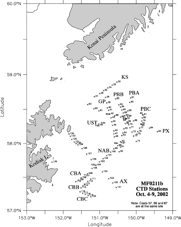
Fig 1 –CTD station 32-135 from
MF0211_Leg2. Transects are identified as:
Appendix: Event Log