|
|
|
||||||||||||||
|
||||||||||
|
Teacher's Report
It's 1800 hours (that's 6 o'clock in the evening for you land lubbers), and it's been an excellent first day at sea. We left Astoria just after nine this morning, under overcast skies and with the seas slightly building. After stowing my gear below, I received the first bit of good news; my cabin isn't directly next to the bow thruster. I was told by previous educators-at-sea to bring earplugs and be prepared for its noise. The bow thruster is used to keep the ship on station over a specific location of seafloor. But fortunately, there weren't as many researchers on board as usual, so they assigned me a less noisy berth just aft of the thruster. However, I won't know the noise level for sure until tomorrow when we are scheduled to arrive at Axial Volcano.
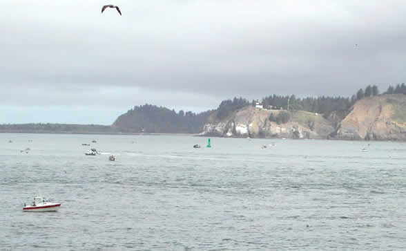
I was surprised at the number of recreational fishing vessels at the Astoria bar. They appeared to be fishing for salmon, probably Chinook, since I think the coho season was closed last week. The captain had to repeatedly sound the R/V Thompson's loud horn to clear a path to the open water. Some of the fishing vessels were slow to move out of the way, considering the relatively large size of the Thompson. After clearing the bar, the science crew met below in the library to be briefed on the dive plan and ship safety procedures. This provided my first opportunity to meet the researchers. Other than three people from Hatfield Marine Science Center (HMSC), most of the science crew is either from Washington or Canada. Some of the teams have worked together on past voyages, so there was already an apparent easy comarade. The challenge, however, is trying to accomplish everything each researcher wants to sample or investigate. Priorities must be set so that the critical work is accomplished. Bad weather and equipment failures are just two reasons why each voyage might not accomplish everything the researchers planned. By setting high/medium/low priorities to each task, and scheduling the highest priorities first, unexpected delays aren't as costly to the research agenda.
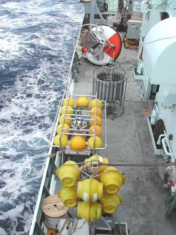
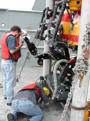
The ROPOS remotely operated vehicle (ROV) will be used extensively during this voyage. Dive planning includes deciding which equipment packages are to be carried below. For example, when a vent fluid sampling dive takes place the ROPOS team must first remove the bio-box to make room for the Hot Fluid Sampler (HFS). The HFS collects hot fluid samples using various types of filters, which will later be analyzed on board and back on land. The equipment packages can be swapped out between dives. Other instrument packages are lashed down on the deck, until time for deployment. The largest is a surface buoy, central to the NeMO Net system. The NeMO Net is a state-of-the-art communication system that links researchers on land to instruments on the seafloor. The NeMONet buoy will be deployed above the mid-caldera of Axial Volcano. An acoustic modem links seafloor instruments to the surface buoy and then data can be relayed to shore by satellite. NOAA researchers at University of Washington and Pacific Marine Environmental Lab (PMEL) will then have two-way communication with two interactive fluid samplers (called RAS's) and a bottom pressure recorder (BPR). Other researchers are preparing their instrument packages for deployment during this brief, two-week voyage. As our planned transit time is 24-26 hours, I should be sharing tomorrow's log entry with you on station at Axial Volcano, 300 miles offshore. |
||||||||||
| NeMO Home |About NeMO | Expeditions | NeMO Net | Explore | Dive! | Education |