| |
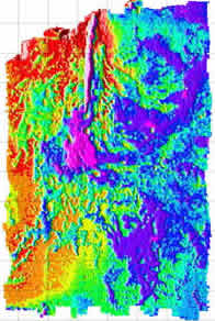
CASM Imagenex scanning sonar map of CASM
area. Reds represent high areas, blues and purples are lows. The vent
field is in the fissure located in the top center of the map. |
|
NOAA Ship Ron Brown/ROV ROPOS
Science News
Science Report - Wednesday, July 25, 2001
Ship's position: 45 55.2'/-129 59.3'
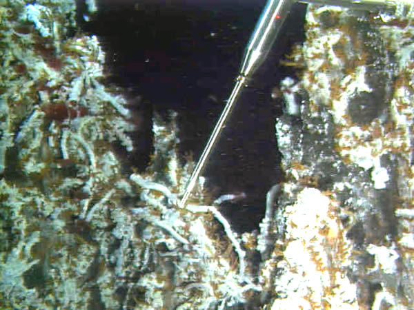
ROPOS
dive 627 is collecting vent fluid samples from hydrothermal sites south
of the Marker 33/Cloud area on and near the 1998
lava flow. For the first time this year, ROPOS visited Castle vent
- the only known high-temperature vent site with sulfide
chimneys in the lava flow area. Castle was a pre-existing vent and
barely survived the 1998 eruption because it is located on a small hill
just east of the lava flow. The two chimneys at Castle are about 5 m high
and there is an active anhydrite chimney at the base of one of them surrounded
by vent fauna.
A
bathymetric map has been produced from yesterday's scanning sonar survey
at CASM (during ROPOS
dive 626). The map area is about 650 m X 1000m and includes the caldera
floor just south of the caldera wall (reds and yellows are high; blues
and purples are low). The CASM fissure is oriented north-south and is
clearly defined in the middle of the northern third of the map. This map
will help us plan the next dive to the CASM area.
|