spacer
horizontal bar
spacer
NeMO home About NeMO Expeditions NeMO Net Explorer Dive! Education
spacer image
horizontal bar
spacer image


AUV bathymetric map

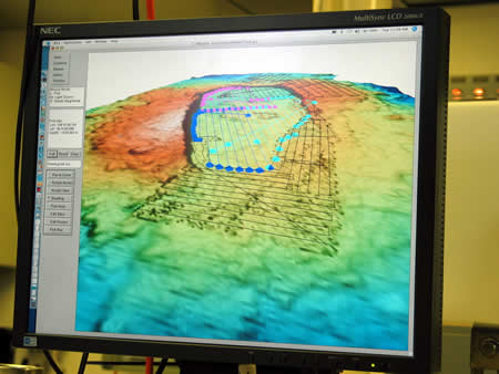
Planning the AUV surveys, using software developed at MBARI. In this image, Axial Volcano's summit is viewed in 3D on a computer monitor. The survey tracks are the lines and dots superimposed on the map. The dark blue track never was run due to DVL sensor failure on the AUV.

Back to August 14, 2007 Log.


spacer image
horizontal bar
spacer image
     
NeMO Home |About NeMO | Expeditions | NeMO Net | Explore | Dive! | Education
spacer
horizontal bar
spacer
spacer imagePrivacy Policy | Disclaimer | oar.pmel.vents.webmaster@noaa.gov