Activity
#3: Contour Profiling
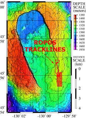
Map showing ROPOS tracklines.
Next, by maneuvering ROPOS back and forth in a grid pattern, we can produce a new bathymetric map of the area to look for changes in the seafloor terrain. Through a technique called contour profiling, we can create cross-section profiles of the seafloor along a given line. By comparing PRE- and POST-event contour profiles we can determine the extent of the new lava, its depth, and identify the collapsed areas. This will give more clues about what happened to the rumbleometer.
Version
2.0 


 page
37 of 55
page
37 of 55