Latitude
and Longitude
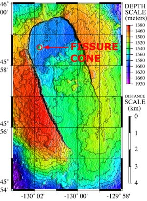
Geographic locations on a map are expressed in latitude (the north-south axis) and longitude (the east-west axis). Both latitude and longitude are measured in degrees (°) and minutes ('). There are 60 minutes in one degree, and each minute can be further divided into tenths. For example, the location of "Fissure Cone" on the map of Axial Caldera (at right) is approximately:
45° 58.6' / -130° 01.8'
Version
2.0 


 page
14 of 55
page
14 of 55