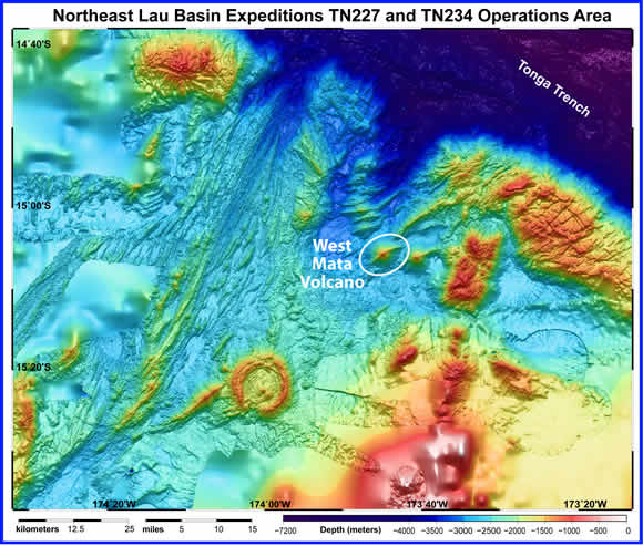
The West Mata Volcano, encircled by a white ellipse on this bathymetric map, is not the largest volcano in the northeast Lau Basin, but appears to be the most active. This map represents the area visited and mapped on two recent NOAA EOI Program expeditions to the area. The summit of West Mata Volcano is nearly one mile deep the base is nearly two miles deep. The Tonga Trench to the north and east of the expedition area is nearly seven miles deep.