What's New Archive
The US Arctic and Bering Sea are big, remote, and harsh environments. PMEL's Innovative Technology for Arctic Exploration program and Engineering Development Division have been developing autonomous technologies and tools to collect critical data to better understand changes in the oceans and its impact on food security, sea ice forecasts, weather and climate.
Drones and gliders are not designed for ice edge and can offer a new perspective on Arctic science, exploring new areas of the Arctic Ocean. One critical area of study is the melting edge of the seasonal ice pack. The timing and speed of annual ice retreat is changing each year, and could have a big impact on ecosystems and global weather patterns. PMEL is pushing the envelope to further develop gliders and drones to advance the science near the ice edge to explore how it moves and changes.
Check out the video on our YouTube Channel to learn more about NOAA PMEL’s autonomous observing technology in the Arctic: https://youtu.be/A_
41 scientists from PMEL, including scientists from NOAA's cooperative institutes at the University of Washington's Joint Institute for the Study of the Ocean and Atmosphere (JISAO) and Oregon State University's Cooperative Institute for Marine Resources Studies (CIMRS), the National Research Council, graduate and undergraduate students are heading to the Ocean Sciences Meeting in San Diego to share their current research. Talks and posters cover a range of topics include saildrone research, ocean observing systems, marine heatwaves, Arctic, acoustics, Deep Argo, genetics and genomics, El Nino, hydrothermal vents, methane, nutrients, technologies, ocean carbon and data management.
The 2020 Oceans Science Meeting is the flagship conference for the ocean sciences and the larger ocean-connected community. As we approach the UN Decade of Ocean Science for Sustainable Development, beginning in 2021, it is increasingly important to gather as a scientific community to raise awareness of the truly global dimension of the ocean, address environmental challenges, and set forth on a path towards a resilient planet. The meeting is co-sponsored by the American Geophysical Union (AGU), the Association for the Sciences of Limnology and Oceanography (ASLO), and The Oceanography Society (TOS).
PMEL research groups that will be present at the conference are: Acoustics, Arctic including Innovative Technology for Arctic Exploration, Climate-Weather Interface, Earth-Ocean Interactions, EcoFOCI, Engineering, Genetics and Genomics, Global Tropical Moored Buoy Array, , Large Scale Ocean Physics, Ocean Carbon, Ocean Climate Stations, Pacific Western Boundary Currents, and Science Data Integration Group.
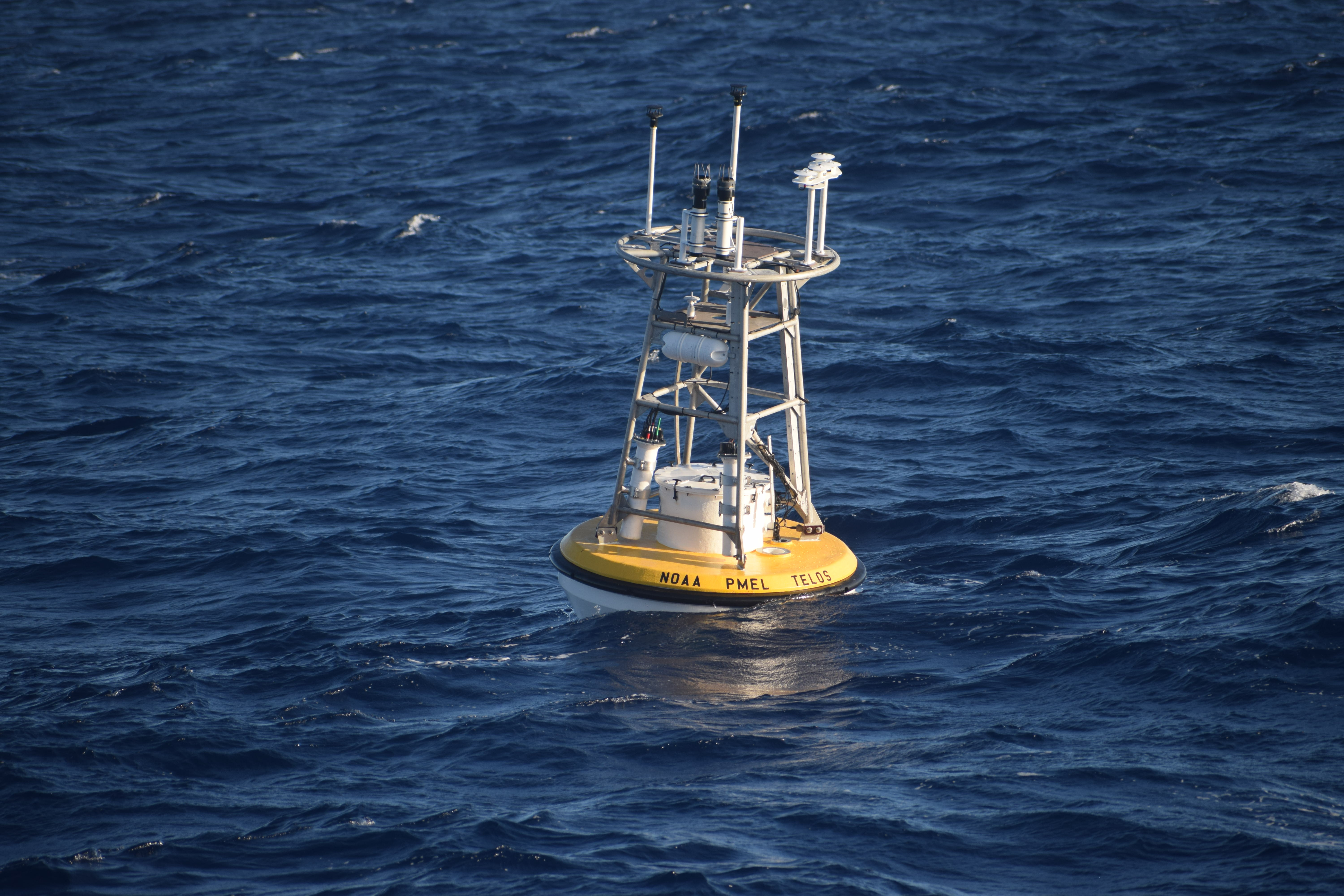
The TELOS protoype mooring interfaces with multiple sensors on the mooring line collecting, storing and transmitting the data in real-time.
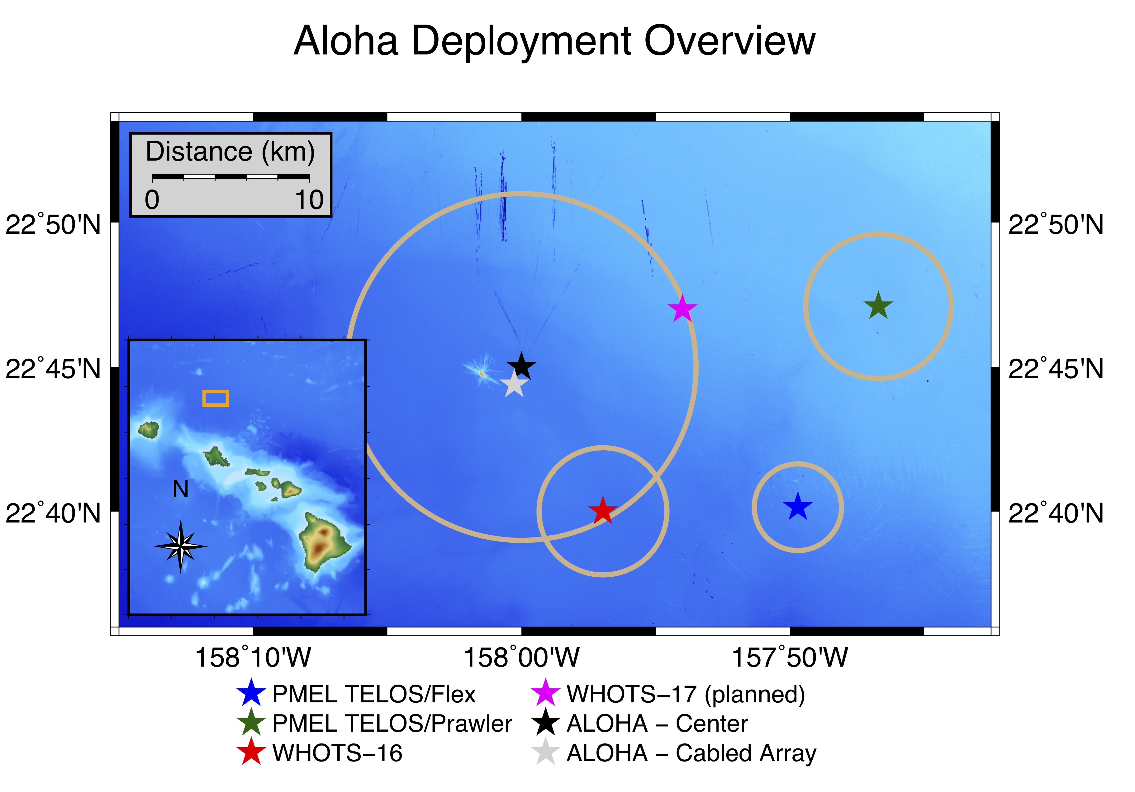
Map of two PMEL prototype TELOS moorings deployed east of Station ALOHA (blue and green stars).
On November 20, 2019, a team of PMEL scientists, engineers, and technicians successfully deployed two deep water oceanographic moorings off the coast of Hawaii to test PMEL’s newest data acquisition system, known as TELOS (Telemetry, Electronics & Logging of Oceanographic Sensors). The “brain” behind oceanographic data collection, TELOS interfaces with the atmospheric and oceanic sensors aboard the moorings -- collecting, storing, and transmitting measured data in real-time via satellite telemetry.
Station ALOHA, located 90 miles north of Oahu, is a well-established hub of ocean research. The site contains a cabled array seafloor observatory, a Woods Hole Oceanographic Institution surface mooring (WHOTS), long-range profilers, autonomous gliders, and other equipment. With the abundance of ocean observations on site, frequent ship visits, and ease of access from a US port to ocean depths greater than 4,500 meters (nearly 3 miles), the site offers an ideal testbed to evaluate the new TELOS technology.
The two deployments near Station ALOHA represent the first-ever open-ocean moorings with TELOS. One mooring contains a standard set of 13 line-mounted temperature/salinity instruments at depths ranging from 1 meter to 500 meters, two current meters, and a full suite of six meteorological instruments similar to the instrumentation on well-established Global Tropical Moored Buoy Array and Ocean Climate Stations moorings. A backup data acquisition system with a duplicate suite of six meteorological instruments is deployed on this mooring for comparison to an established control system. The second mooring also includes the standard set of 6 meteorological instruments and features a PMEL subsurface Prawler device that crawls up and down the mooring line, transmitting upper-ocean temperature/salinity profile data and potentially replacing the need for multiple in-line instruments. Both moorings will be evaluated over the 1-year deployment period to compare the data acquisition systems, using measurements from both moorings as well as the WHOTS mooring for additional comparison. TELOS has already demonstrated the capability to collect, process, and return higher volumes of real-time data than previous data acquisition systems, with the additional capacity for integrating new instrumentation.
So far, the mission has been a success. High-resolution real-time data are transmitted to PMEL via satellite, and scientists are developing visualization tools and analyzing data quality. The full data payload will be downloaded from the moorings in late 2020, testing the ability to survive a yearlong deployment at sea. If successful, TELOS will be scaled up for implementation across the PMEL mooring networks, transforming the future of oceanographic data collection.
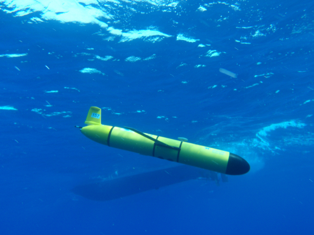
Ocean gliders are a quiet and efficient mobile autonomous platform for passive acoustic monitoring and oceanographic measurements in remote marine environments. Researchers equppied a Teledyne Webb Research Slocum glider with a hydrophone to record sound along the US Pacific Northwest coast.
NOAA and Oregon State University researchers have developed an effective method to use an underwater robotic glider to measure sound levels over broad areas of the ocean, published today in the journal PLOS ONE.
“Healthy marine ecosystems need to have noise levels within particular ranges,” said Joe Haxel, lead author of the paper and assistant professor/senior research at Oregon State University and part of NOAA’s Pacific Marine Environmental Lab Acoustics Program. “As an analogy for humans it’s the difference between living in the country or living in the city or somewhere really loud.”
Ocean sound was recently listed as an essential ocean variable by the Global Ocean Observing System, a UNESCO program, due to its importance for marine life and seagoing humans and because it is used to monitor and locate everything from earthquakes to tsunamis to nuclear explosions.
Traditionally, scientists have measured ocean sound by attaching hydrophones, essentially an underwater microphone, to a fixed mooring in the water. The problem with that is scientists only get data from that single location. Ocean sound can also be measured from a research ship, but they are expensive to operate. They also create a lot of noise themselves, which disturbs marine animals and fish that are sensitive to sound.
Attaching a hydrophone to a glider solves those problems because gliders operate autonomously, relatively quietly and can cover hundreds of miles over several weeks.
Gliders equipped with hydrophones can conduct repeated surveys of a region of concern for acoustic habitat degradation and provide real-time measurements of changing noise levels. Gliders have also successfully been used by scientists to measure noise from an underwater volcano and to predict surface wind speeds. An additional benefit of gliders is that they are outfitted with other sensors and instruments that provide important measurements, such as temperature, salinity and depth.
In the research described in the PLOS ONE paper, the research team attached the hydrophone to the glider, which is about 5 feet long and weighs about 120 pounds. The glider traveled for 18 days between Grey’s Harbor, Washington and Brookings, Oregon, a distance of about 285 miles. The glider operated along the North American continental shelf break, which on average is about 30 miles off the coast where the ocean depth begins to drop more steeply. The shelf break is a key migratory path for marine animals.
Once the scientists retrieved the hydrophone data, their main challenge was fine-tuning their algorithms to filter out the noise the glider creates when operating. After that filtering occurred, the researchers were able to cross-reference the data collected during the 18-day glider trip with historical data from hydrophones attached to moorings along that route.
Haxel said it was pretty shocking how closely the data sets aligned. That led the team to conclude that the gliders are an effective and valuable asset for measuring underwater ocean sound.
Read the paper here: https://doi.org/10.1371/journal.pone.0225325
The story was originally published by Oregon State University on November 20, 2019.
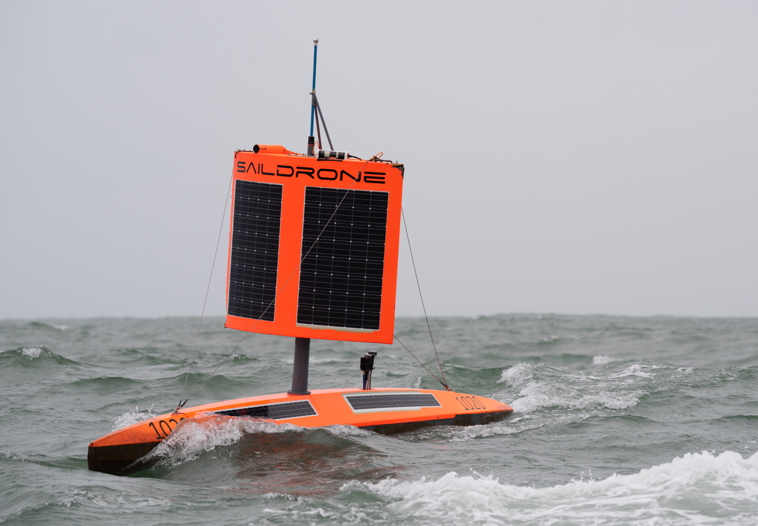
Saildrone 1020 survived freezing temperatures, 15-meter waves, 130 km/h winds, and collisions with giant icebergs to complete the 22,000-kilometer mission in 196 days.
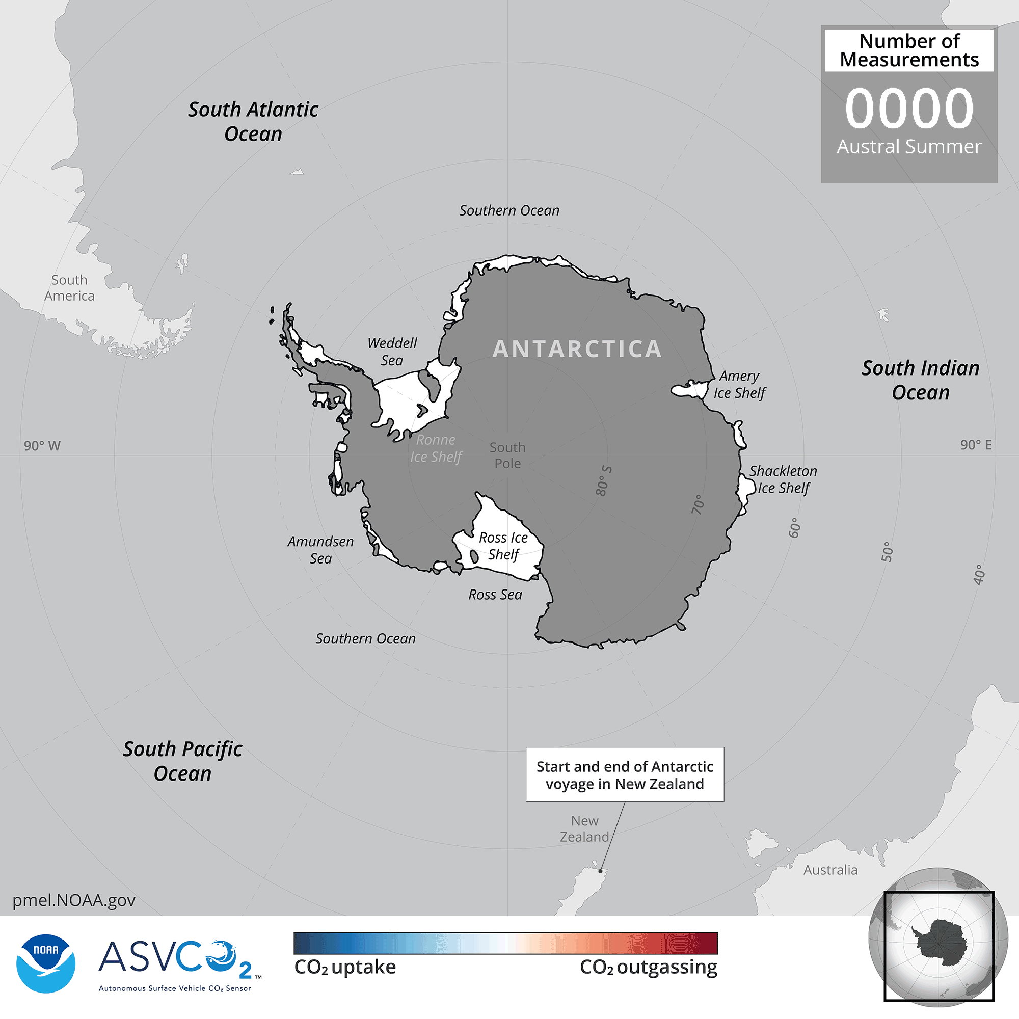
Click on image to see animation of the sea-air CO2 from the 2019 Antarctica circumnavigation.
It was an audacious idea: To send an unmanned saildrone on a 13,670-nautical-mile journey around Antarctica alone, at the mercy of the most hostile seas on the planet. In winter.
“The assumption was the Southern Ocean would eat the saildrone … and that would be that,” said NOAA oceanographer Adrienne Sutton. “But we were willing to try, given the large role the ocean plays in the trajectory of climate change. Getting the Southern Ocean's carbon balance right is urgently important."
Despite a run-in with an iceberg that wrecked some of its sensors, Saildrone 1020 completed its mission on August 3 having successfully collected oceanic and atmospheric carbon dioxide measurements with an instrument developed by NOAA’s Pacific Marine Environmental Laboratory.
The 196-day voyage was the world’s first autonomous circumnavigation of Antarctica — a technological feat that was unfathomable just a decade ago.
An arduous journey around the end of the world
Saildrone 1020 and two counterparts launched from Point Bluff, New Zealand on January 19, 2019, on a mission funded by the Li Ka Shing Foundation. The three saildrones collect and transmit a range of data on weather, seal and krill populations, and levels of carbon dioxide, CO2, in the air and water.
Until recently, scientists assumed that the Southern Ocean steadily absorbed large volumes of CO2 from the atmosphere — a big contributor to the entire ocean’s uptake of up to 40 percent of the greenhouse gases driving global warming.
However, scientists also knew shifts in winds and circulation around Antarctica could alter CO2 uptake from the atmosphere, and recent measurements from instrumented Argo floats showed that under certain conditions the Southern Ocean could emit CO2 instead of absorbing it. But researchers had yet to sample vast areas, especially during stormy autumn and winter seasons.
The severe weather survived by the saildrone demonstrated why.
Pounded by storms right after leaving New Zealand, Saildrone 1020’s partners, Saildrones 1022 and 1023, were soon forced to return to port for repairs, while Saildrone 1020 pushed on through roaring winds and giant waves.
Navigating east of the Drake Passage on April 5, a collision with an iceberg damaged its atmospheric sensors and onboard camera, but left the carbon dioxide sensor intact.
“On four previous voyages in the Southern Ocean, the wings on our saildrones broke after just a few days, so we went back and built something we thought was indestructible,” said Saildrone founder and CEO Richard Jenkins. “It was a long shot, but it worked out exactly as we hoped."
Preliminary results suggest that parts of the ocean identified by the floats as potential CO2 sources were indeed emitting the greenhouse gas during winter months. Saildrone 1020 also got close enough to one of the floats to allow scientists to compare their CO2 measurements, a valuable cross-check of different robots and observing techniques.
“It was a high-risk, high reward kind of deployment,” Sutton said. “We weren’t sure it was going to make it.
Meanwhile, after being repaired and relaunched, Saildrones 1022 and 1023 are finding their own their way around Antarctica now.
Read more here: https://www.saildrone.com/news/unmanned-vehicle-completes-antarctica-circumnavigation
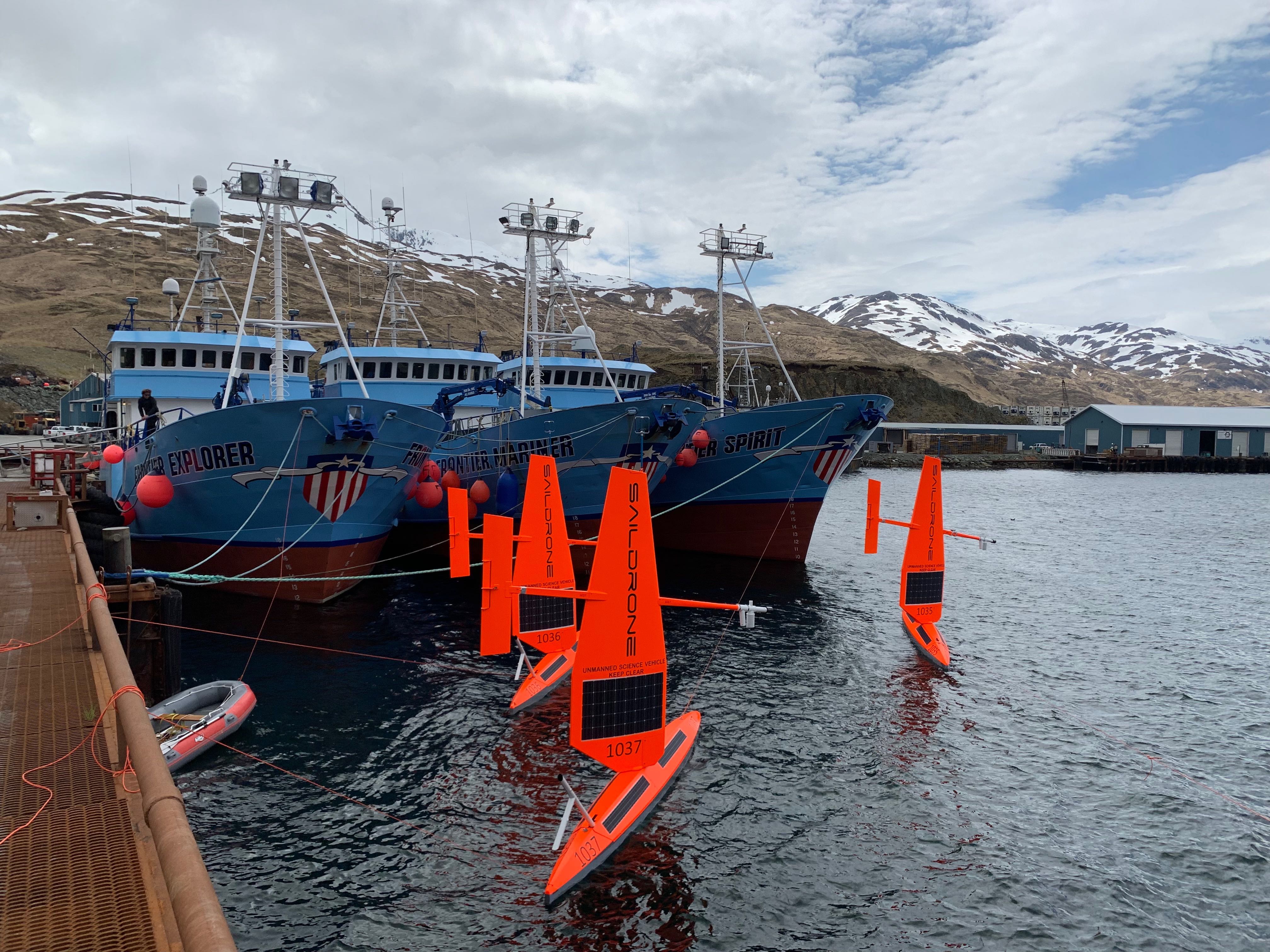
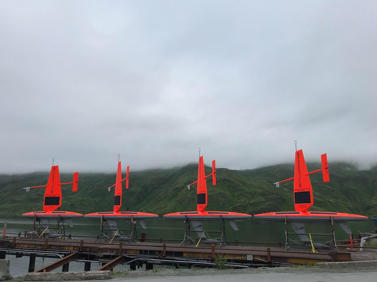
Three of six saildrones getting ready for deployment from Dutch Harbor, AK, on the 2019 Arctic mission. Photo Credit: Saildrone, Inc.
On May 16, six saildrones loaded with scientific instruments and cameras launched from a dock in Alaska's Dutch Harbor to monitor ongoing changes to the U.S. Arctic ecosystem food-chain, ice movement, and large-scale climate and weather systems.
This is the first year NOAA and NASA scientists will be working together to use the drones to survey as close to the Arctic ice edge as possible. Measurements collected this summer in the Arctic will not only be used to improve NOAA and NASA satellite ocean temperature measurements, they will also be available to global weather agencies for operational use.
While most of the saildrones will be pursuing the ice edge for the duration of the three-month mission, two other simultaneous projects will also tackle some big questions on how this cutting-edge technology can be used to collect critical observations. NOAA PMEL scientists will continue to study how the Chukchi Sea is absorbing carbon dioxide to help improve weather and climate forecasting as well as our understanding of ongoing changes in the Pacific-Arctic ecosystem. The Bering Sea is home to the largest walleye pollock fishery and the declining population of northern fur seal which primarily feed on pollock. During the summer, NOAA Fisheries scientists will use the saildrone combined with traditional at-sea tracking techniques and video cameras to get a seals-eye view during fur seal feeding trips and measure walleye pollock abundance and distribution. Read more about the work done by NOAA's Alaska Fisheries Science Center.
This is a joint NOAA mission along with the Earth & Space Research, the University of Washington's Joint Institute for the Study of Ocean and Atmosphere and the Applied Physics Lab, and Saildrone, Inc.
Saildrones have traveled about 45,000 nautical miles on Arctic missions since 2015. Follow along with drones as they collect data on fish, fur seals, changes in the Arctic ecosystem and more on the mission blog.
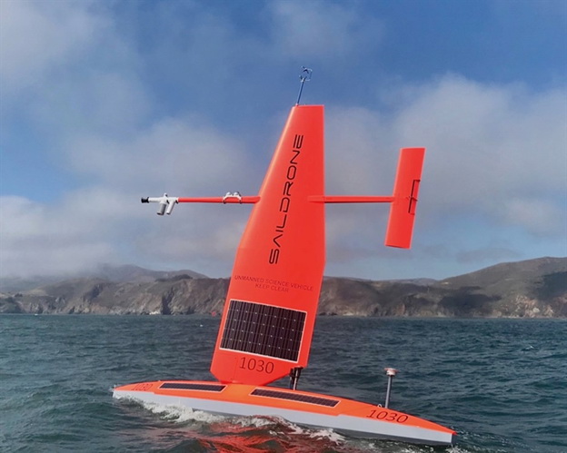
The Saildrone is an autonomous sailing drone currently being explored as a tool to provide high quality oceanic and atmospheric observations (Photo Credit: Saildrone, Inc.).
This week, four saildrones departed from Hawaii on the second mission to the equator in an effort to improve the Tropical Pacific Observing System (TPOS). NOAA forecasts a 50-55% chance of a weak El Niño developing during September - November 2018, increasing to 65-70% chance during winter 2018-19. The second saildrone mission will thus capture ocean and atmospheric data during this developing El Niño, including changes in ocean temperature, winds, currents and ocean carbon dioxide concentrations.
During the first mission in late 2017-early 2018, La Niña conditions were present. Strong currents and low winds on the equator made navigation challenging. This year, two of the four saildrones have been outfitted with larger, more efficient sails, making them faster and more capable in low wind-strong current environments.
This mission is part of a series of saildrone missions to the tropical Pacific, focusing on how this new technology could best be used within the TPOS to improve longterm weather forecasts.
PMEL began a partnership with Saildrone, Inc. in 2014 to develop the unmanned surface vehicles for collecting high quality oceanic and atmospheric observations. PMEL's Ocean Climate Stations group has been working together with PMEL engineers and Saildrone, Inc. since 2016 to install sensors on the drones with equivalent or better quality than those currently used on TAO moorings for air-sea flux measurements.
Follow the TPOS Saildrones’ progress at: https://www.pmel.noaa.gov/ocs/ocs-saildrone-mission-blog-tpos-mission-2
Four saildrones ready for deployment in Dutch Harbor, Alaska. to conduct ocean acidification and fisheries research in the Arctic Ocean. Photo credit; Saildrone, Inc.
Over the last week, Saildrone Inc. and NOAA have launched the first batch of saildrones in Alaska and the Washington coast to enhance our understanding of fisheries, ocean acidification and climate science.
Four of these saildrones launched from Dutch Harbor, Alaska this past weekend and will make their way northward, surveying more than 20,000 miles through Bering Strait and into the Arctic Ocean to measure atmospheric and surface ocean conditions, carbon dioxide in the ocean, and the abundance of Arctic cod. Arctic cod is a key component of the Arctic marine ecosystem as a food source for seabirds, ringed seals, narwhals, belugas and other fish. These two missions will gather measurements to identify ongoing changes to the Arctic ecosystem and how changes may affect the food-chain as well as large-scale climate and weather systems.
Last year was the first time the drones journeyed through the Bering Strait into the Arctic with a newly adapted system to measure carbon dioxide concentrations. Jessica Cross, NOAA Oceanographer at PMEL, continues to use saildrones to study how the Arctic Ocean is absorbing carbon dioxide to help improve weather and climate forecasting and our understanding of ocean acidification in these critical ecosystem areas.
Alex De Robertis, NOAA Fisheries Biologist with Alaska Fisheries Science Center, is mapping fish with sound to determine the amount and distribution of Arctic cod. Two drones will survey the same remote locations as previous ship-based surveys in hopes of demystifying the story of Arctic cod as temperatures and ice cover change in the Arctic. “We are trying to unravel the puzzle of what happens to the young Arctic cod that are so abundant in the summer on the Chukchi shelf,” says De Robertis. “There are many young-of the year Arctic cod in this area, but comparatively few adults. They either move to other areas or don’t survive the winter. What is their fate?”
These two missions will continue to further demonstrate the operation of these platforms at high-latitudes through the first fully autonomous acoustic fish survey and field tests of an updated carbon dioxide system that was re-designed to address challenges observed during the 2017 mission.
NOAA and Saildrone, Inc. are embarking on the fifth year of collaboration and novel data collection using saildrones to better understand how changes in the ocean are affecting weather, climate, fisheries and marine mammals.
Read more about all the NOAA Saildrone missions this summer here: http://www.noaa.gov/stories/flotilla-of-saildrones-deploy-to-artic-and-pacific-for-earth-science-missions
Follow along with the Arctic missions on this blog: https://www.pmel.noaa.gov/itae/follow-saildrone-2018
Read more about the West Coast Fisheries survey here: https://swfsc.noaa.gov/news.aspx?ParentMenuId=39&id=23090
Learn more about what we did in previous Alaska surveys:
PMEL Follow the Saildrone 2017
NOAA Fisheries video on 2017 mission
2017 Fur Seal Blog by Carey Kuhn
NOAA Saildrone Research 2016 – Live YouTube Broadcast Recording
2016 Press release and Press Conference
Tracking Technology: the Science of Finding Whales: Video interview with Jessica Crance
2016 Fur Seal Blog by Carey Kuhn
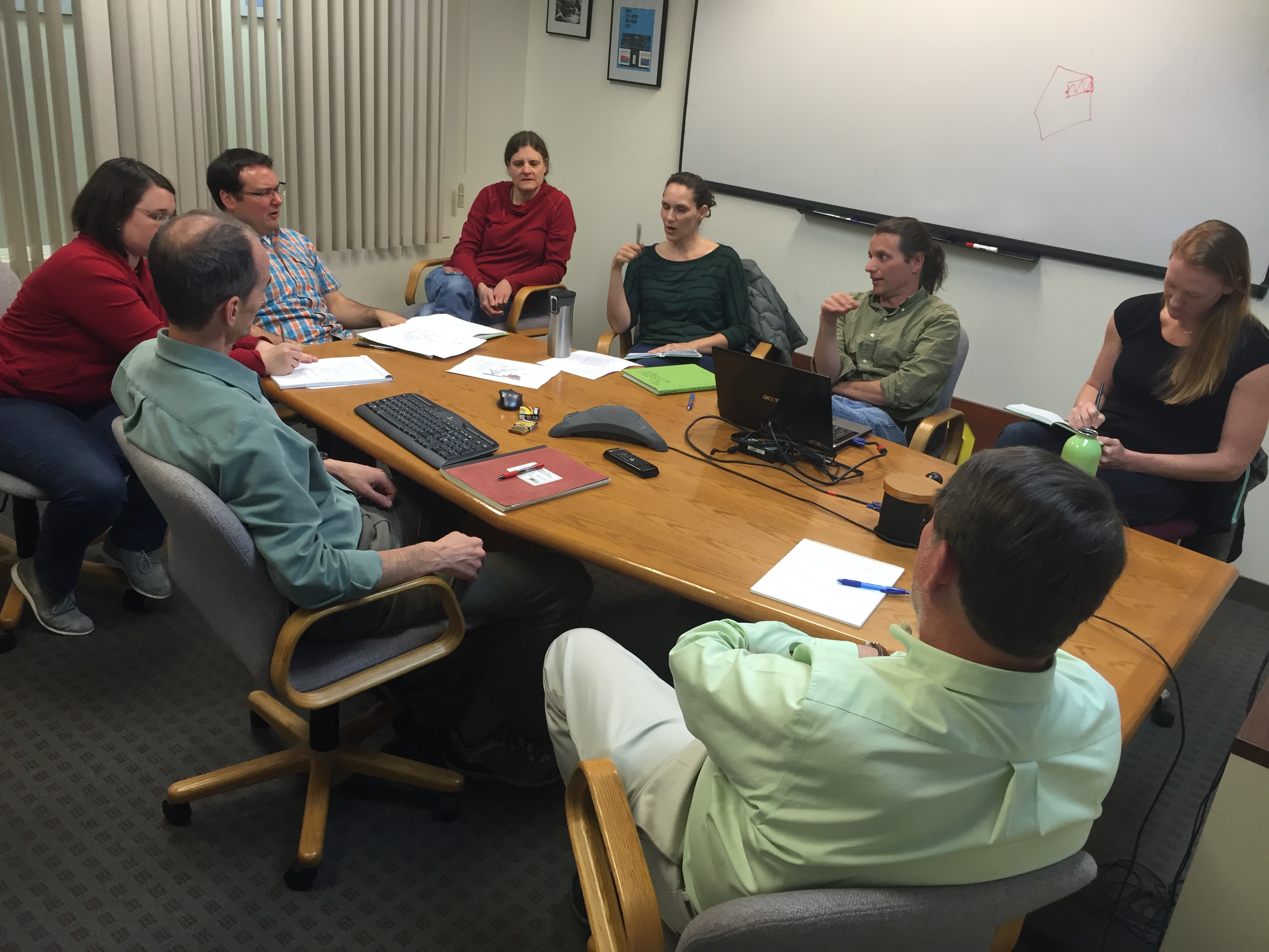
Engineers and scientists of the 2016 Saildrone Team discussing the first phases of the summer mission in the Bering Sea.
Congratulations to all involved with the 2016 Saildrone missions on receiving the Department of Commence Bronze Award and to Susie Snyder for receiving the NOAA Distinguished Career Award.
NOAA’s PMEL and Alaska Fisheries Science Center were awarded the Bronze Medal for “strengthening NMSF-OAR collaborations through the pioneering use of a Saildrone for next-generation ecosystem surveys in the Bering Sea”.
In 2016, the team successfully conducted the first ecosystem study using two Saildrones. The mission combined both physical and biological oceanography to seek out new ways to supplement traditional vessel-based research. The Saildrones each traveled almost 3,000 nautical miles in the 101 day mission testing innovative technologies, including a specially developed echo sounder and a modified whale acoustic hydrophone. Collectively, the oceanographic, meteorological, and fisheries measurements provided unique and groundbreaking insights to understanding the economically and culturally important ecosystem in the Bering Sea.
This was a collaborative mission between the NOAA’s Pacific Marine Environmental Lab, NOAA’s Alaska Fisheries Science Center, UW Joint Institute for the Study of the Atmosphere and Ocean, Saildrone Inc., Simrad AS/Kongsberg Maritime, Greeneridge Sciences Inc, and Wildlife Computers. Read more about the 2016 mission here.
The DOC Bronze Award is the highest honor award granted by the Under Secretary of Commerce for Oceans and Atmosphere, which recognizes superior performance characterized by outstanding or significant contributions, which have increased the efficiency and effectiveness of NOAA.
Susie Snyder was also awarded The Distinguished Career Award for her “continued efforts in improving budgetary policies and procedures relating to memorandum of agreements and reimbursable funds throughout 30 years of service to NOAA”. This award honors contributions on a sustained basis — a body of work — rather than a single, defined accomplishment. This award also recognizes significant accomplishments across all NOAA program areas and functions that have resulted in long- term benefits to the bureau’s mission and strategic goals.
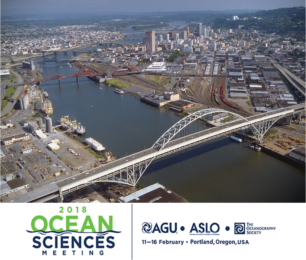
Image of the Willamette River in Portland, OR where the Ocean Sciences Meeting will take place.
More than 50 PMEL scientists, including scientists from NOAA, University of Washington's Joint Institute for the Study of the Ocean and Atmosphere (JISAO), Oregon State University's Cooperative Institute for Marine Resources Studies (CIMRS) and the National Research Council, will present a talk or share a poster on their research at the 2018 Ocean Sciences Meeting in Portland, Oregon February 12-16, 2018. PMEL research groups that will be present at the conference are: Acoustics, Arctic, Earth-Ocean Interactions, EcoFOCI, Engineering, Global Tropical Moored Buoy Array, Innovative Technology for Arctic Exploration, Large Scale Ocean Physics, Ocean Carbon, Ocean Climate Stations, Pacific Western Boundary Currents, Science Data Integration Group, Thermal Modeling and Analysis Project
28 talks will present research on ocean carbon, ocean acidification, ocean observing systems, Arctic research including the Distributed Biological Observatory and Arctic Marine Pulses (AMP), ENSO, MJO, hydrothermal vents, Saildrone research, air-sea interactions, SOCCOM, and ocean mixing. 26 posters will be up during the poster sessions and highlight research in the Arctic, hydrothermal vents, acoustics, methane bubbles and hydrates, Saildrone, Oculus Coastal Glider, ocean carbon, deep ocean temperatures, glider research in the Solomon Sea, and ocean acidification and hyopxia.
PMEL staff will also be chairing sessions and workshops on:
- El Nino-Southern Oscillation (ENSO) Diversity, Predictability, and Impacts
- Western Pacific and Indonesian Sea Circulation and Its Environmental and Climatic Impacts
- New Platform and Sensor Technologies: Advancing Research, Readiness, and Transitioning for Sustained Ocean Observing of Essential Ocean Variables
- Methane from the Subsurface Through the Bio-, Hydro-, and Atmosphere: Advances in Natural Hydrate Systems and Methane Seeps in Marine Ecosystems
- Cascadia Margin methane seep and hydrates to share results and coordinate future work
The 2018 Ocean Sciences Meeting is co-sponsored by the American Geophysical Union (AGU), the Association for the Sciences of Limnology and Oceanography (ASLO), and The Oceanography Society (TOS). The meeting is an important venue for scientific exchange across broad marine science disciplines. Sessions will include all aspects of oceanography, especially multidisciplinary topics, as well as presentations that reflect new and emerging research on the global ocean and society, including science education, outreach, and public policy