What's New Archive
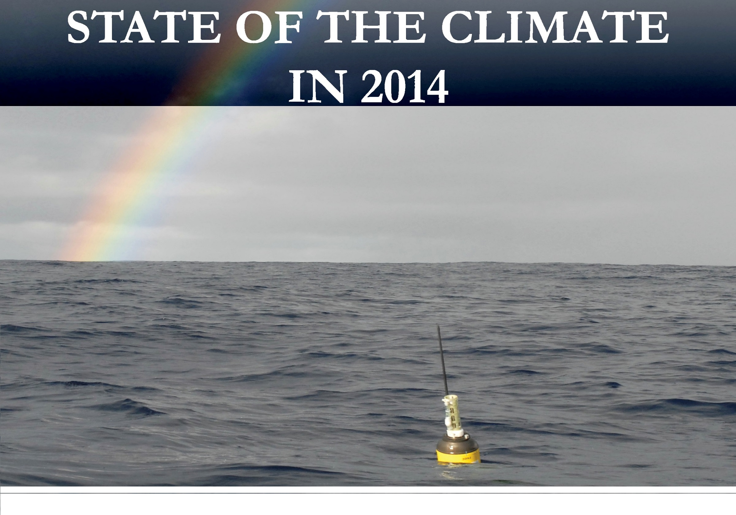
An Argo float on the cover of the State of the Climate in 2014.
The State of the Climate in 2014 report, published in July 2015 as a Bulletin of the American Meteorological Society supplement, highlights records in sea level, ocean heat content, and sea surface temperature, also documenting ocean climate variability including the borderline El Niño, the warm-water “Blob” in the Northeast Pacific, and a transition to the warm phase of the Pacific Decadal Oscillation. The cover features a PMEL Argo float, deployed in September 2007 and still active in July 2015. PMEL scientist Gregory Johnson co-edited the Global Oceans chapter of the report, composing haiku to summarize 2014 ocean variations:
Not quite El Niño, | North Oceans’ fluxes, warmth shift, | dance with weird weather.
and longer-term changes:
Seas warm, ice caps melt, | waters rise, sour, rains shift salt, | unceasing, worldwide.
Several PMEL, JISAO, and JIMAR scientists are section authors.
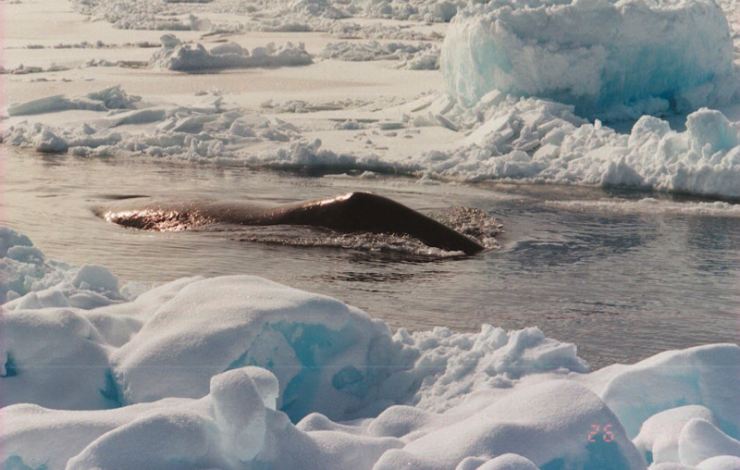
A bowhead whale swims through a lead in the sea ice. Photo by Robert Suydam.
More than 100 Arctic scientists and local experts have completed a multidisciplinary synthesis of marine ecosystem science in the Pacific Arctic to better understand recent, extreme changes in the region’s biophysics. The Synthesis of Arctic Research (SOAR) project, led by NOAA scientists Sue Moore (NOAA/Fisheries) and Phyllis Stabeno (NOAA/OAR), and supported by the Bureau of Ocean Energy Management, uses completed and ongoing research to capture the conditions of the ‘new state’ of the Pacific Arctic.
Synthesis findings are published in a special issue of Progress in Oceanography available July 13th, 2015, comprised of 17 papers on topics ranging from ocean physics to whales (http://www.sciencedirect.com/science/journal/00796611/136). Four of the special issue papers are open access, including the preface to the special issue by Moore and Stabeno (http://www.sciencedirect.com/science/article/pii/S0079661115001147).
SOAR website: https://www.pmel.noaa.gov/soar/
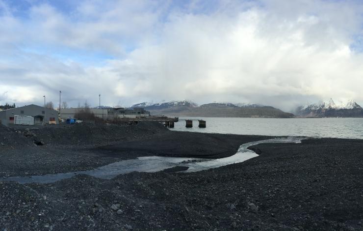
The Alutiiq Pride Shellfish Hatchery in Seward, Alaska.
Alaska currently has one shellfish hatchery in the state, but the industry is expected to expand to more than $1 billion in the next 30 years as demand for seafood increases. A new study, published in PLOS ONE, is a collaboration between NOAA/PMEL, the University of Alaska Fairbanks and the Alutiiq Pride Shellfish Hatchery in Seward, AK. This study is the first continuous monitoring of seawater conditions at an Alaska shellfish hatchery and it illustrates the potential vulnerability to ocean acidification in this industry. Under current conditions there is a 5-month window of favorable growing conditions for shellfish each year, but this window will shrink and may ultimately close as early as 2040 as water quality declines due to carbon dioxide. Hatcheries and natural shellfish populations will both be vulnerable to these declining growth conditions.
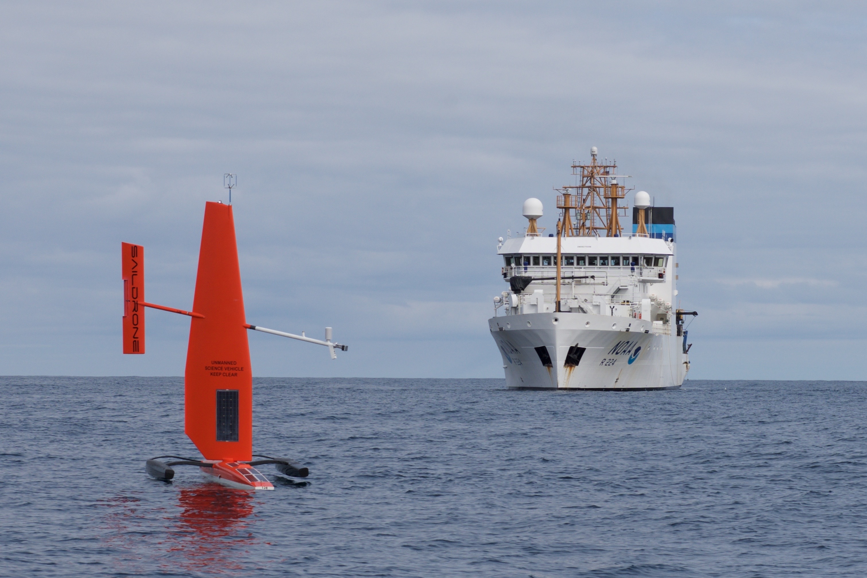
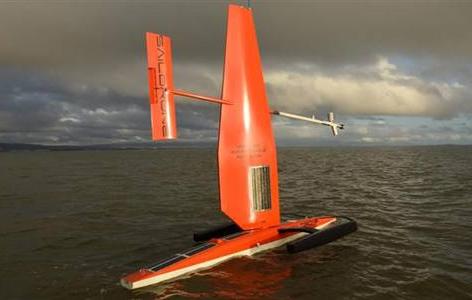
The Saildrone with NOAA ship Oscar Dyson in the background. Photo credit: Mark Frydrych
In April, PMEL and JISAO scientists and engineers teamed up with Saildrone, Inc. to test two Saildrones in the harsh environment of the Bering Sea for the first time. The unmanned instruments sailed from Dutch Harbor, AK on April 22. They have traveled over 2,000 miles each since then, taking over 40 million measurements as they sail north following the ice retreat. With the Arctic environment changing rapidly, the success of these vehicles couldn’t come at a better time. The measurements taken across the eastern Bering Sea have the potential to provide a comprehensive picture of the changes that occur in the late spring environment when the ice is retreating.
Read more about this research on the NOAA Research page and the Innovative Technology for Arctic Exploration site.
The changing Arctic climate is a harbinger of a global future, but to understand emerging patterns we need to know more about the past history of the Earth's weather. The handwritten journals and logbooks of scientists and sailors who for centuries have left records of the weather and environmental conditions they encountered on their travels provide unique information about the history of the Arctic climate.
Help scientists recover Arctic weather observations made by explorers. These transcriptions will contribute to climate model projections and improve a database of weather extremes. Historians will use your work to track past ship movements and the stories of the people on board. Learn more from the Old Weather YouTube video and at the Arctic ReDiscovery website.
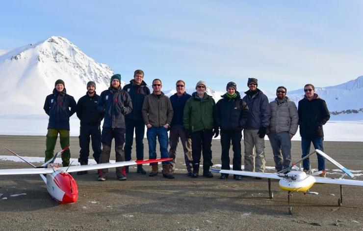
Kjell-Sture Johansen (NORUT), Dan Mock (AUV), Andreas TØllefsen (NORUT), Rune Storvold (NORUT), Scott Stalin (PMEL), Nick Delich (PMEL), Jim Johnson (PMEL), Hagen Teig (ESRL),Brad Hooper (AUV), Tej Dhakai (LDEO), and Scott Brown (LDEO) with partner groups after the final mission. Photo credit: Kjell-Sture Johansen
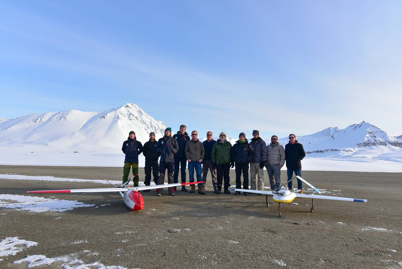
Kjell-Sture Johansen (NORUT), Dan Mock (AUV), Andreas TØllefsen (NORUT), Rune Storvold (NORUT), Scott Stalin (PMEL), Nick Delich (PMEL), Jim Johnson (PMEL), Hagen Teig (ESRL),Brad Hooper (AUV), Tej Dhakai (LDEO), and Scott Brown (LDEO) with partner groups after the final mission. Photo credit: Kjell-Sture Johansen
PMEL atmospheric chemists Trish Quinn and Tim Bates teamed up with other scientists and engineers to measure black carbon (soot) in the climate sensitive Arctic region. The scientists launched out of Ny-Ålesund, Norway using Mantas, an unmanned aerial systems (drones) to take measurements in the atmosphere, using a suite of sensors that could capture particle size and composition, light scattering properties and tracers that help detect the geographic origin of the particles. Scientists and engineers completed a total of 26 flights during this field season, in addition to sampling snow on the ground for black carbon deposition measurements. The data from flights and snow will help scientists better understand how black carbon is transported to the Arctic and to constrain its contribution to ice melt and warming in the Arctic.
For more information, read here about the 2015 field season and visit the Atmospheric Chemistry webpage.
Saildrone in the open water. Credit: Saildrone Inc.
On April 22, two autonomous surface vehicles equipped with meteorological and oceanographic sensors will be released for the first time in the Bering Sea by NOAA’s Office of Oceanic and Atmospheric Research Pacific Marine Environmental Laboratory (PMEL).
Saildrones have the capacity to increase observational infrastructure in remote and hostile polar regions where ship time and human labor is costly and potentially hazardous. The ongoing development of Saildrones is a collaborative effort of researchers at PMEL, the Joint Institute for the Study of Atmosphere and Ocean (JISAO) at the University of Washington, the University of Alaska Fairbanks, and Saildrone Inc.
The wind- and solar-powered Saildrone incorporates the principles of sailing and scientific research with a nearly 20 foot high carbon-fiber wing that speeds through the waters with a suite of high resolution sensors. Compared to other remotely operated vehicles, these autonomous surface vehicles can carry over 200 pounds of instrumentation, travel at speeds up to 16 mph, and are quickly maneuverable. There is also no need to ‘drive’ or continuously monitor Saildrones. Like a ship with a set course, a Saildrone will continue on its path while continuously taking measurements, notifying on-call engineers of potential dangers via phone.
For the past year, scientists and engineers have focused on successfully developing the technology to operate in colder waters while obtaining quality data. The April deployment in the Bering Sea will focus on gathering and verifying that data collected are accurate enough for NOAA research and climate studies. By 2016, researchers hope to be north of the Bering Sea and entering Arctic waters.
PMEL researchers and Saildrone Inc. engineers have incorporated a suite of sensors into the Saildrone that include wind, air temperature and humidity, barometer, ocean surface temperature, water temperature, salinity, dissolved oxygen, and fluorescence. Pending a successful mission, the researchers and engineers are working on additional technologies, such as an acoustic fish finder to examine fish populations and a carbon dioxide-methane sensor to measure gas exchange between the air and water.
“Our ultimate goal using Saildrones is to understand the Arctic ecosystem at the water surface and throughout the water column,” said Calvin Mordy, Ph.D., a lead scientist on the project from JISAO.
“Our ultimate goal using Saildrones is to understand the Arctic ecosystem at the water surface and throughout the water column”
Studies of the Bering Sea and Arctic waters are conducted mostly with ships. However, shortcomings of research vessels include their cost, limited range of observations, and seasonal measurements. The use of Saildrones in colder waters could allow scientists to enhance ship time, expand their range of measurements in the ocean, and continue to monitor through the entire year. These air and water measurements can be used to better understand warming temperatures, decreasing sea ice, and ocean acidification in an area that is not only a productive ecosystem, but also a valuable fishery for salmon, king crab, and Walleye pollock.
While Saildrones are rugged instruments that have been tested in the waters of San Francisco and other more temperate waters, the Bering Sea presents unique challenges. Strong currents around Alaska can make steering difficult, while limited sunshine may affect some of the solar-powered instruments. The most unique challenge of the Saildrone will be navigating through a potential sea of jellyfish. In large enough numbers, the jellyfish can clog the water intake system that allows the suite of instruments to take measurements.
After the initial testing, the two Saildrones will spend the next couple weeks mirroring the NOAA ship Oscar Dyson and testing validity of the data sets during regular operations on the M2 Biophysical Mooring in the southeastern Bering Sea . Once these comparisons are complete the autonomous surface vehicles will continue solo, heading northward in search of sea ice until July, when they will be retrieved from Nome, Alaska. A successful deployment of Saildrones into the Bering Strait would be symbolic for the potential of these autonomous surface vehicles to survey waters from pole to pole.
Published in NOAA Research News
by Caroline Mosley, NOAA Research Communications
The age of Arctic sea ice can be determined using satellite observations and drifting buoy records to track the movement of ice floes, and can be a rough indicator for ice thickness.
This NOAA PMEL animation shows the age of the ice at the end of each winter since 1987. Paler colors indicate older ice, with light blue indicating 4-year ice to white indicating very old ice.
In the 1980’s, 26% of the Arctic winter ice pack consisted of thick ice built up over multiple years. After 2007, older ice diminishes rapidly and is replaced by younger ice. Starting in 2011, very old ice remains only along the Canadian coast.
At the end of winter 2014, only 10% of the ice pack was old ice, less than half the amount in the early 1980’s, and very old ice has become more rare. Learn more about Arctic Sea ice in 2014 in the Sea Ice article in the 2014 Arctic Report Card and visit PMEL's Arctic Research Page.
The NOAA-led Arctic Report Card was released today. The annual assessment of change in the Arctic shows the region continues to outpace the rest of the globe in response to climate change, warming at twice the rate of anywhere else on earth.
The report documents changes in air temperature, sea surface temperature, snow cover, sea ice extent, the Greenland ice sheet, ocean productivity, and vegetation over the tundra. A special addition this year includes an assessment of polar bear population dynamics in several different regions of the Arctic.
Read the NOAA press release and visit the Arctic Report Card: Update for 2014.
The NOAA-led Arctic Report Card 2014 was released today. In 2014, rising air and sea temperatures continued to trigger changes in the Arctic.
The Arctic is warming at twice the rate of anywhere else on Earth. However, natural variation remains, such as the slight increase in March 2014 sea ice thickness and only a slight decrease in total mass of the Greenland ice sheet in summer 2014.
The warming Arctic atmosphere was strongly connected to lower latitudes in early 2014, with cold air outbreaks into the eastern USA and warm air intrusions into Alaska and northern Europe. Arctic warming conditions are impacting polar bear conditions, northern hemisphere snow cover, sea surface temperatures and primary productivity, tundra and the Greenland ice sheet.
The annual Arctic Report Card tracks recent environmental changes, with 10 essays in 2014 prepared by an international team of 63 scientists from 13 different countries and an independent peer-review organized by the Arctic Monitoring and Assessment Programme of the Arctic Council. Read more...