September 2006 - Present | |||||||||||||
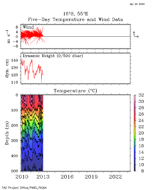
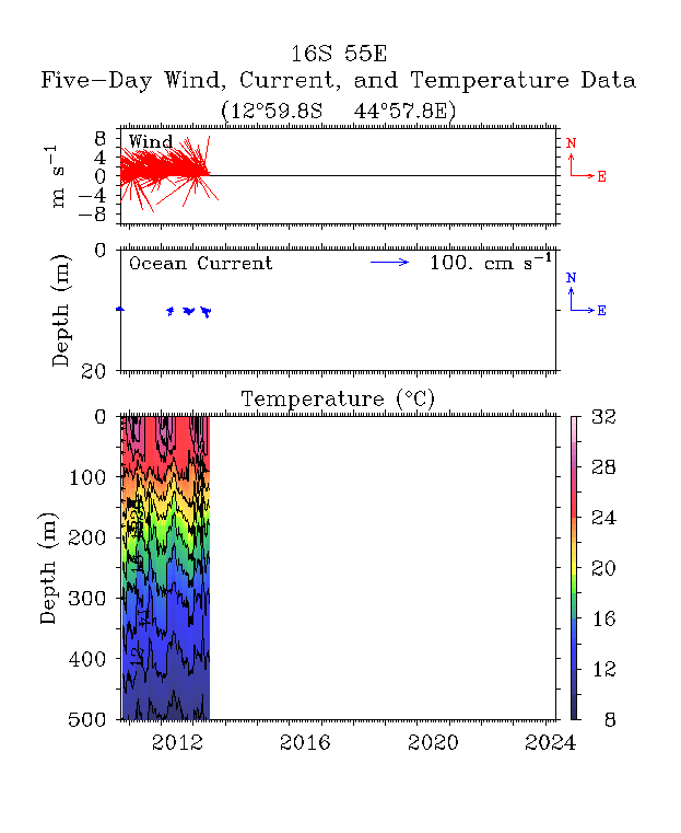
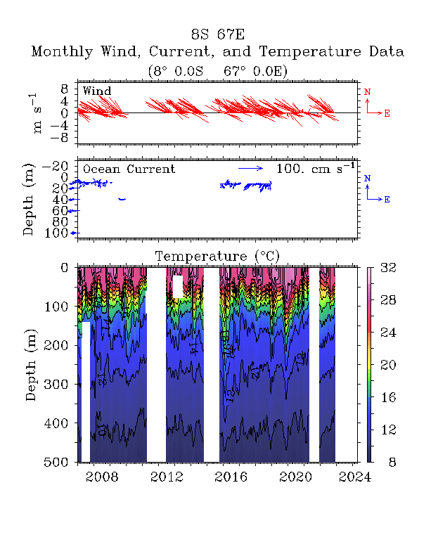
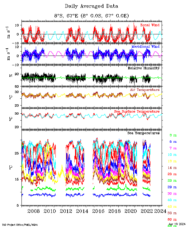
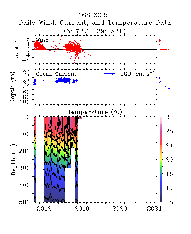
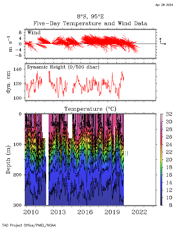
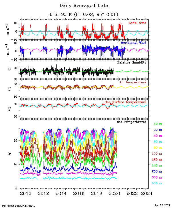
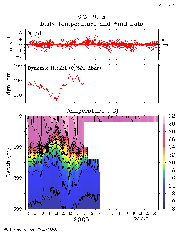
| Buoy Plot | Winds, Currents and Temperatures |
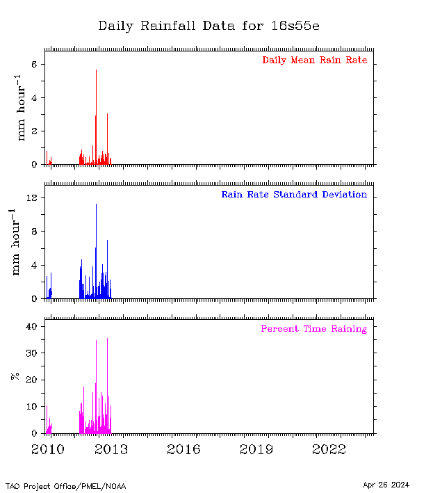
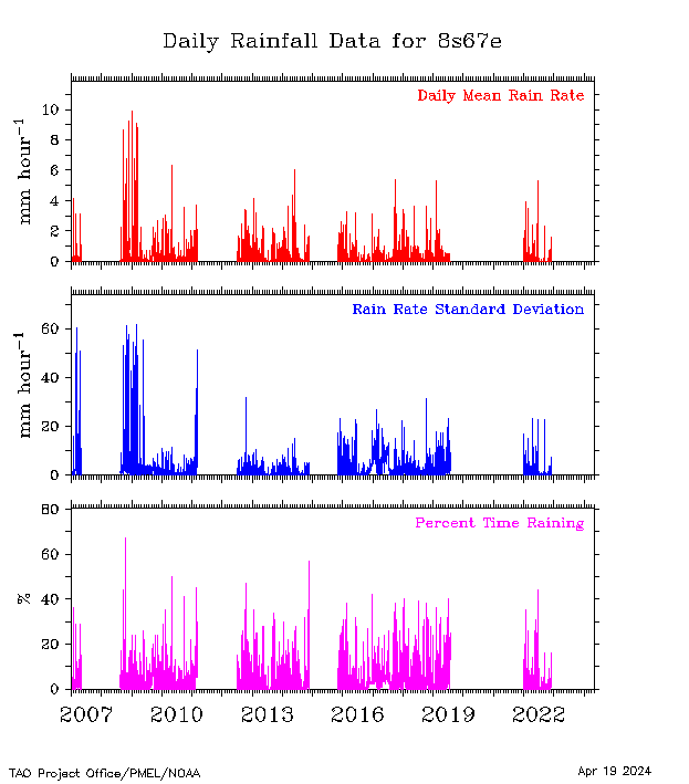
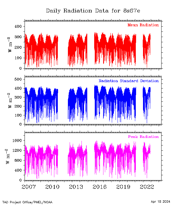
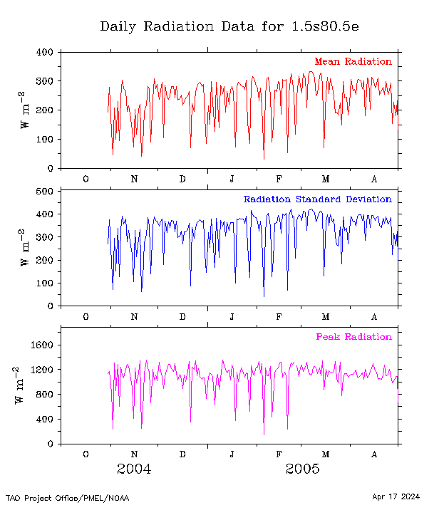
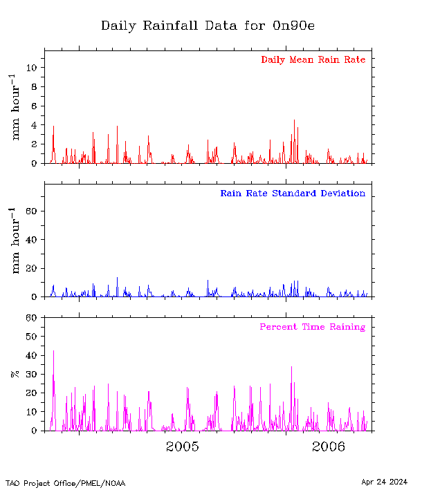
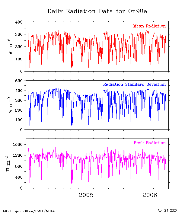
Sensor Plot | Rainfall | Shortwave Radiation |
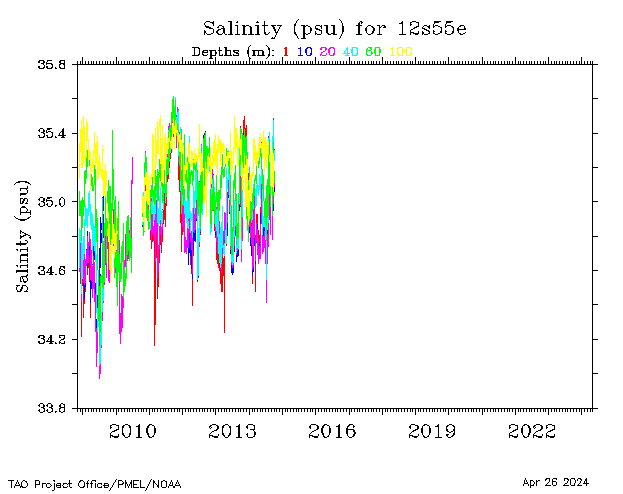
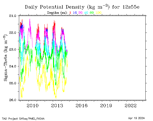
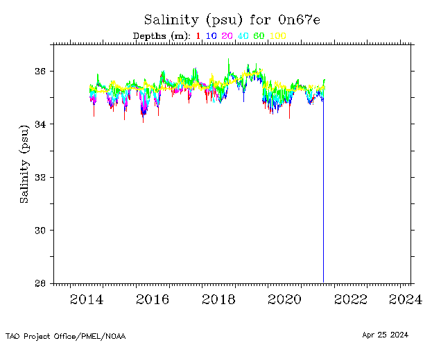
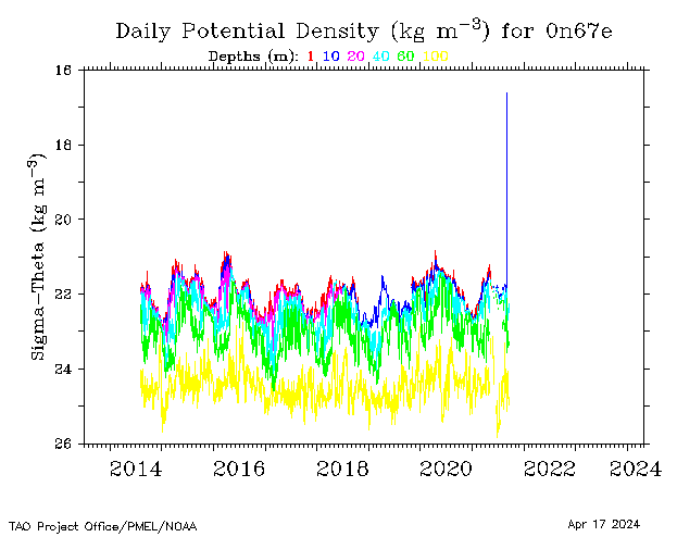
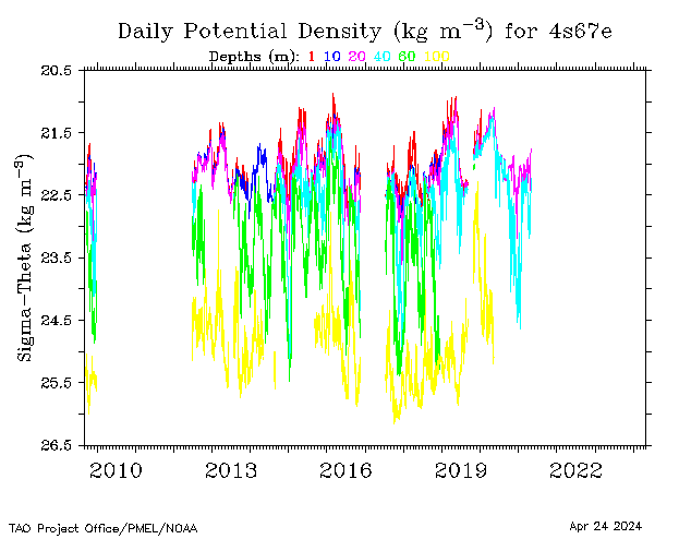
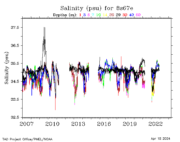
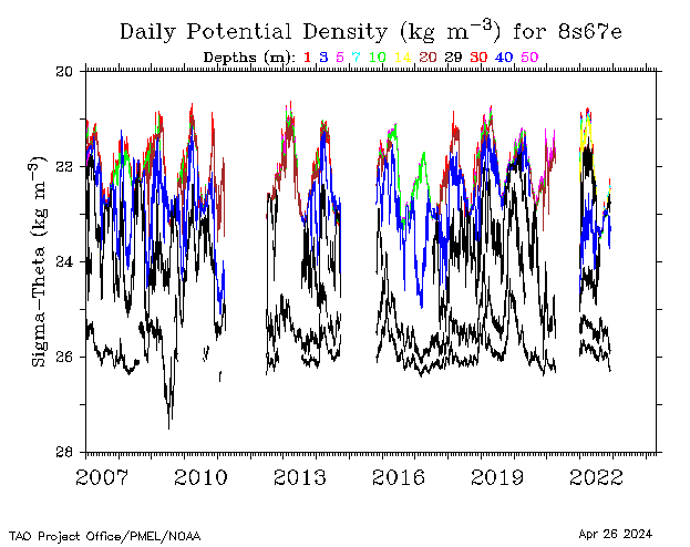
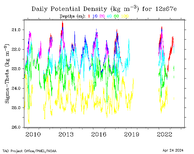
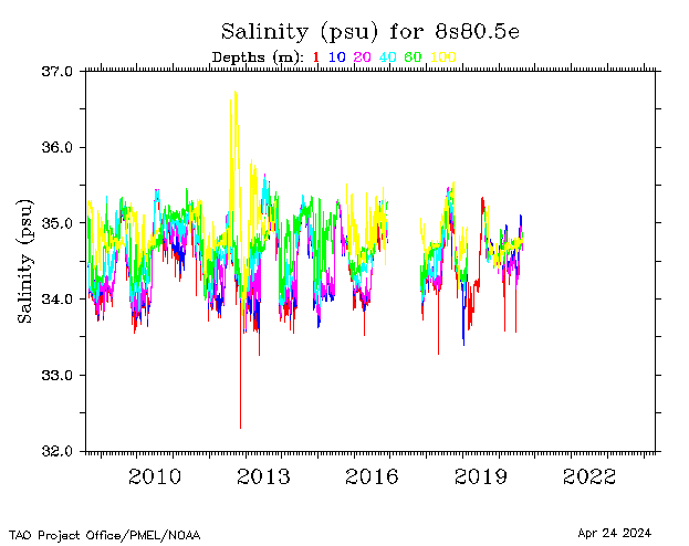
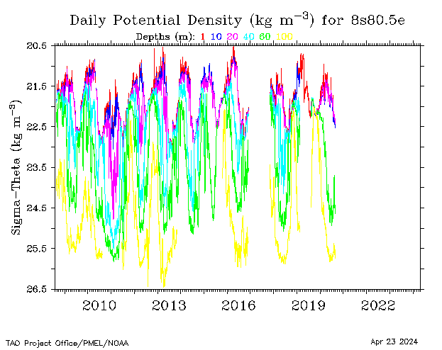
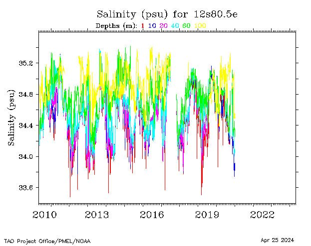
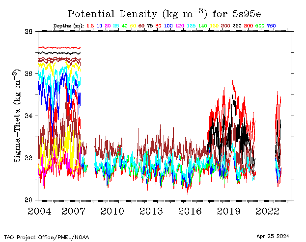
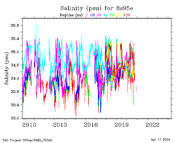
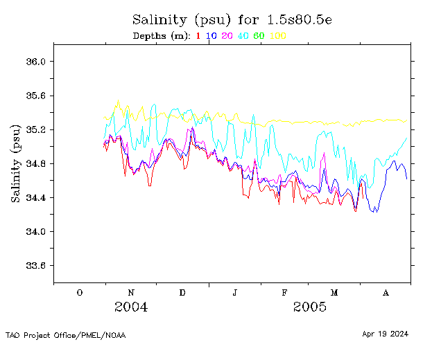
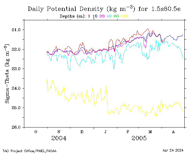
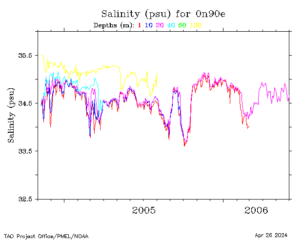
Salinity | Potential Density |
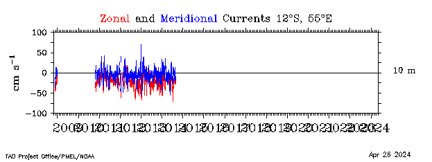
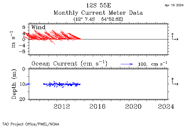
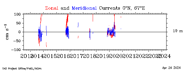
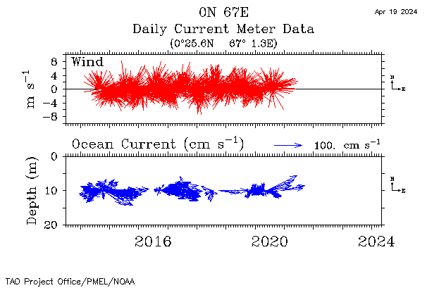
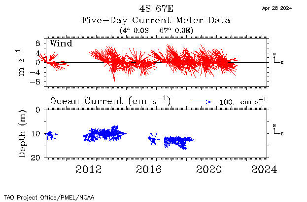
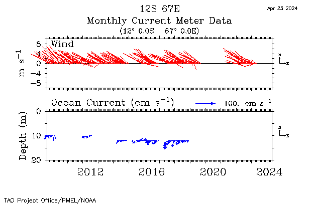
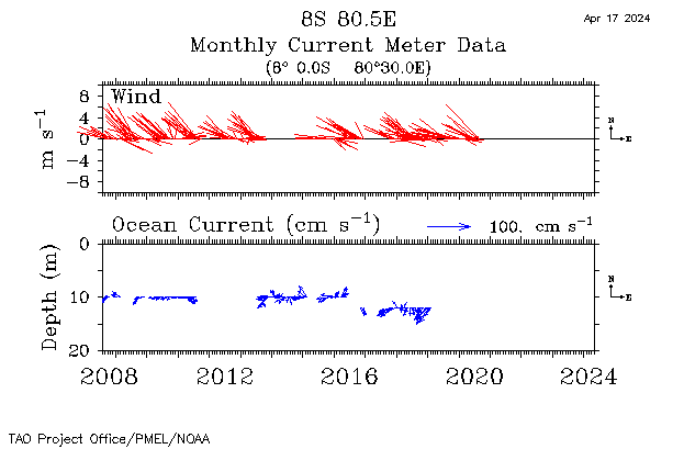
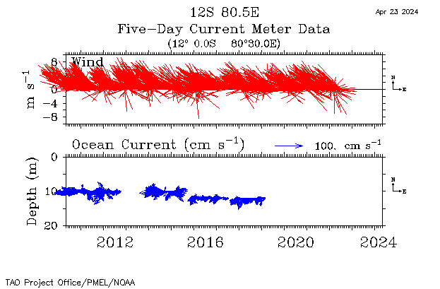
Currents | Winds and Currents |
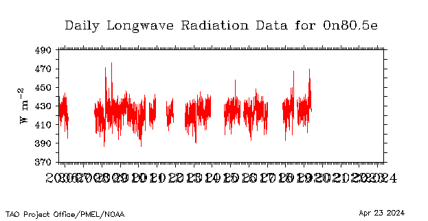
Longwave Radiation |
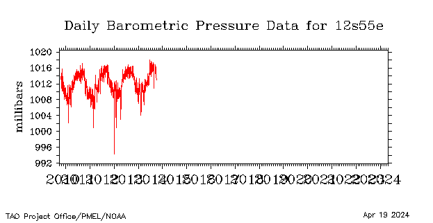
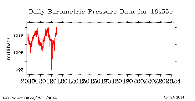
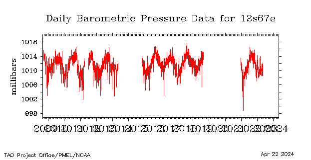
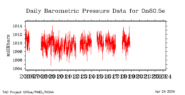
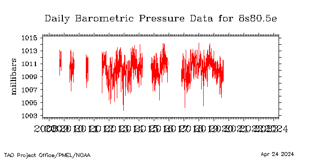
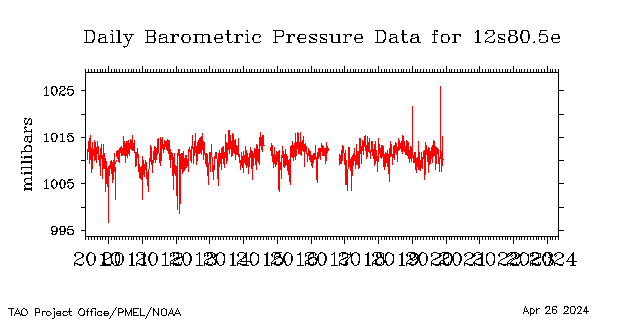
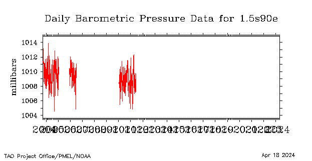
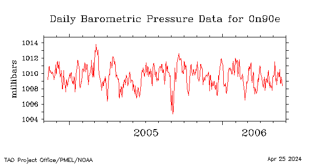
Barometric Pressure |
|||
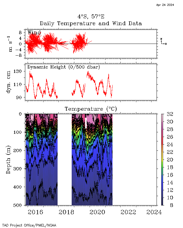
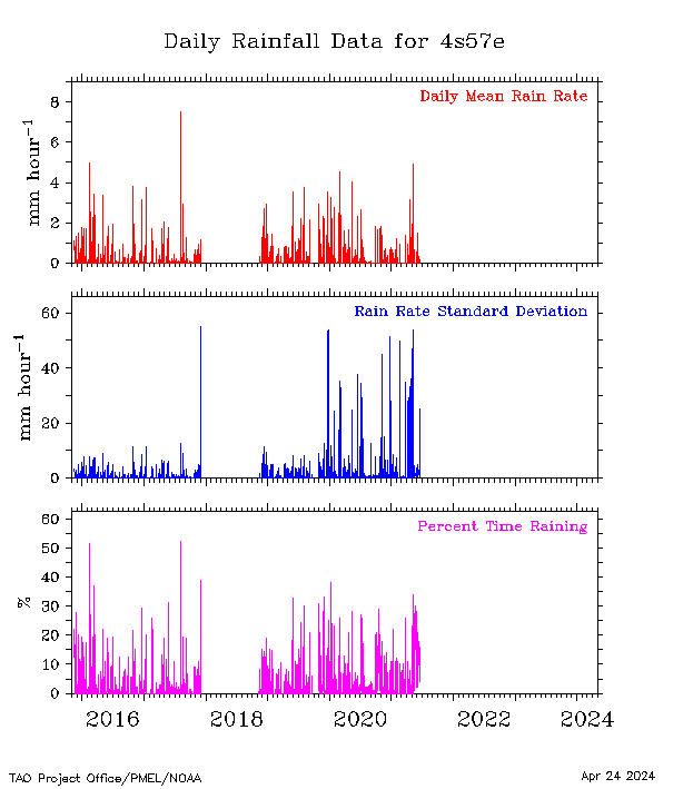
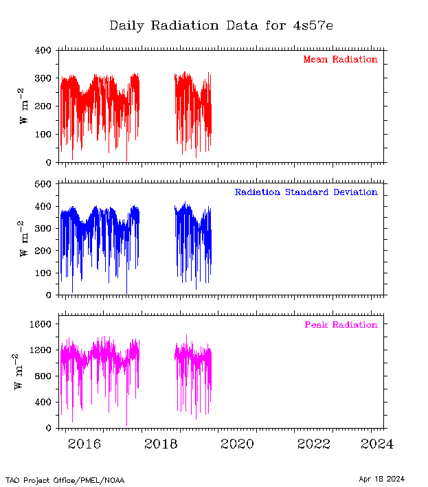
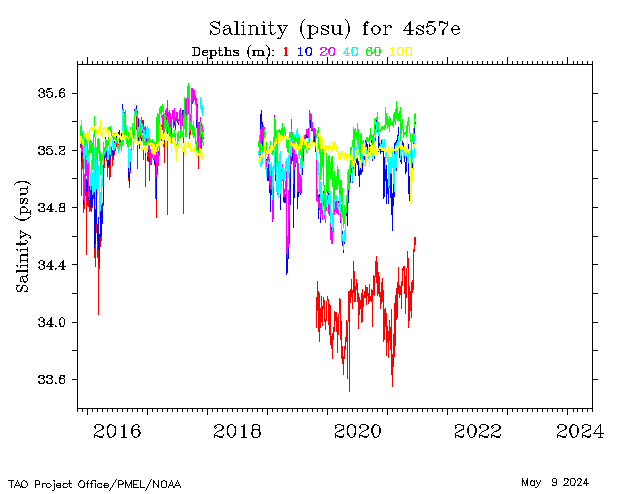
| 4°S, 57°E |
 |
 |
 |
 |
 |
 |
|||||||
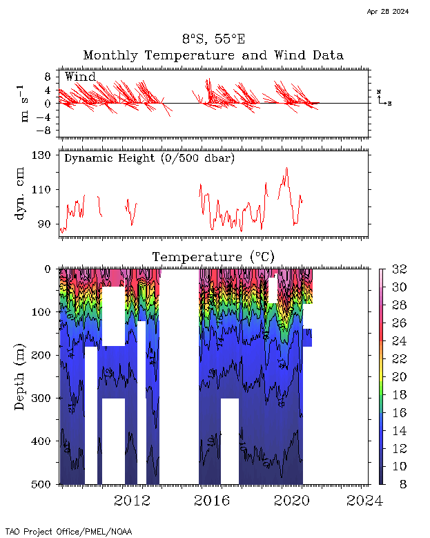
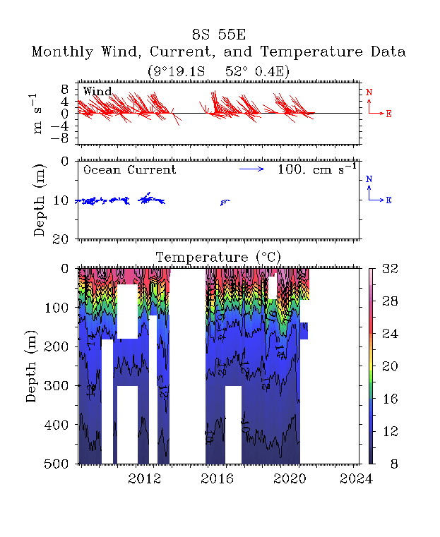
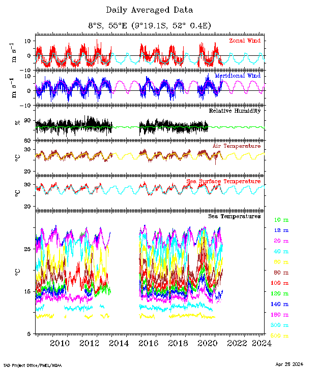
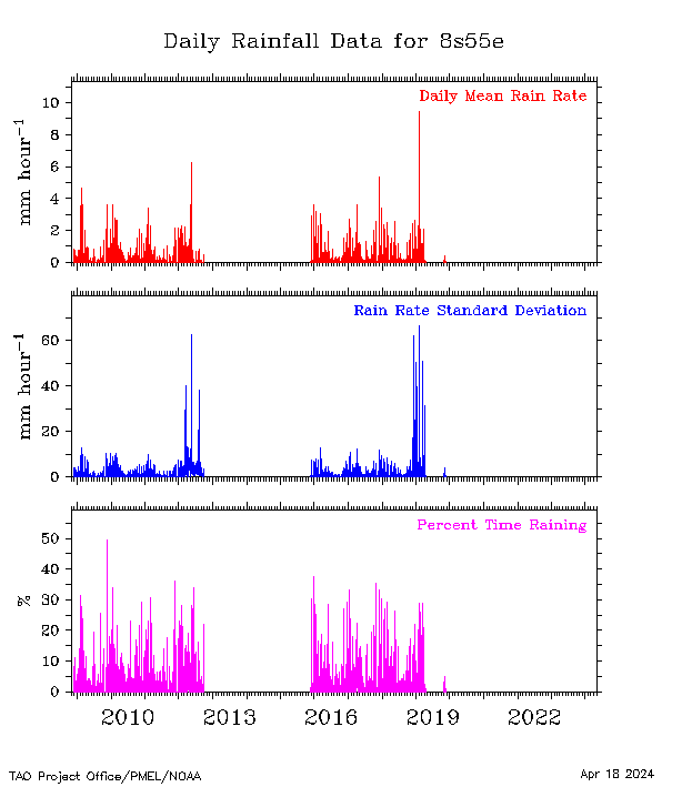
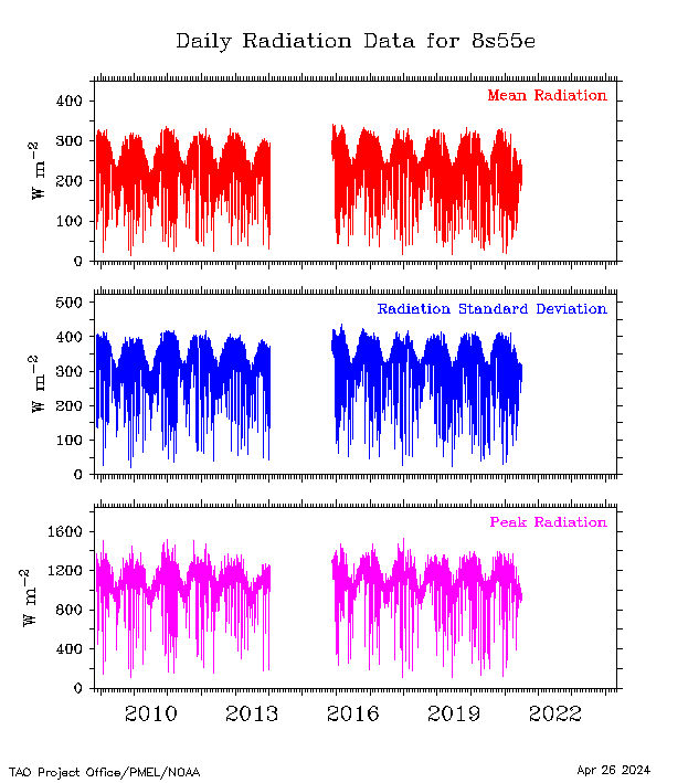
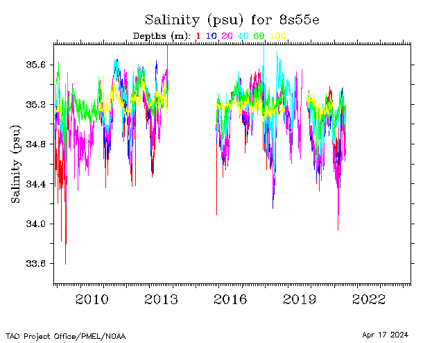
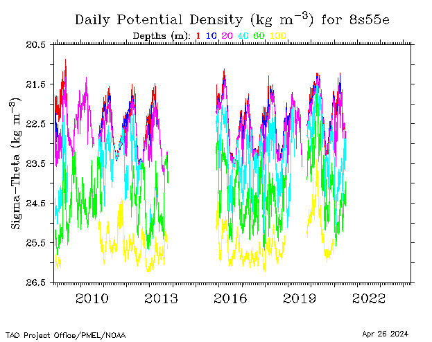
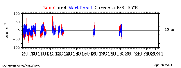
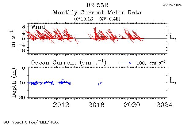
| 8°S, 55°E |
 |
 |
 |
 |
 |
 |
 |
 |
 |
||||
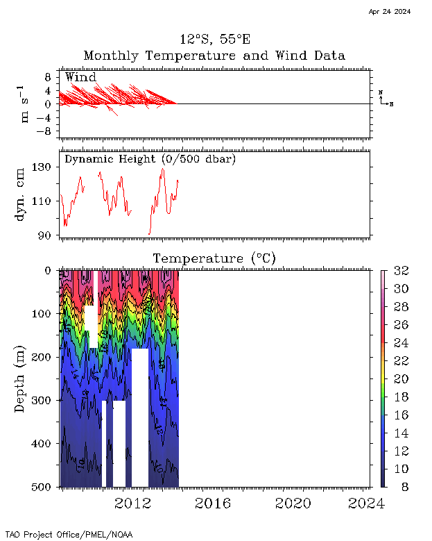
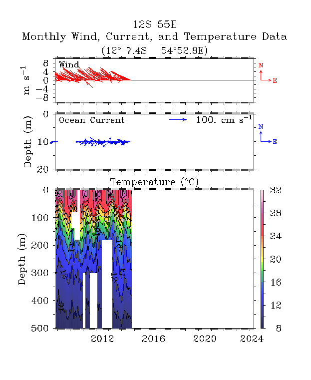
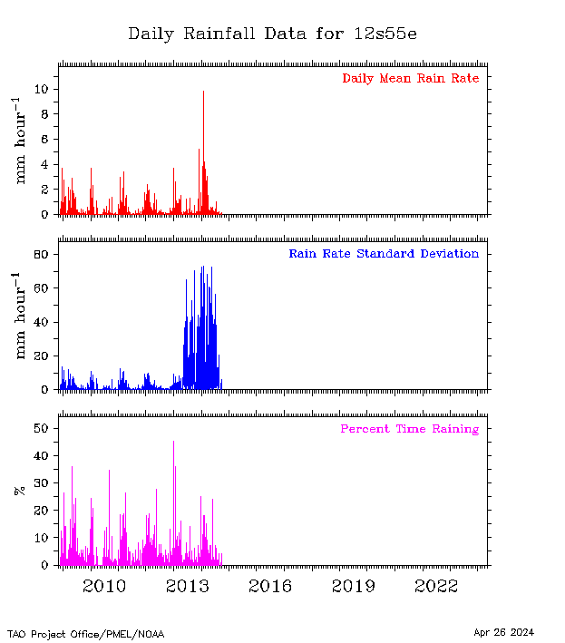
| 12°S, 55°E |
 |
 |
 |
 |
 |
 |
 |
 |
 |
 |
|||
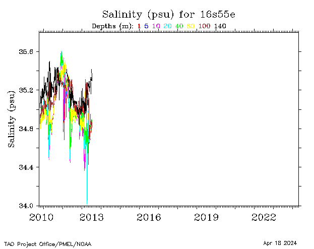
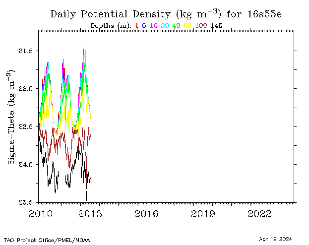
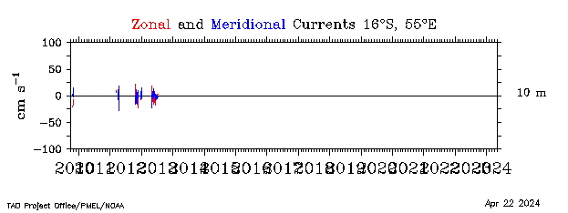
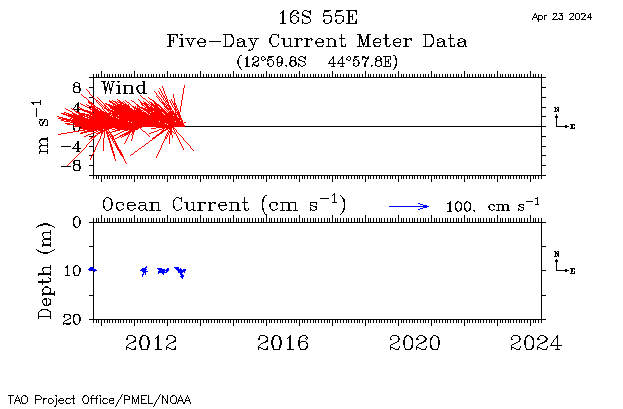
| 16°S, 55°E |
 |
 |
 |
 |
 |
 |
 |
 |
 |
 |
 |
||
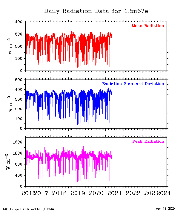
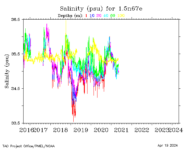
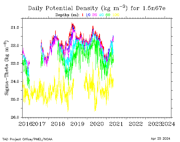
| 1.5°N, 67°E |
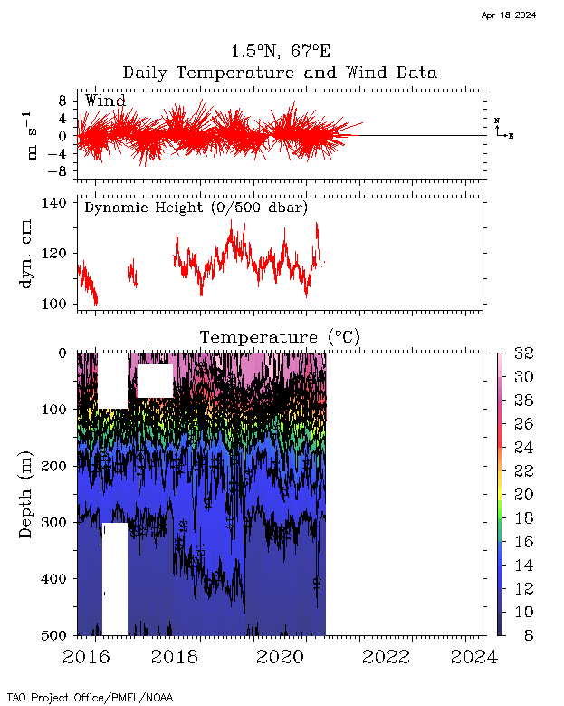 |
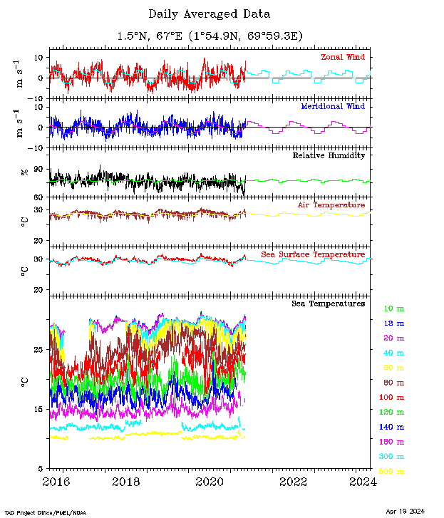 |
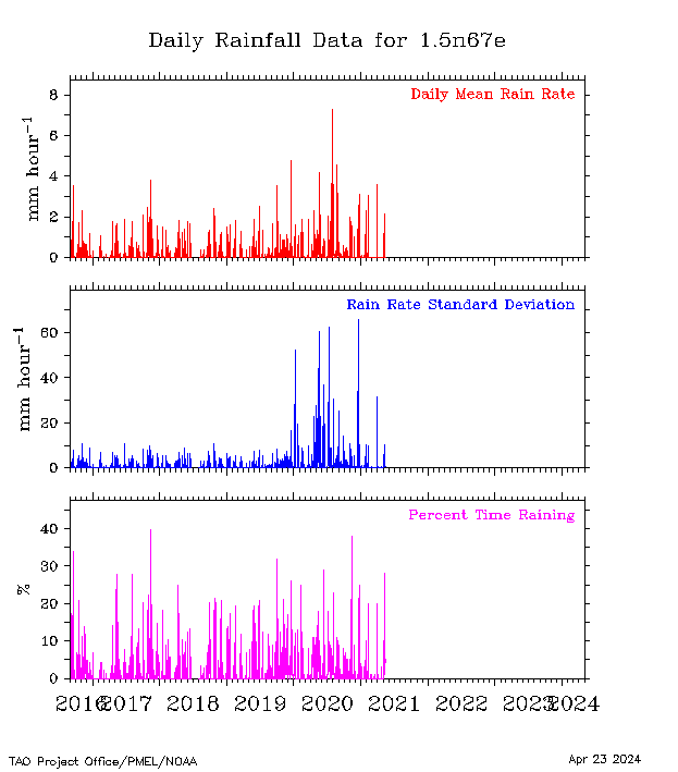 |
 |
 |
 |
|||||||
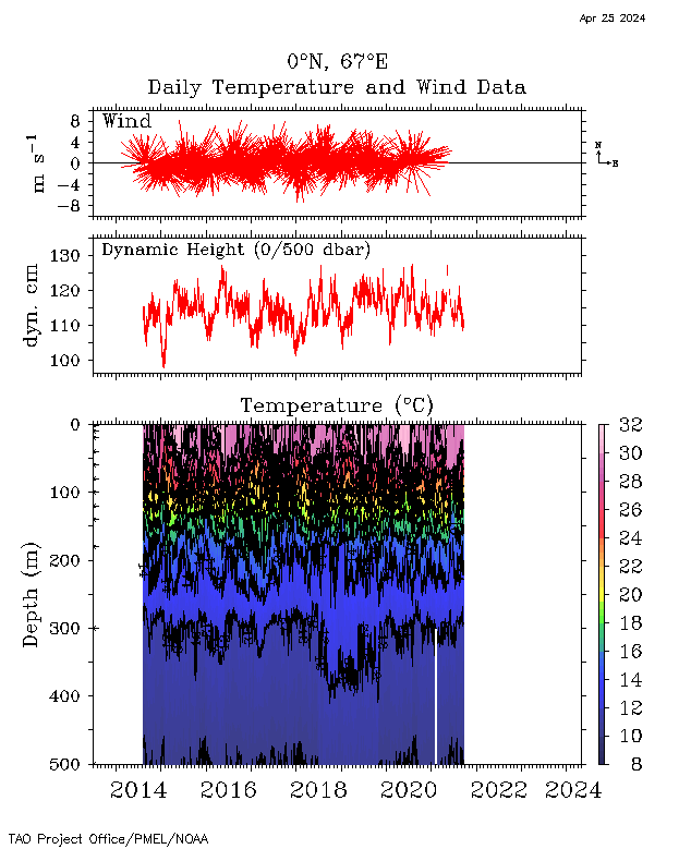
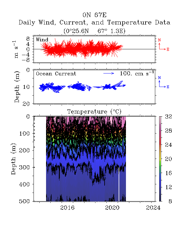
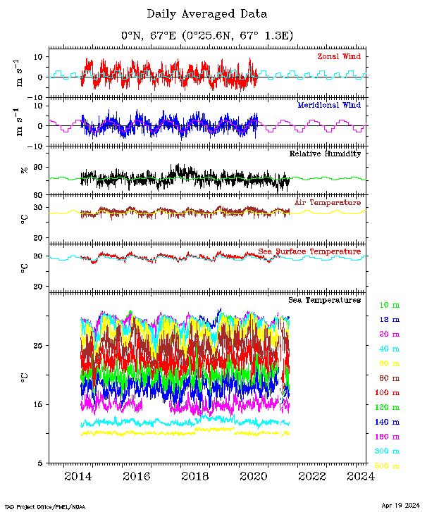
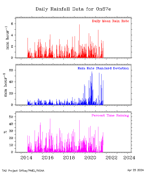
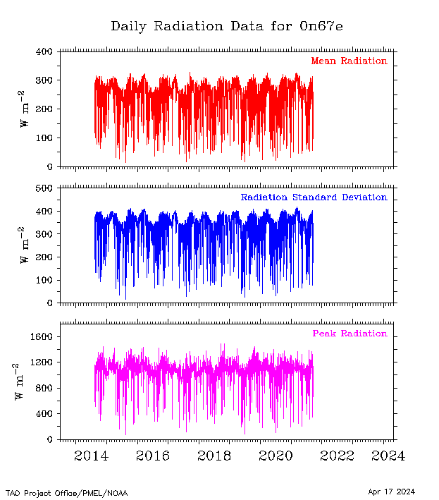
| 0°, 67°E |
 |
 |
 |
 |
 |
 |
 |
 |
 |
||||
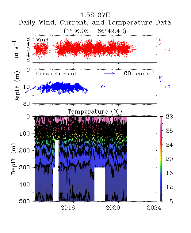
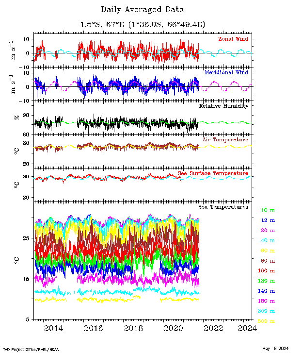
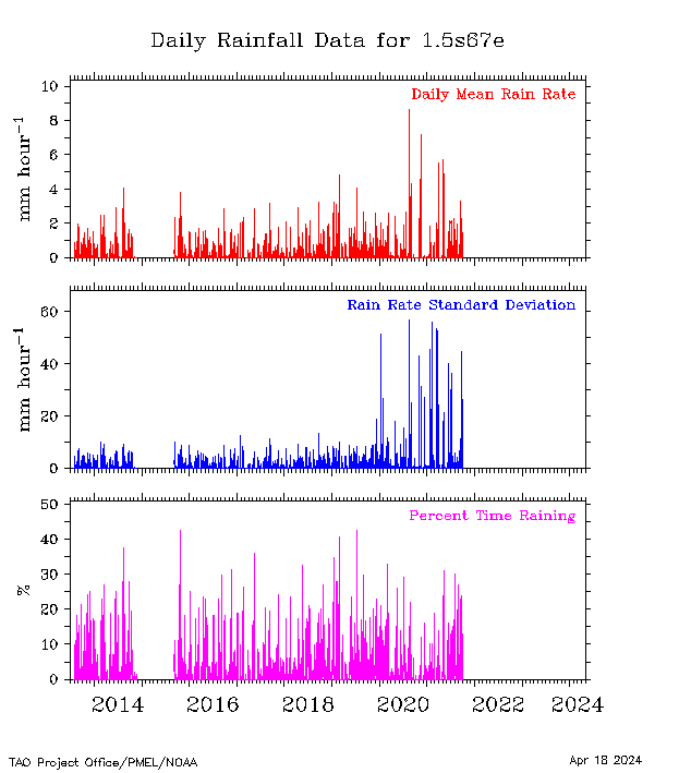
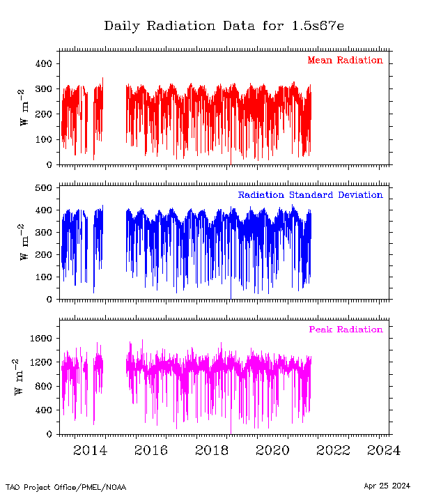
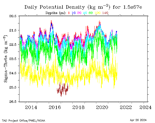
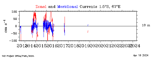
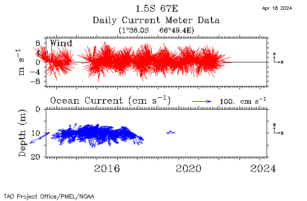
| 1.5°S, 67°E |
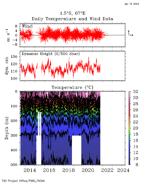 |
 |
 |
 |
 |
 |
 |
 |
 |
||||
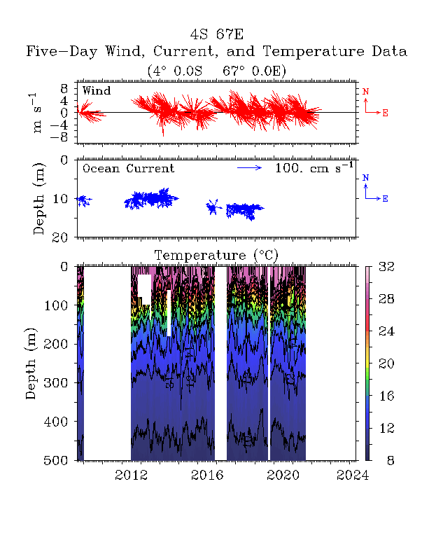
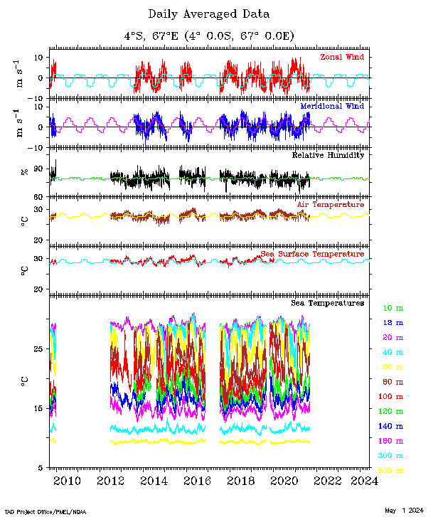
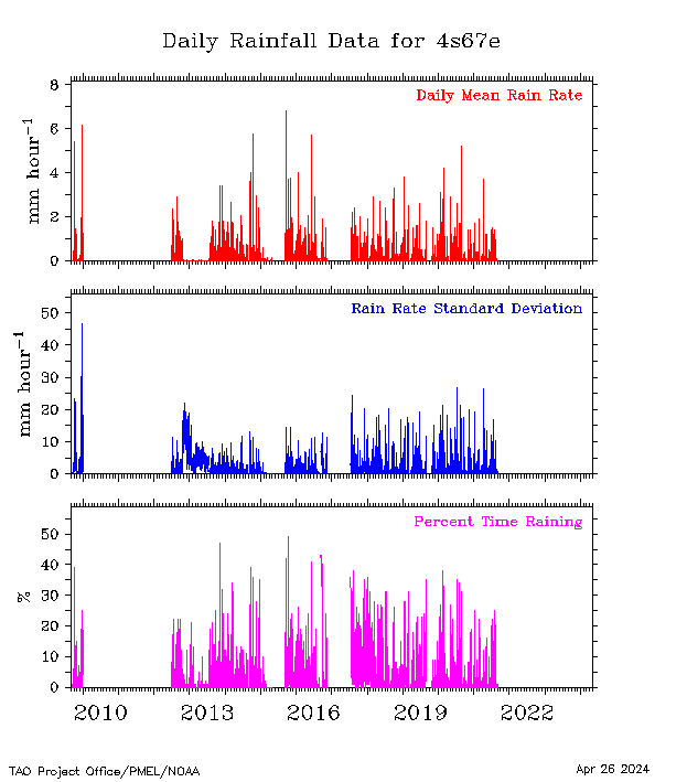
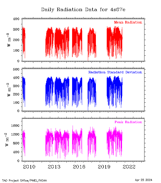
| 4°S, 67°E |
 |
 |
 |
 |
 |
 |
 |
 |
 |
||||
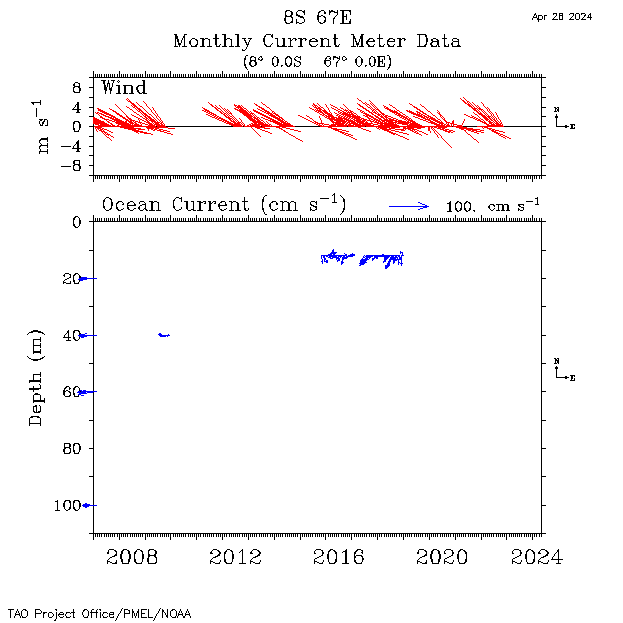
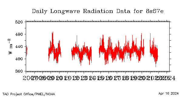
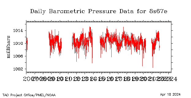
| 8°S, 67°E |
 |
 |
 |
 |
 |
 |
 |
 |
 |
 |
 |
||
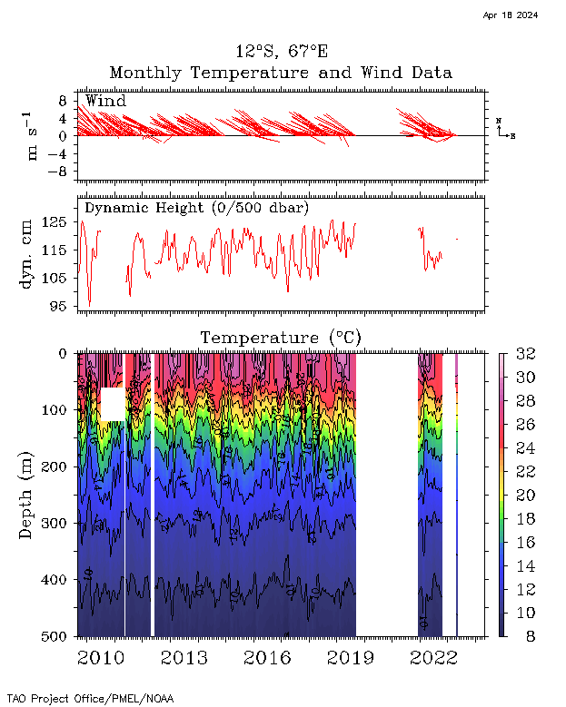
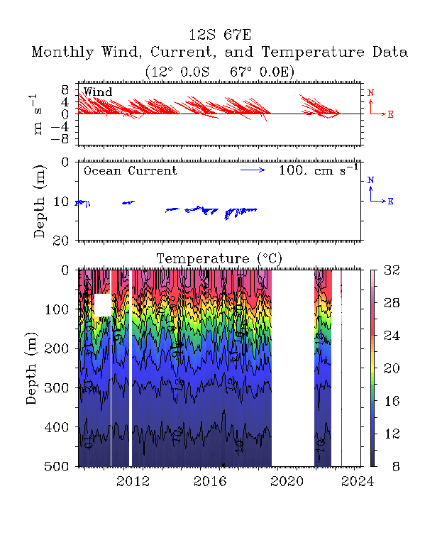
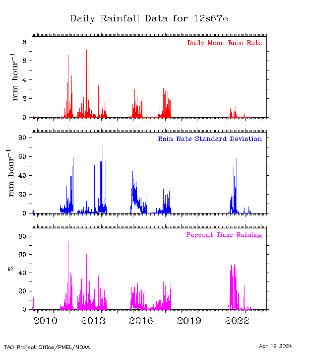
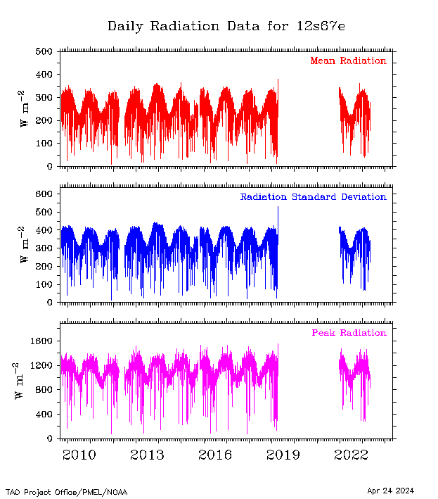
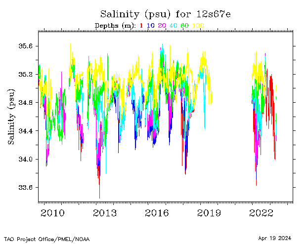
| 12°S, 67°E |
 |
 |
 |
 |
 |
 |
 |
 |
 |
 |
|||
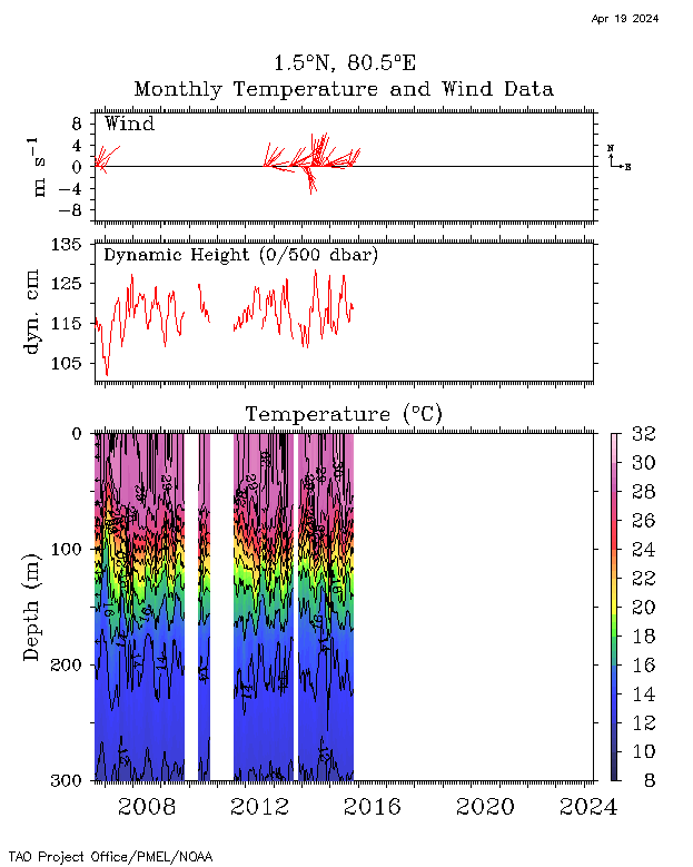
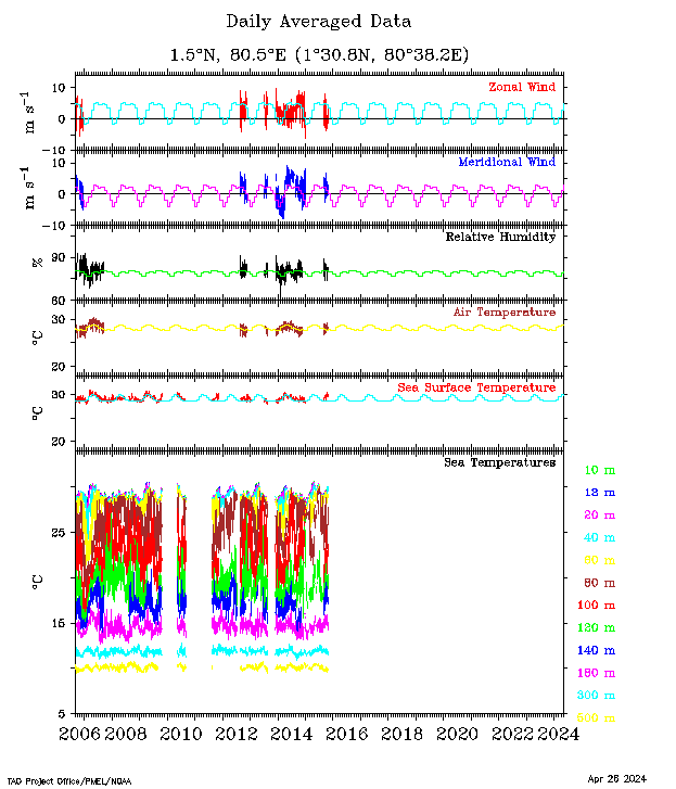
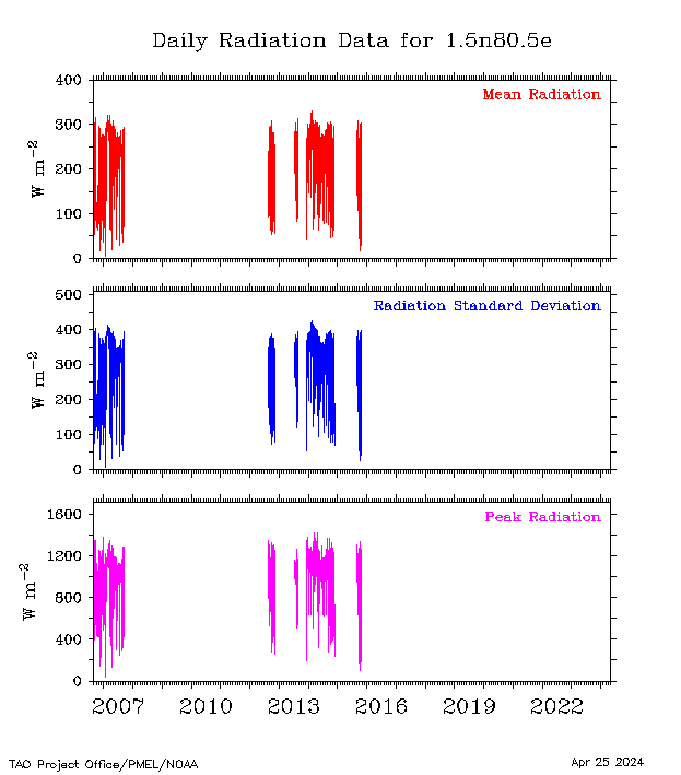
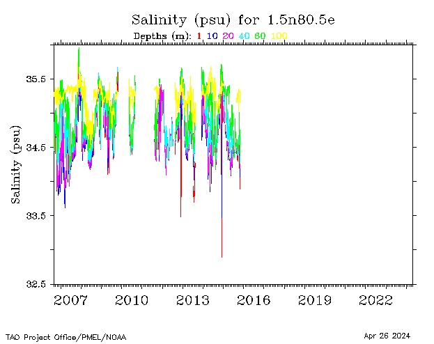
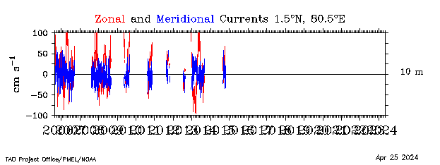
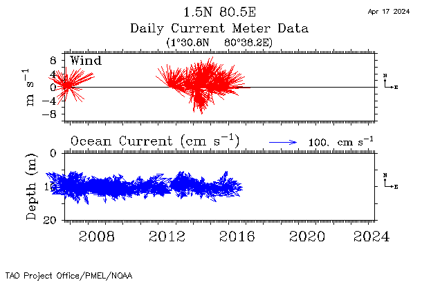
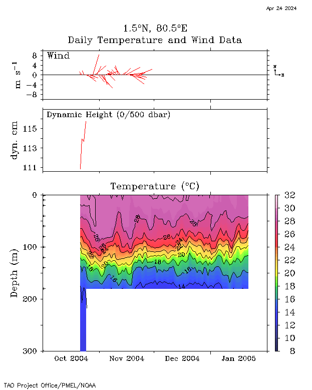
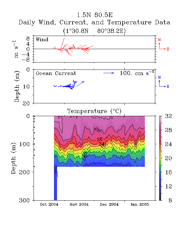
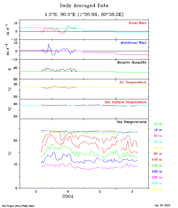
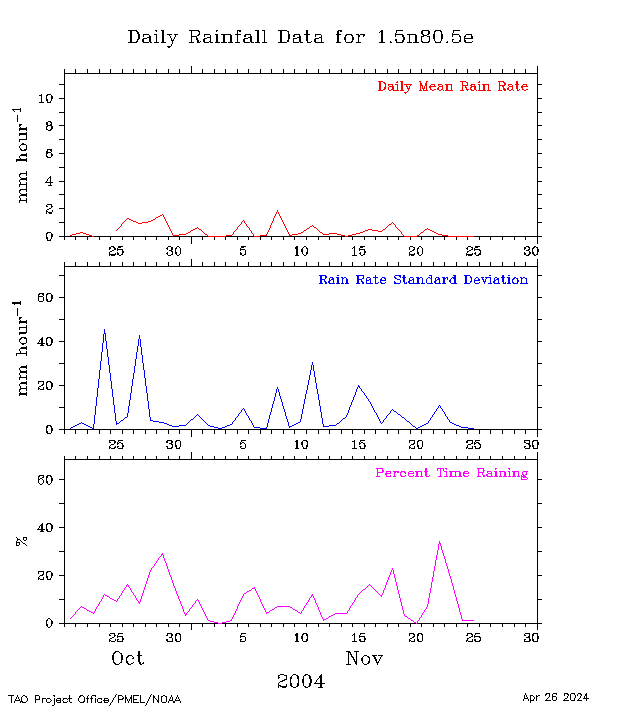
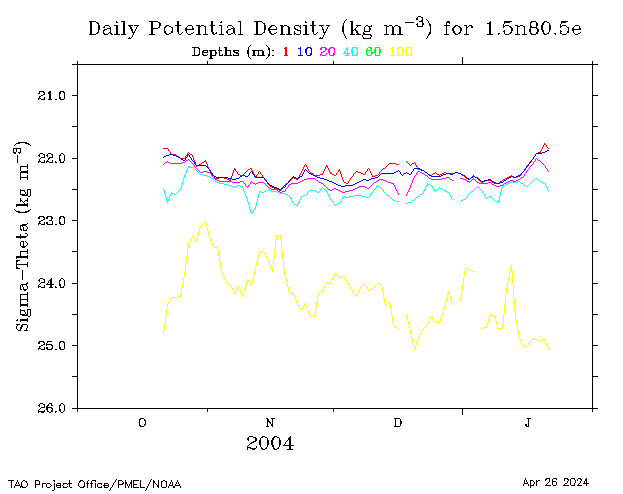
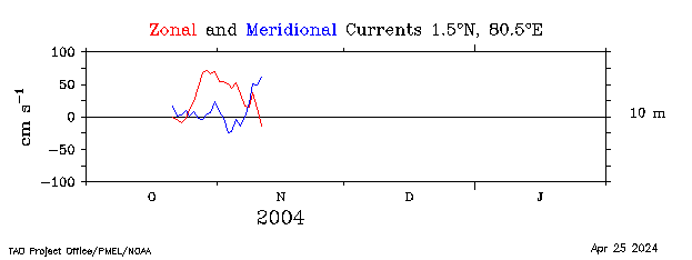
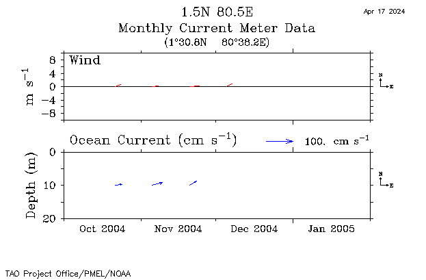
| 1.5°N, 80.5°E |
 |
 |
 |
 |
 |
 |
 |
 |
 |
||||
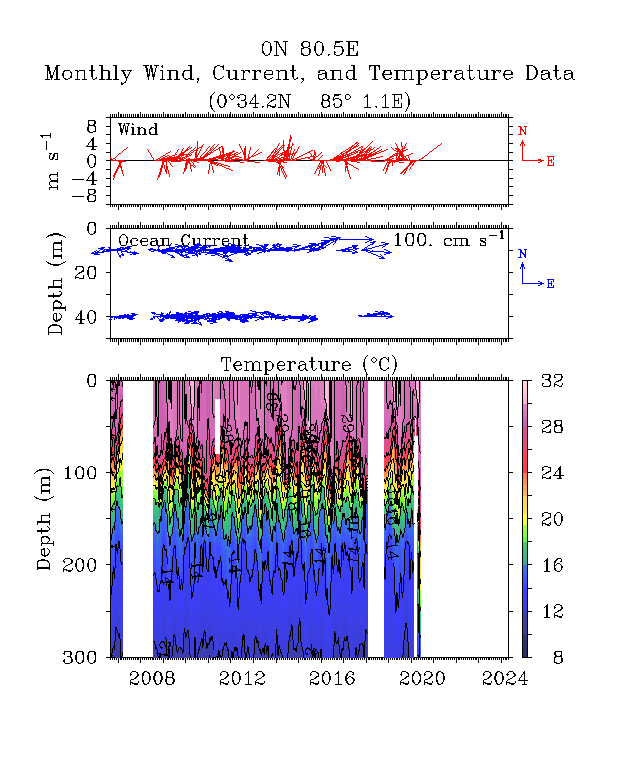
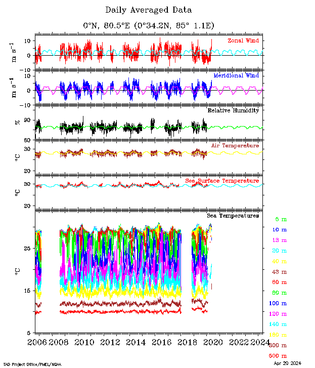
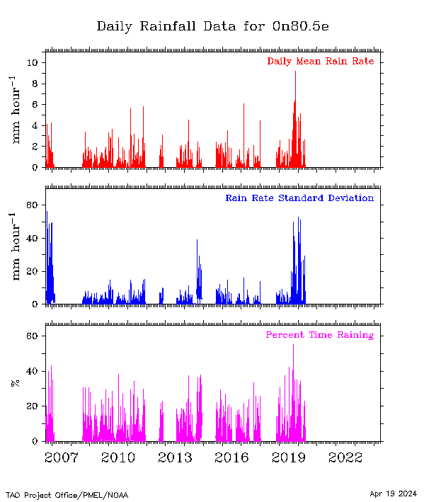
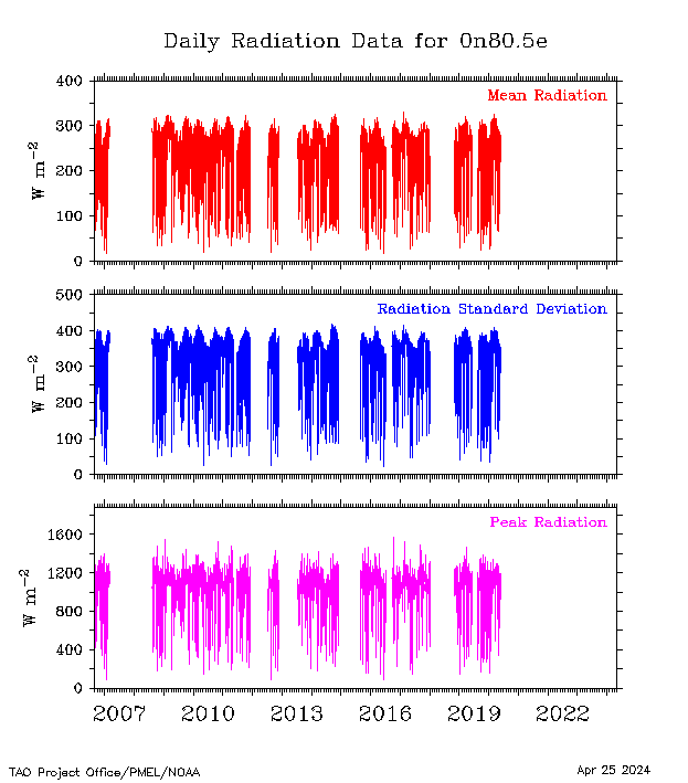
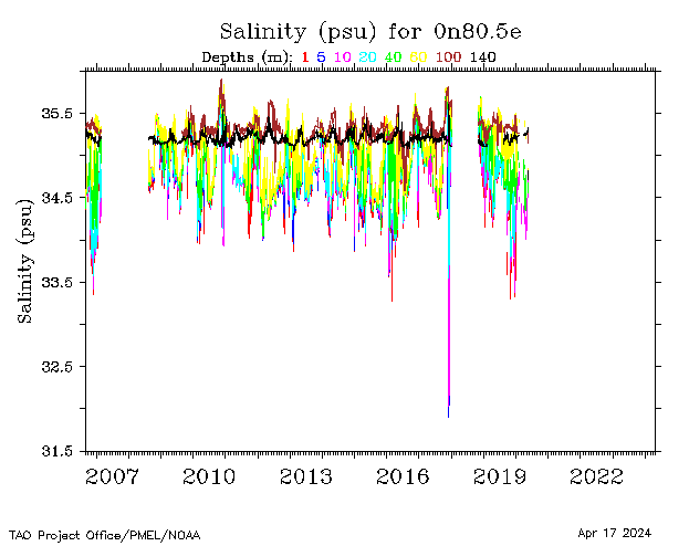
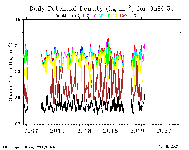
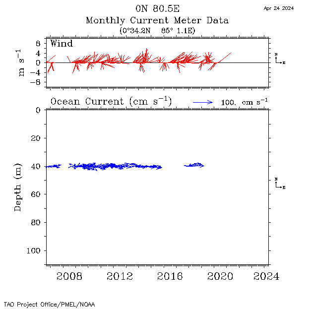
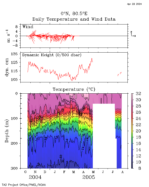
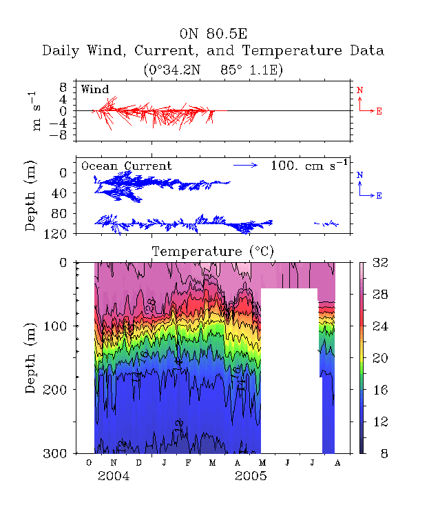
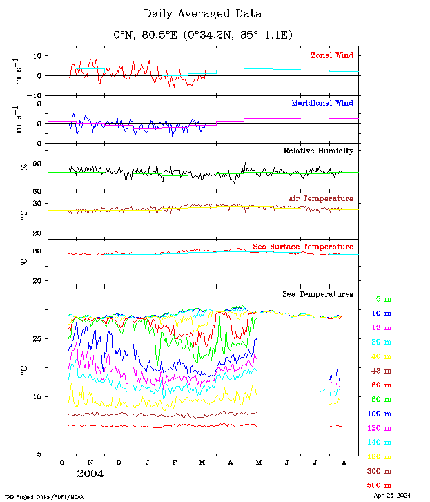
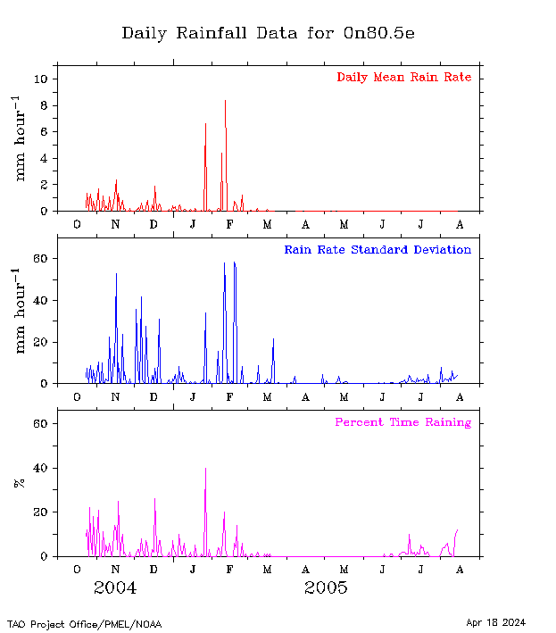
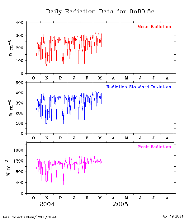
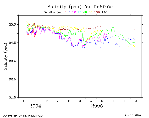
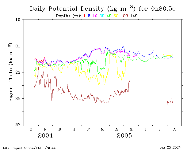
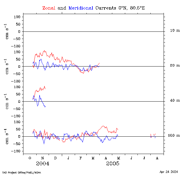
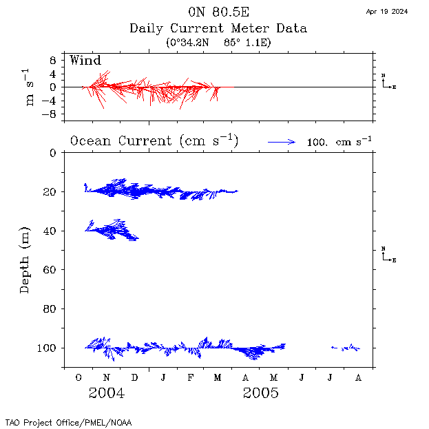
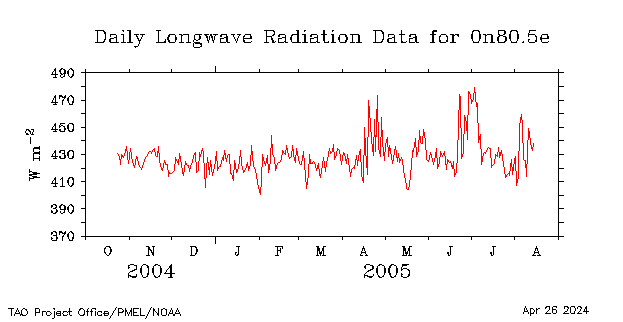
| 0°, 80.5°E |
 |
 |
 |
 |
 |
 |
 |
 |
 |
 |
 |
||
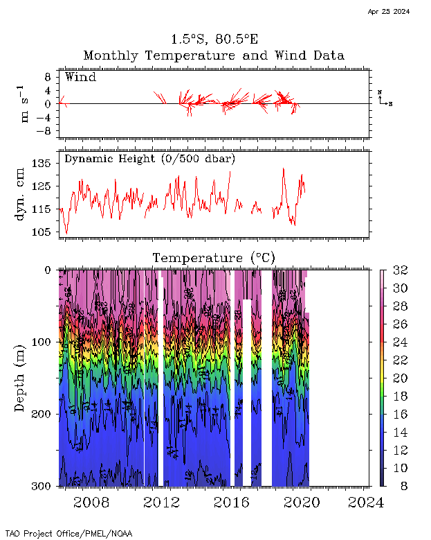
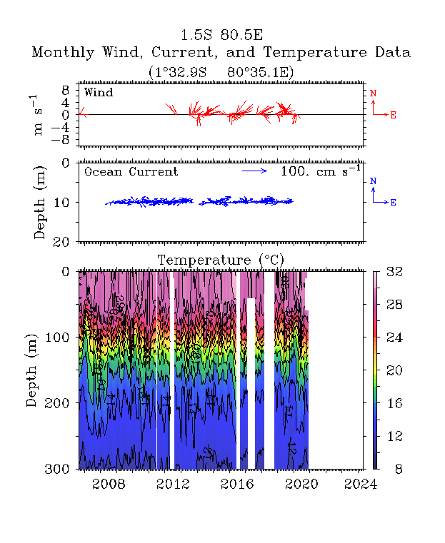
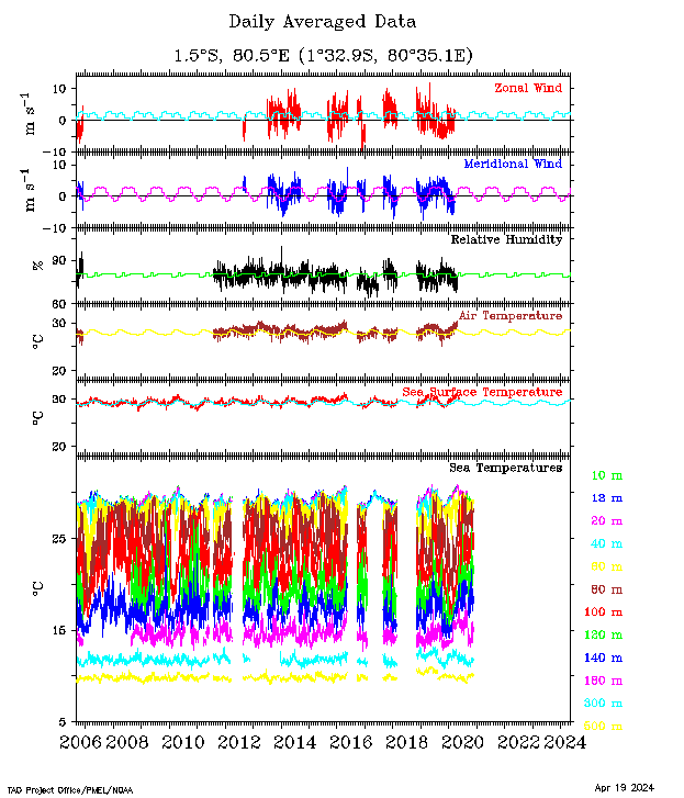
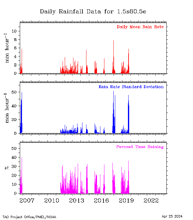
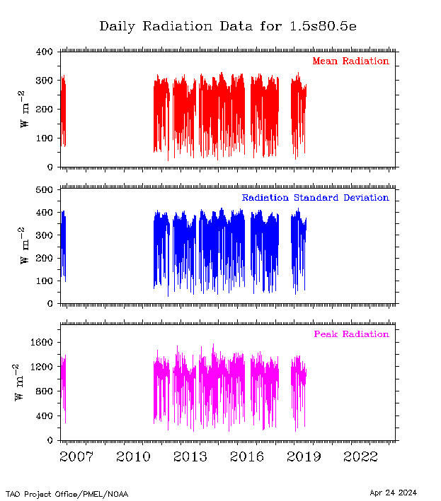
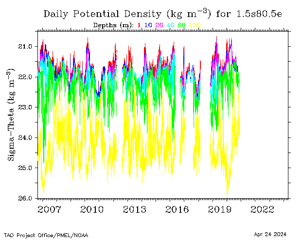
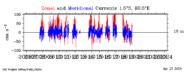
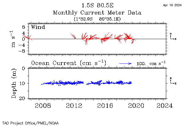
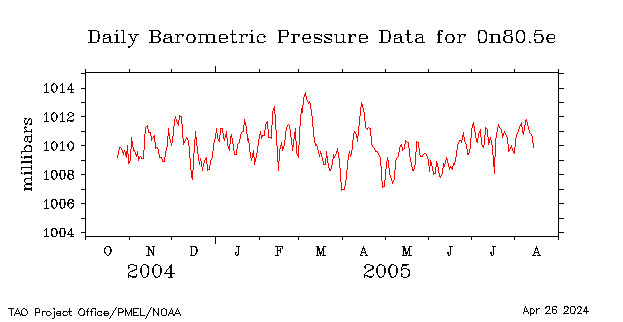
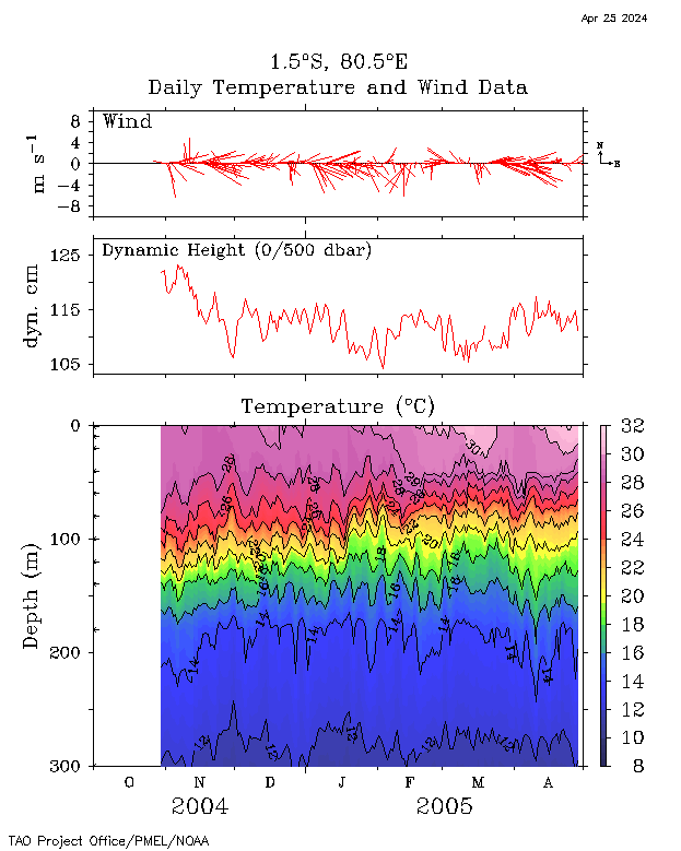
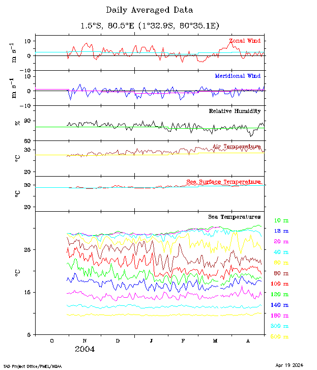
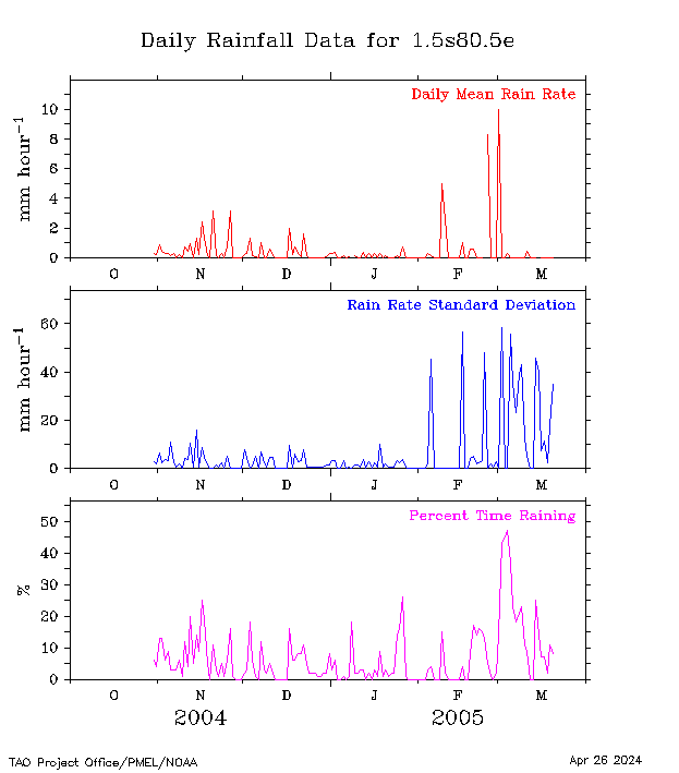
| 1.5°S, 80.5°E |
 |
 |
 |
 |
 |
 |
 |
 |
 |
||||
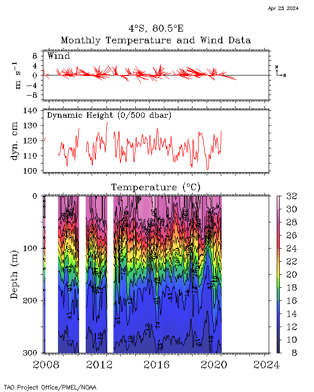
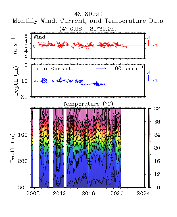
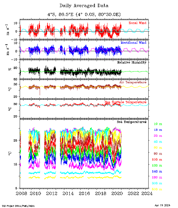
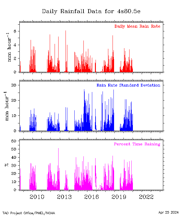
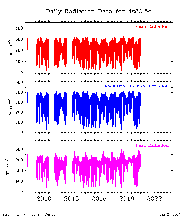
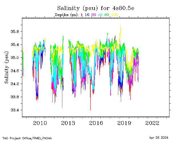
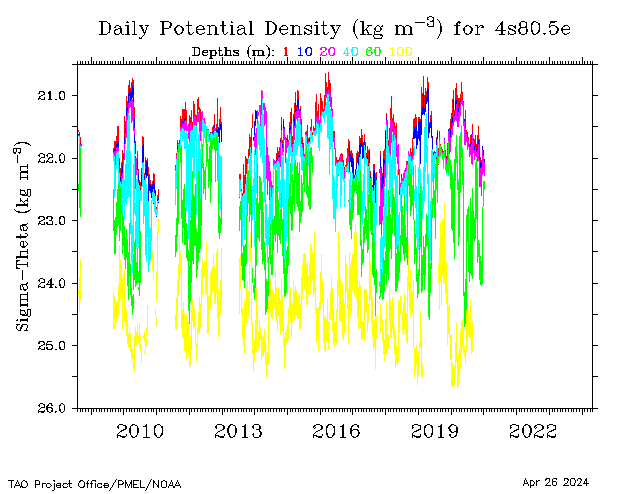
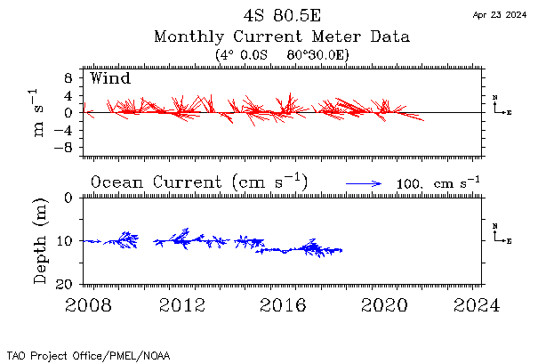
| 4°S, 80.5°E |
 |
 |
 |
 |
 |
 |
 |
 |
 |
||||
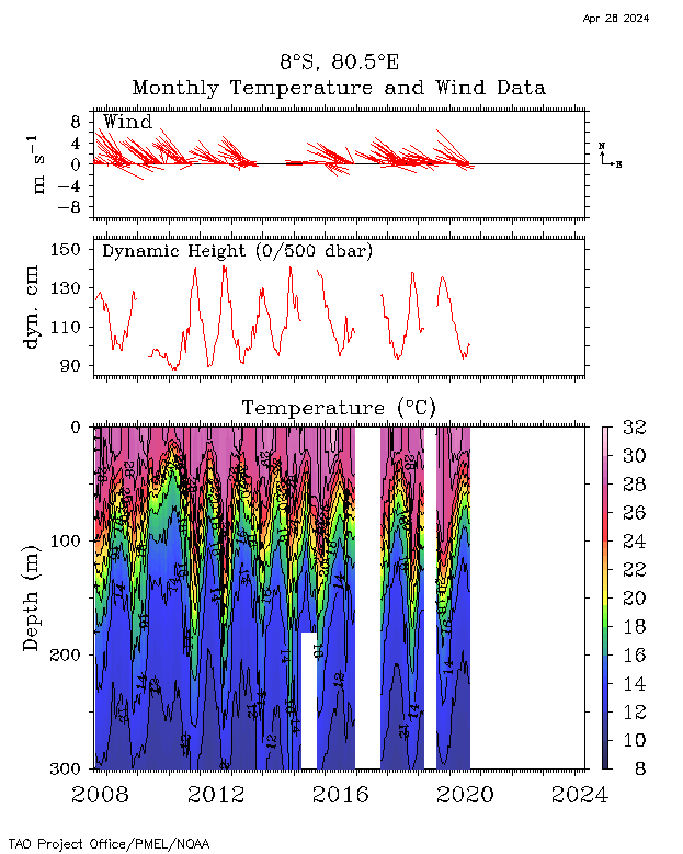
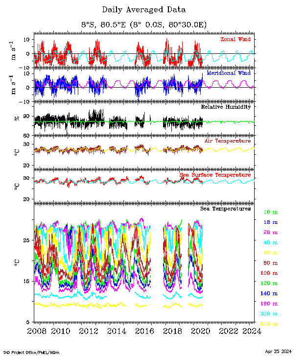
| 8°S, 80.5°E |
 |
 |
 |
 > > |
 |
 |
 |
 |
 |
 |
|||
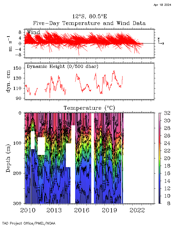
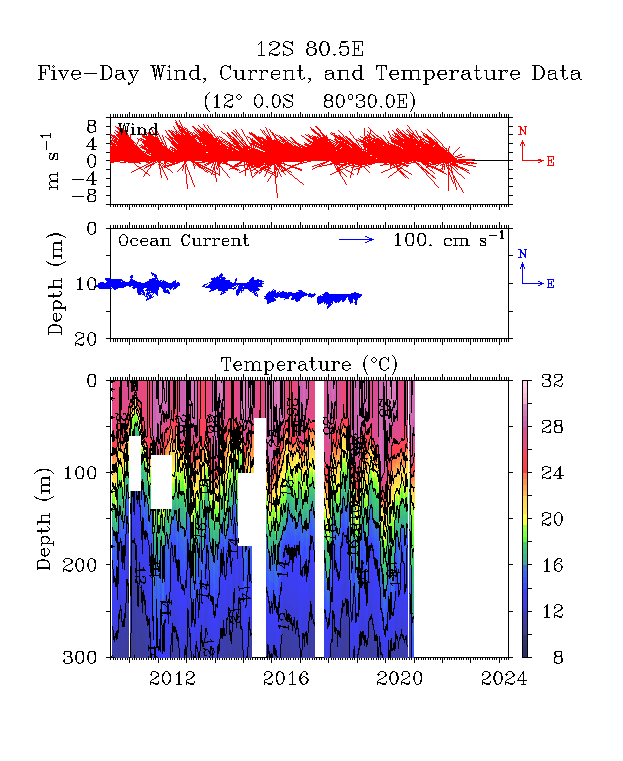
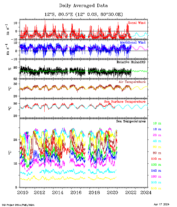
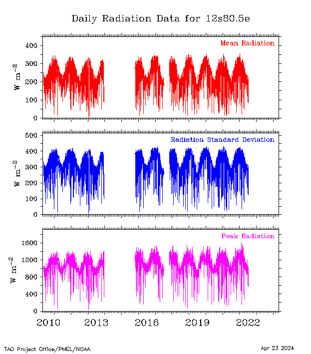
| 12°S, 80.5°E |
 |
 |
 |
 > > |
 |
 |
 |
 |
 |
 |
|||
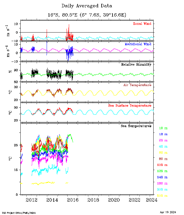
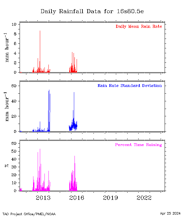
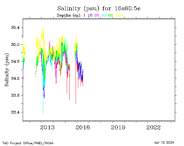
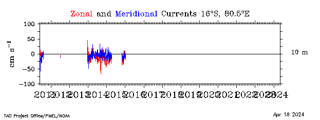
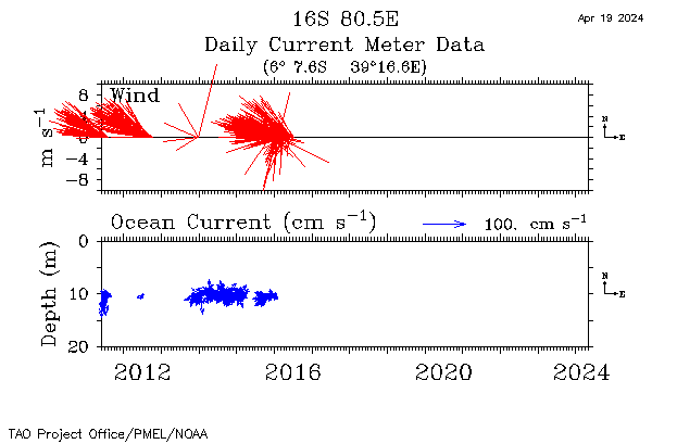
| 16°S, 80.5°E |
 |
 |
 |
 |
 |
 |
 |
 |
 |
||||
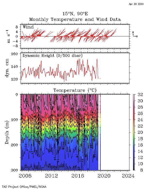
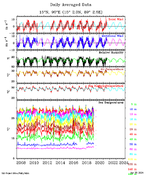
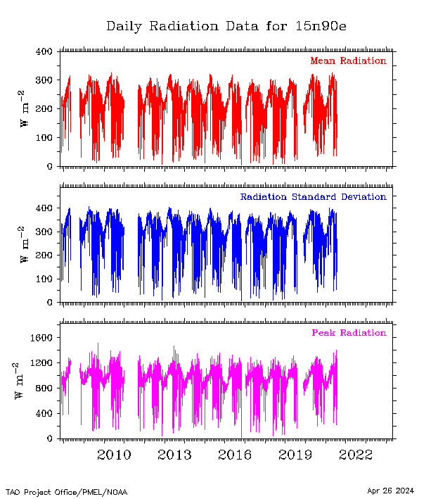
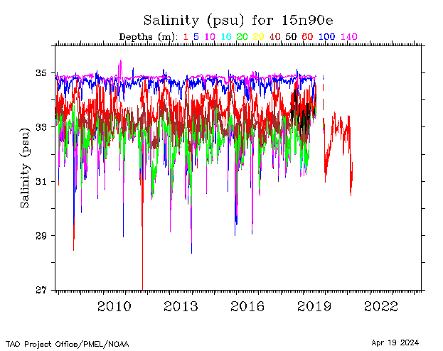
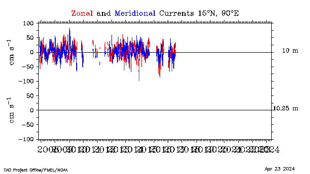
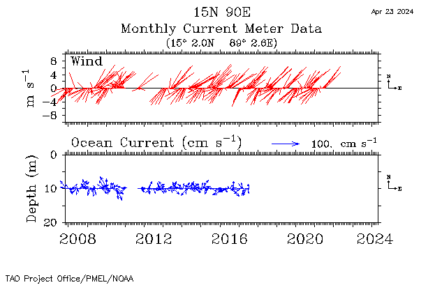
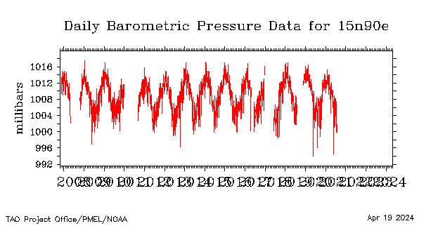
| 15°N, 90°E |
 |
 |
 |
 |
 |
 |
 |
 |
 |
 |
 |
||
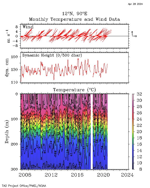
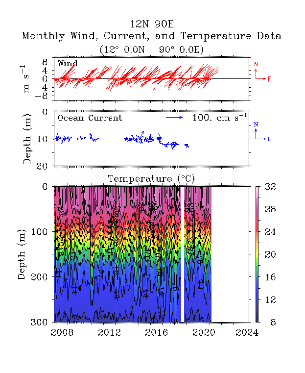
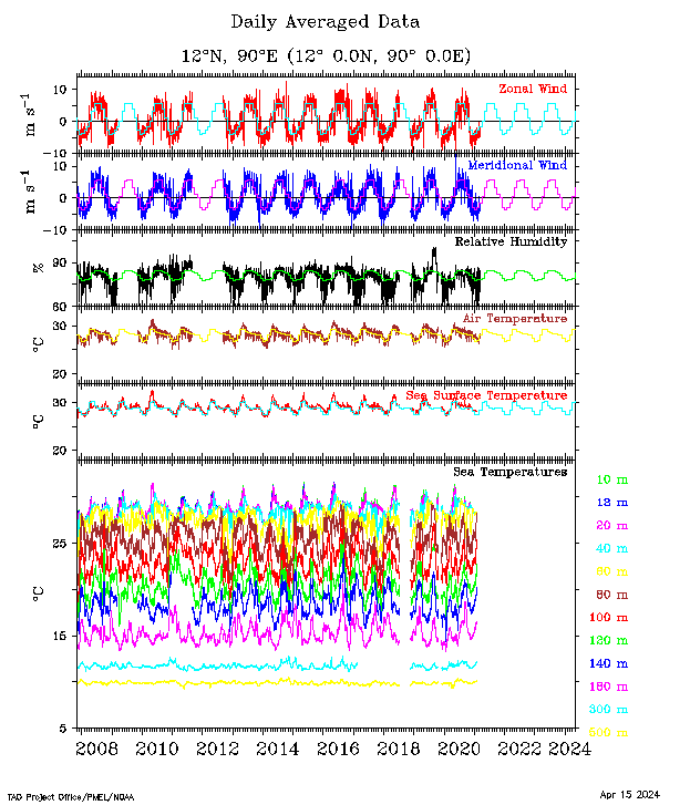
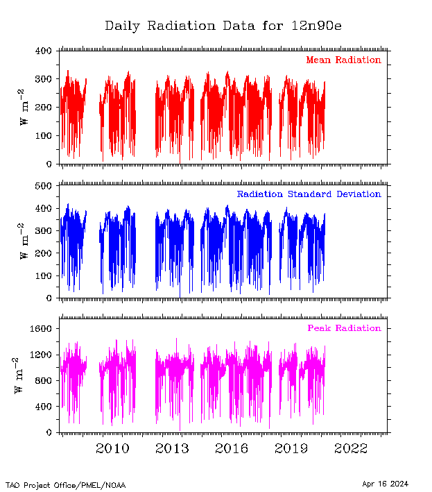
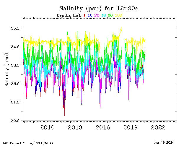
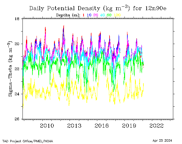
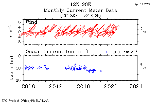
| 12°N, 90°E |
 |
 |
 |
 |
 |
 |
 |
 |
 |
||||
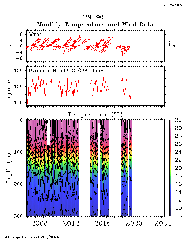
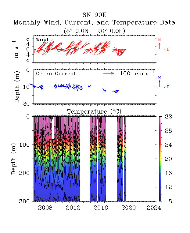
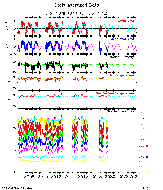
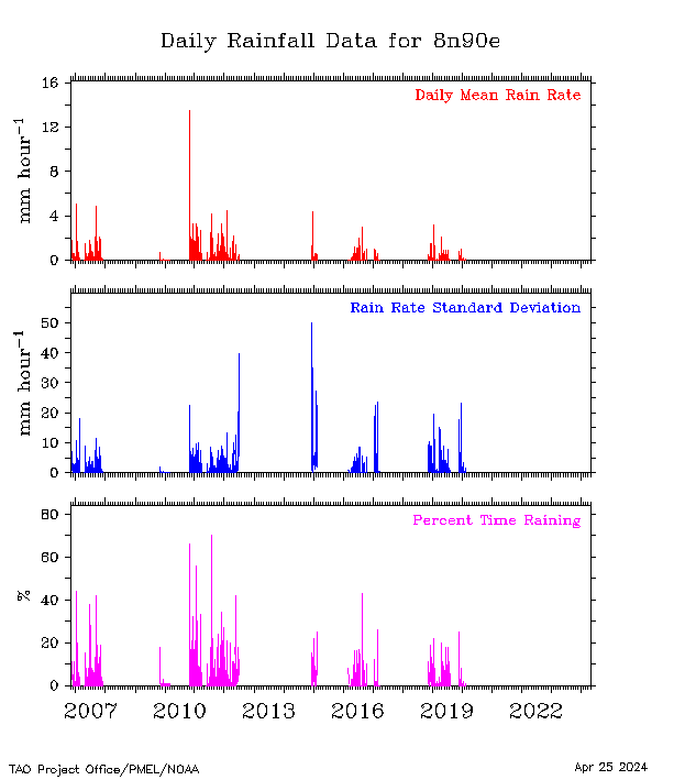
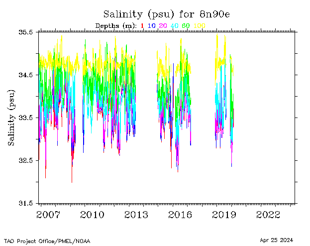
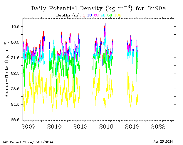
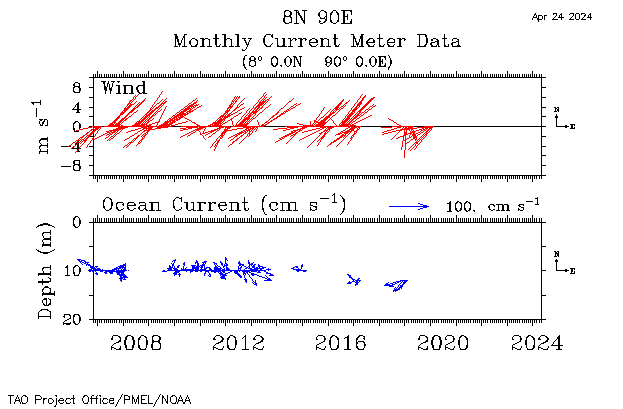
| 8°N, 90°E |
 |
 |
 |
 |
 |
 |
 |
 |
 |
||||
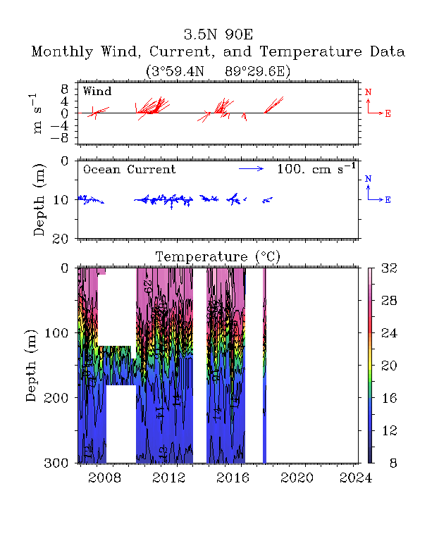
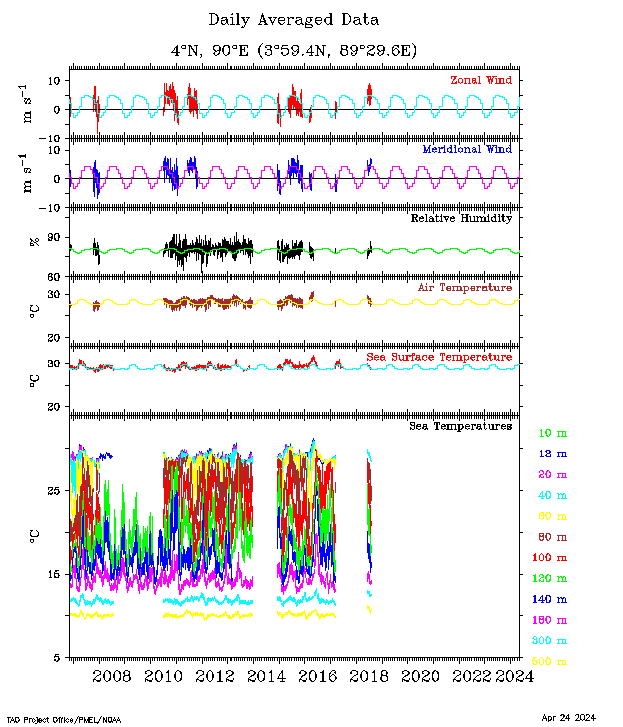
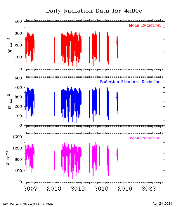
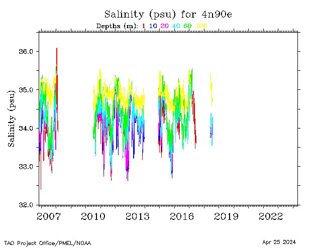
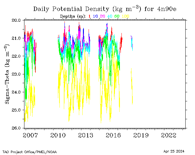
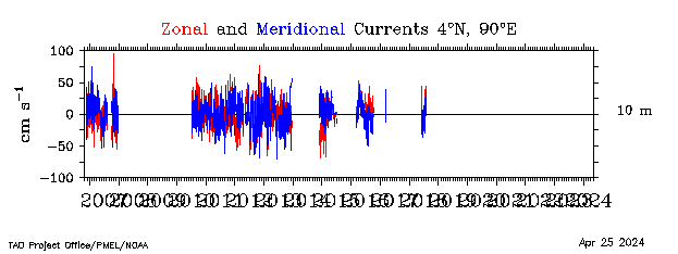
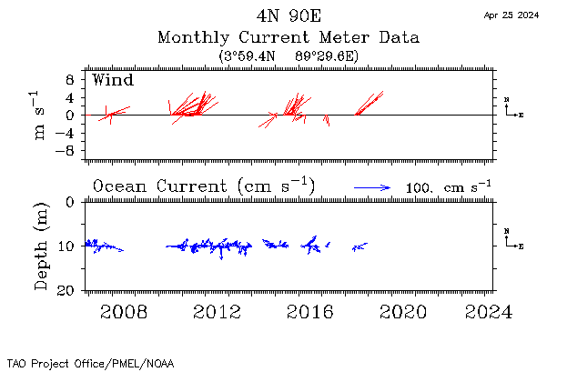
| 4°N, 90°E |
 |
 |
 |
 |
 |
 |
 |
 |
|||||
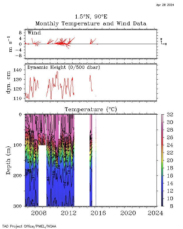
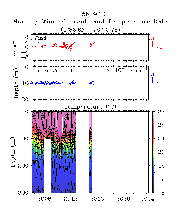
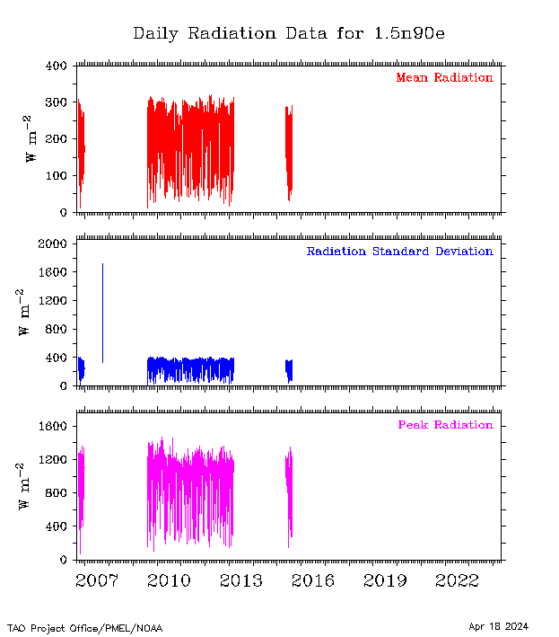
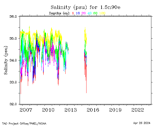
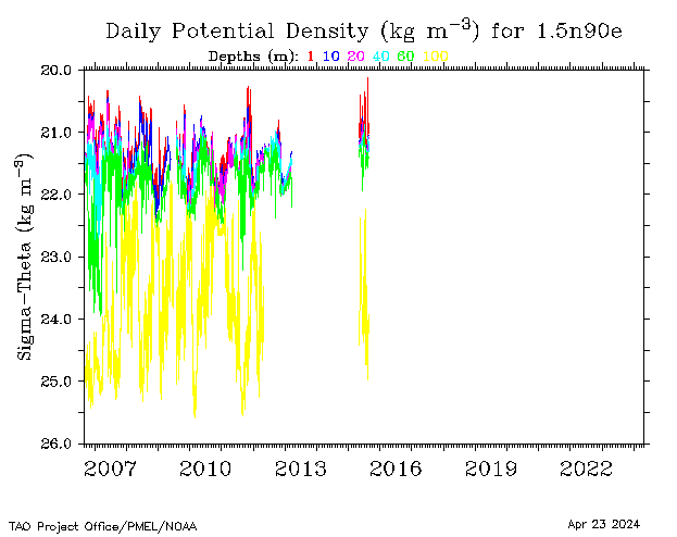
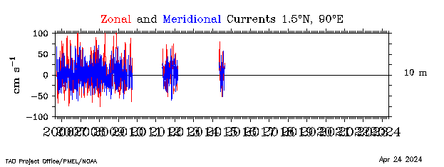
| 1.5°N, 90°E |
 |
 |
 |
 |
 |
 |
 |
 |
 |
||||
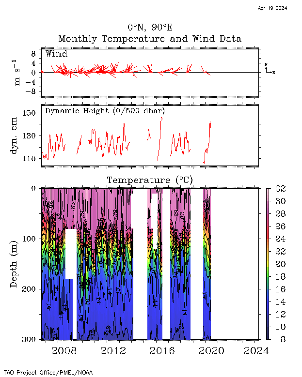
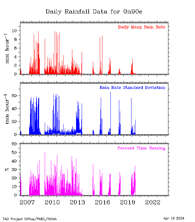
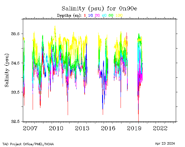
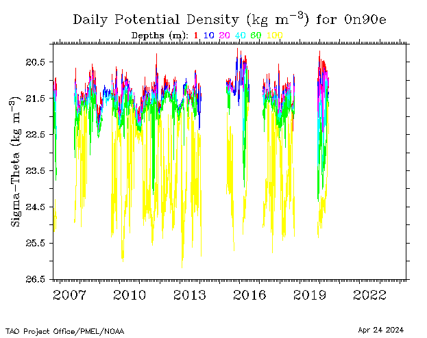
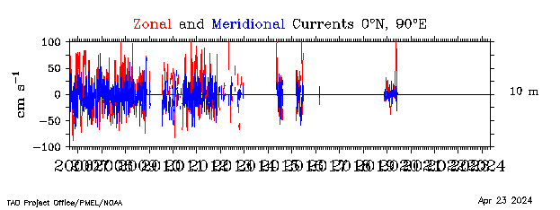
| 0°, 90°E |
 |
 |
 |
 |
 |
 |
 |
 |
 |
||||
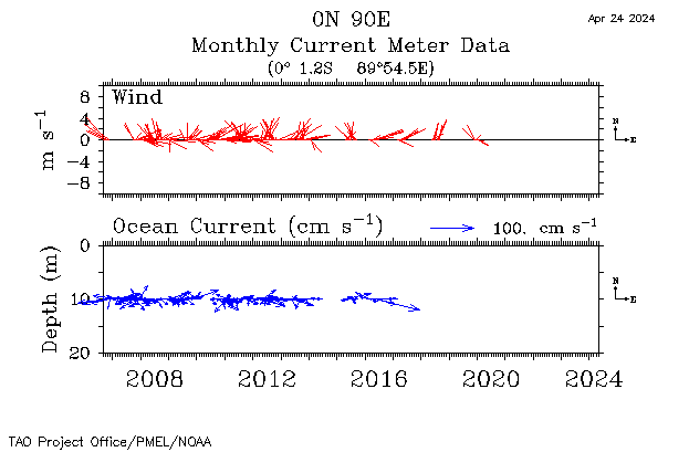
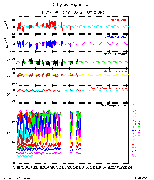
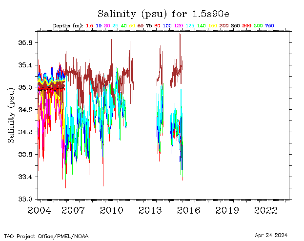
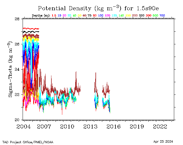
| 1.5°S, 90°E |
 |
 |
 |
 |
 |
||||||||
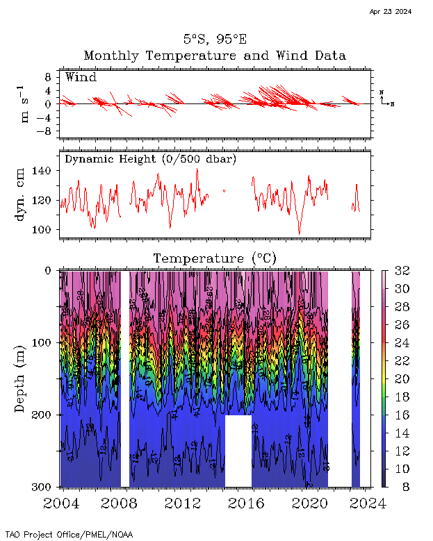
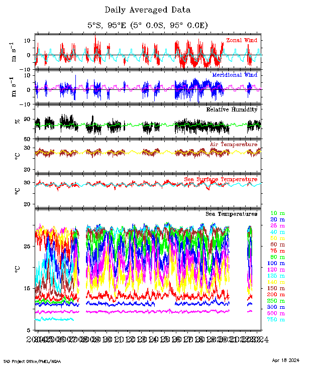
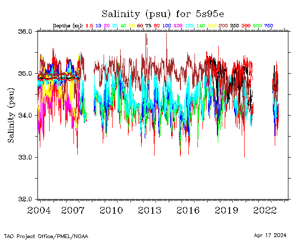
| 5°S, 95°E |
 |
 |
 |
 |
 |
||||||||
| 8°S, 95°E |
 |
 |
 |
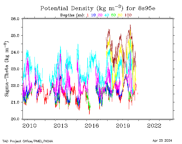 |
|||||||||
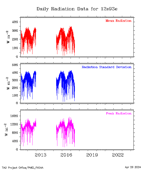
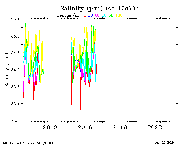
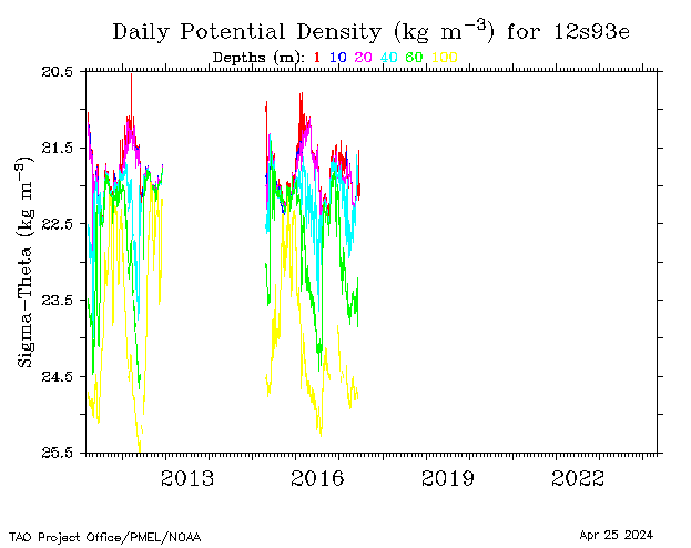
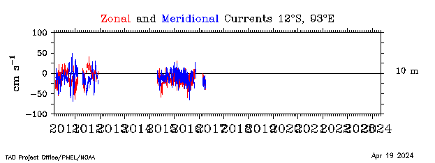
| 12°S, 93°E |
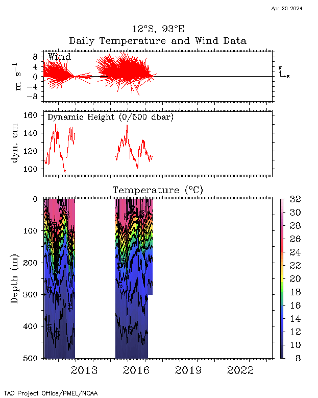 |
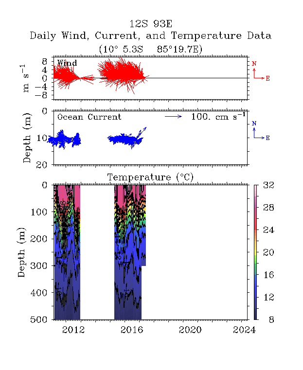 |
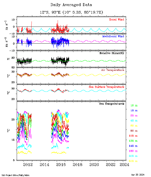 |
 |
 |
 |
 |
 |
 |
||||
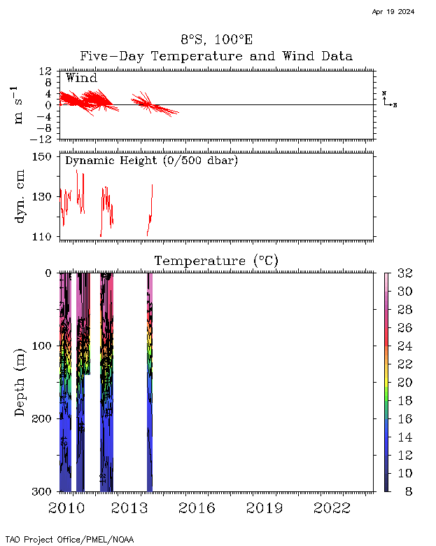
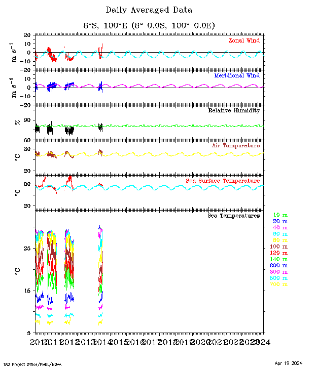
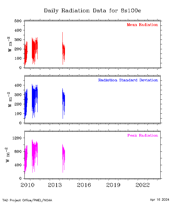
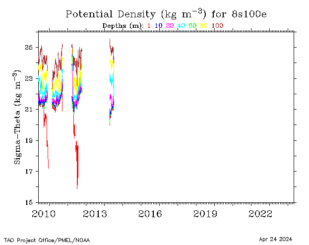
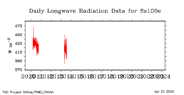
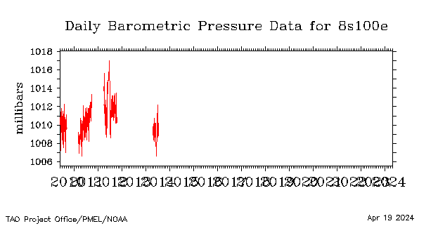
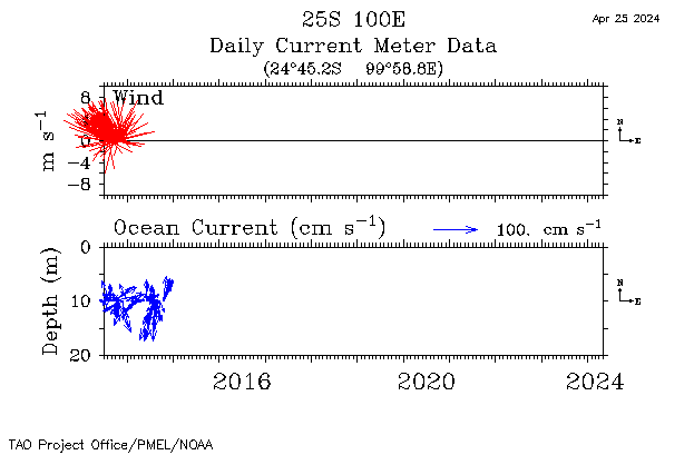
| 8°S, 100°E |
 |
 |
 |
 |
 |
 |
 |
||||||
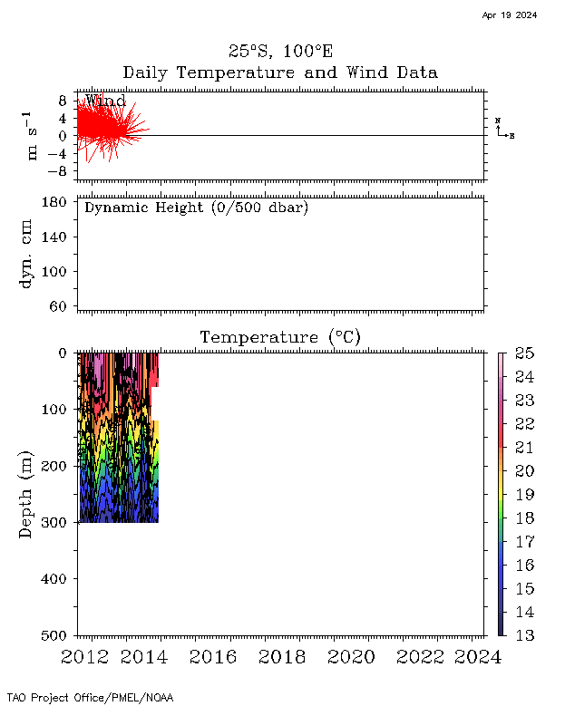
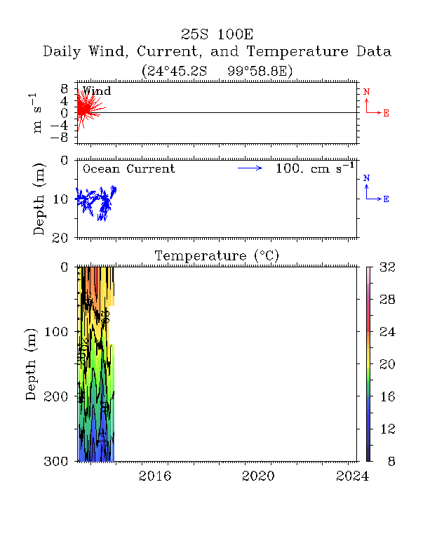
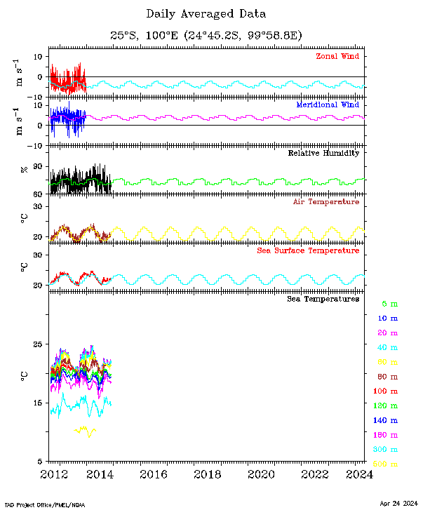
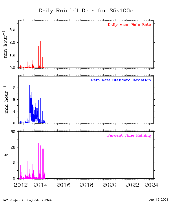
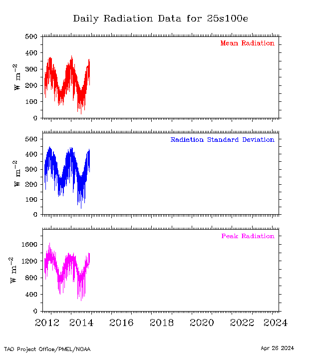
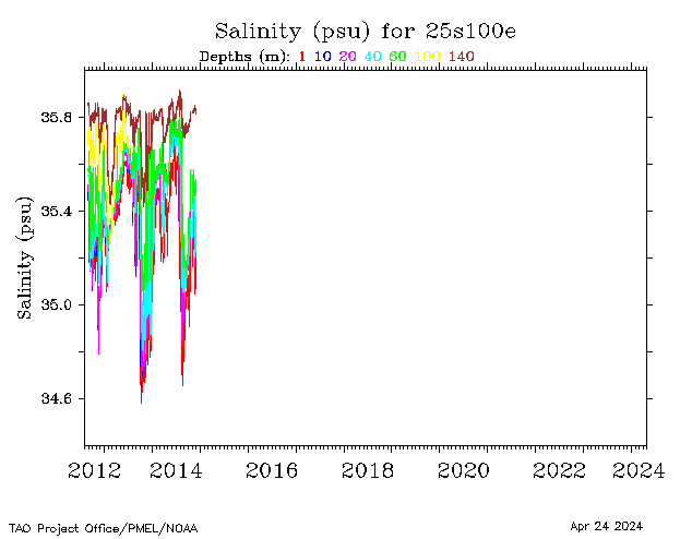
| 25°S, 100°E |
 |
 |
 |
 |
 |
 |
 |
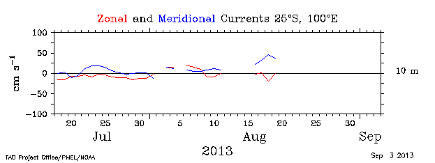 |
 |
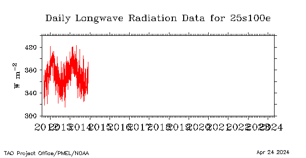 |
 |
||
2004 - 2006 | |||||||||||||
| Buoy Plot | Winds, Currents and Temperatures |
Sensor Plot | Rainfall | Shortwave Radiation |
Salinity | Potential Density |
Currents | Winds and Currents |
Longwave Radiation |
Barometric Pressure |
|||
| 1.5°N, 80.5°E |
 |
 |
 |
 |
 |
 |
 |
 |
 |
||||
| 0°, 80.5°E |
 |
 |
 |
 |
 |
 |
 |
 |
 |
 |
 |
||
| 1.5°S, 80.5°E |
 |
 |
 |
 |
 |
 |
|||||||
| 0°, 90°E |
 |
 |
 |
 |
 |
 |
 |
||||||