Dear ferret users,
I try to use polygon command as land region to cover the interpolated
variable to avoid misunderstanding.
The scripts works fine when I use normal mode (which shows on the
screen with X env.)
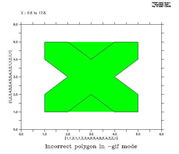
However, when I try to produce gif file with gif mode (ferret -gif),
scripts still works fine but polygon cut unexpected regions in my plot.
I attach 2 figures to show the difference, first one is site1_01.gif
which is produced by ferret -gif mode,
can easily found the salinity field was cut by polygon which suppose
only to overwrite the land region.
normal.bmp is under normal mode ferret and extracted by print-screen.

Any suggestions?

Dan