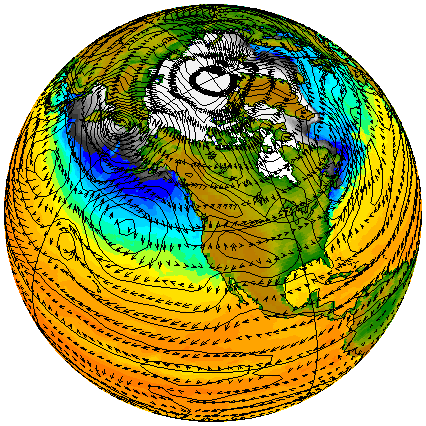
I've got a really nifty plot (see below) that's *almost* perfect.

I'd like to make the vector head arrows smaller, and I'd like to label the
relative Hs and Ls of the contoured field. I know about 'extremum.jnl', and
I've tinkered with calling it over different regions, but that results in
labels adjacent to each other if the regions specified are adjacent. BTW,
the picture is SST, sea ice, sea level pressure and winds, from three differ-
ent models on three different grids. No interpolation of the data from one
grid to another was done. FERRET 5.22 has really solved the curvilinear grids
on map projections!
Attachment:
example.gif
Description: example.gif
--
Gary Strand                 Climate Change Research Section, NCAR, 303-497-1336
strandwg@ucar.edu                          http://www.cgd.ucar.edu/ccr/strandwg