
Lau Basin Multimedia:
Lau Basin Multimedia
|
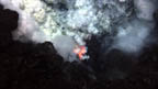 |
ash_rock_molten_lava.tif (12MB) ash_rock_molten_lava-lores.jpg (.2MB) An explosion near the summit of West Mata volcano throws ash and rock, and molten lava glows below. This image is approximately six feet across in an eruptive area approximately the length of a football field that runs along the summit. Image courtesy of NSF and NOAA. |
 |
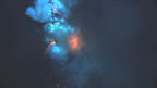
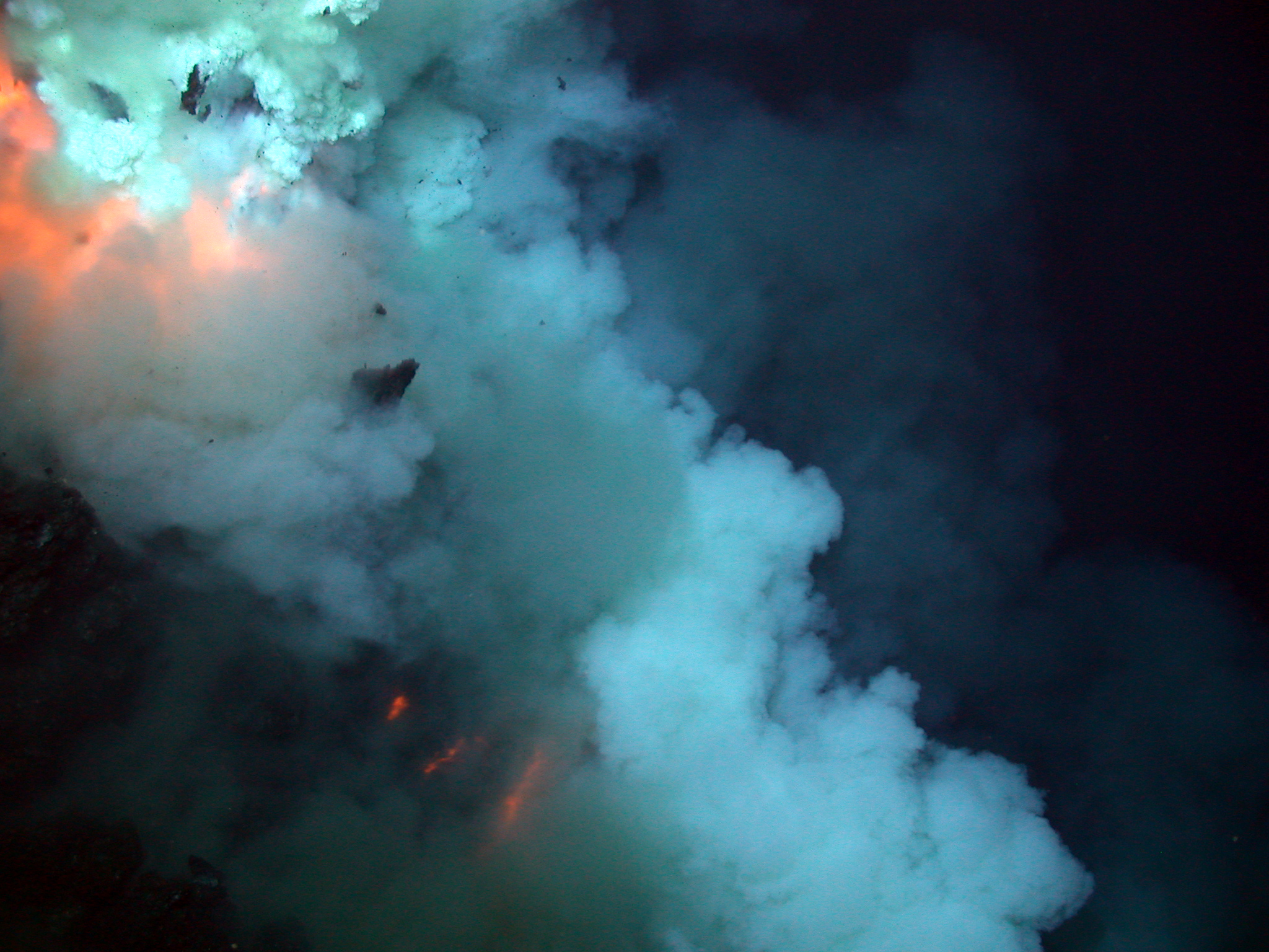
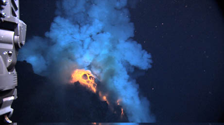
eruptive-blast-lores.jpg (.4BM) hades-eruptive-blast.jpg (1.8MB) An eruption near the summit of the West Mata Volcano. The blast is in the top left portion of the image, and broken rock can be seen in the plume. The three red lines below the blast are bands of superheated pillow lava flowing down the volcano´s slope. Image courtesy of NSF and NOAA. |
 |
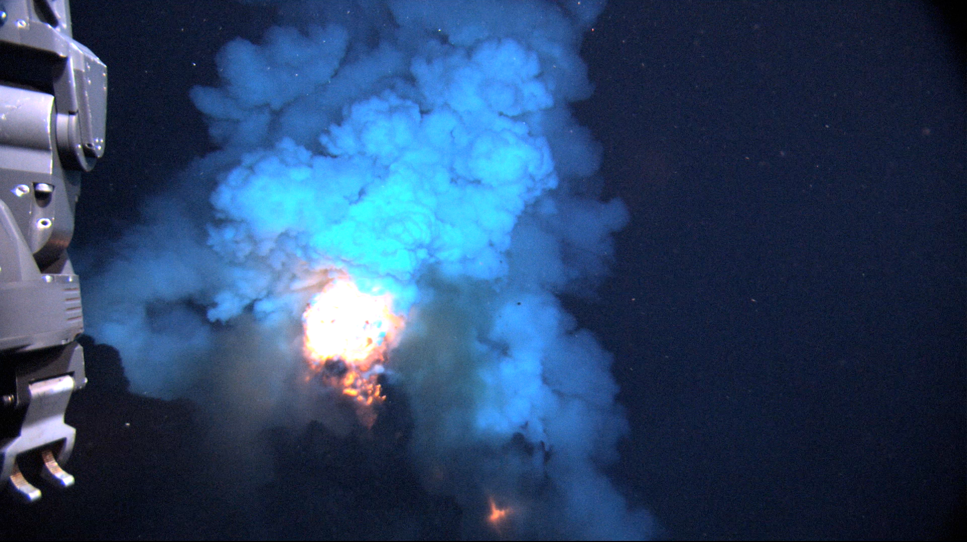
Fiery_blast-lores.jpg (.15MB) Fiery_blast.jpg (14MB) The eruption produces a bright flash of hot magma that is blown up into the water before settling back to the seafloor. In the foreground is the front of the Jason remotely-operated vehicle (ROV) with sampling hoses. The area in view is about 6-10 feet across in an eruptive area approximately the length of a football field that runs along the summit. Image courtesy of NSF and NOAA. |
 |
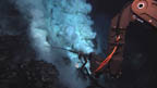
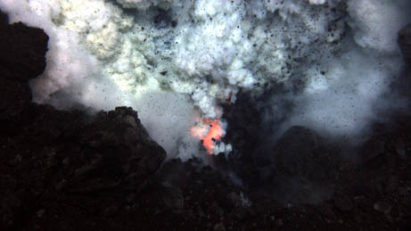
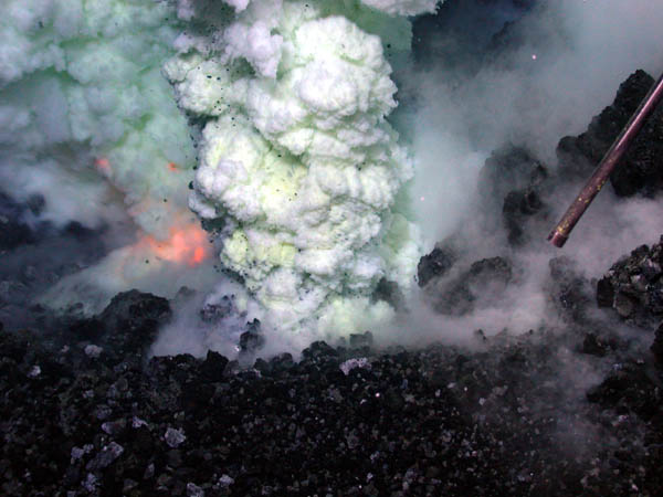
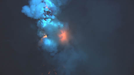
fire_smoke-lores.jpg (.7MB) hades-fire-smoke.jpg (2MB) The orange glow of magma is visible on the left of the sulfur-laden plume. This image is approximately six feet across in an eruptive area approximately the length of a football field that runs along the summit. Image courtesy of NSF and NOAA. |
 |
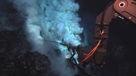
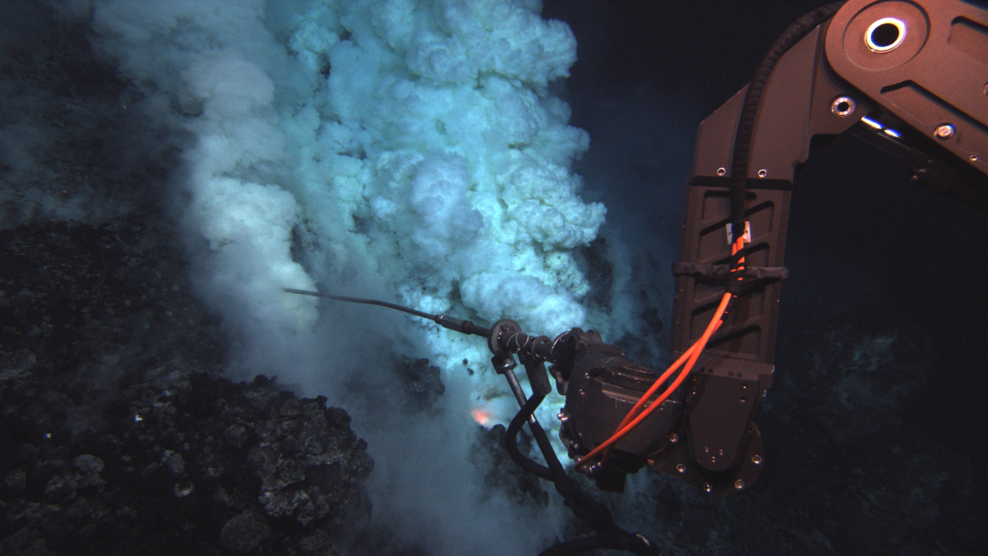
fluid-sampling-lores.jpg (.2MB) akels-afi-fluid-sampling.jpg (1.4MB) The Jason remotely-operated vehicle (ROV) samples fluid at an eruptive area near the summit of the West Mata Volcano. The fluid sampling "wand" is approximately three feet long. Image courtesy of NSF and NOAA. |
 |
magma_down_slope_zoom.tif (12MB) magma_down_slope_zoom-lores.jpg (.11MB) This is a side-view of an eruptive area, with magma and rock fragments cascading down the volcano´s slope. This image is approximately nine feet across in an eruptive area approximately the length of a football field that runs along the summit. Image courtesy of NSF and NOAA. |
 |
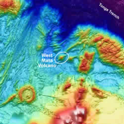
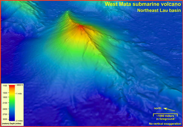
3D-west-mata-with-text.tif (74MB) 3D-west-mata-no-text.tif (70MB) 3D-west-mata-with-text-lores.jpg (.5MB) The summit of the West Mata Volcano, shown here in red, is nearly a mile below the ocean surface (1165 meters / 3882 feet), and the base, shown in blue, descends to nearly two miles (3000 meters / 9842 feet) deep. The eruptive activity occurred at several places along the summit, in an area approximately the length of a football field. The volcano has a six-mile-long rift zone running along its spine in a SW/NE orientation. 3D image courtesy of NOAA. |
 |
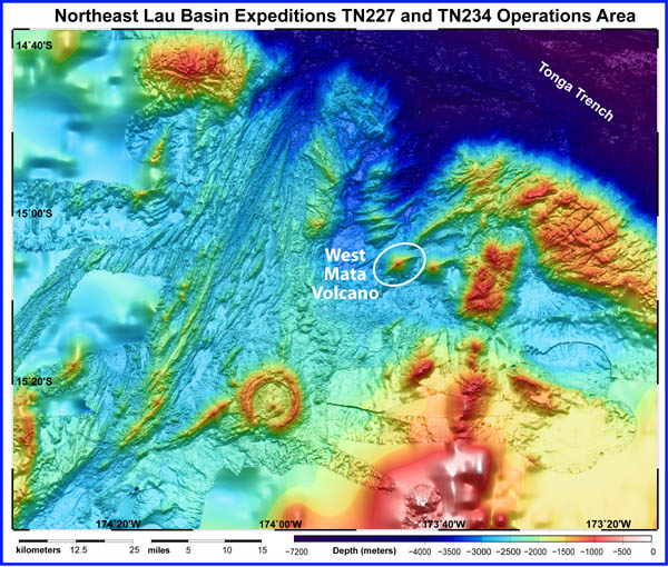
expedition-area-bathymetry-with-text.tif (69MB) |
 |
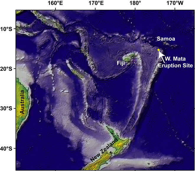
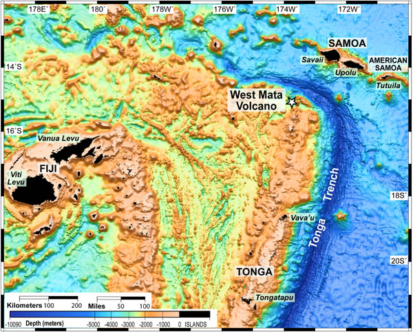
lau-basin-area-satellite-altimetry-with-text.tif (71MB) lau-basin-area-satellite-altimetry-no-text.tif (71MB) lau-basin-area-satellite-altimetry-with-text-lores.jpg (1.2MB) The West Mata Volcano is in the Lau Basin. The Lau Basin is located in the southwest Pacific, within an area bounded by Samoa, Tonga and Fiji (the black areas on the map, which are the only areas above water). This area is home to many submarine volcanoes, but very few have been explored. Map courtesy of NOAA. |
 |
Molten_lava-lores.jpg (.2MB) Molten_lava.jpg (1.3MB) Superheated molten lava, about 2200 degrees Fahrenheit, is about to explode into the water in this image. The area in view is about 6-10 feet across in an eruptive area approximately the length of a football field that runs along the summit. Images courtesy of NSF and NOAA. |
 |
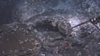
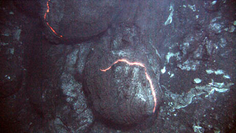
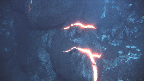
pillow_lava1.tif (12MB) pillow_lava1-lores.jpg (.3MB) These are consecutive images. The orange glow of superheated magma, about 2,200 degrees Fahrenheit, is exposed as pillow lavas extrude from the eruption. These images are approximately three feet across in an eruptive area approximately the length of a football field that runs along the summit. Images courtesy of NSF and NOAA. |
 |
pillow_lava2.tif (12MB) (caption above pillow-lava1) |
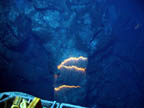 |
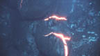
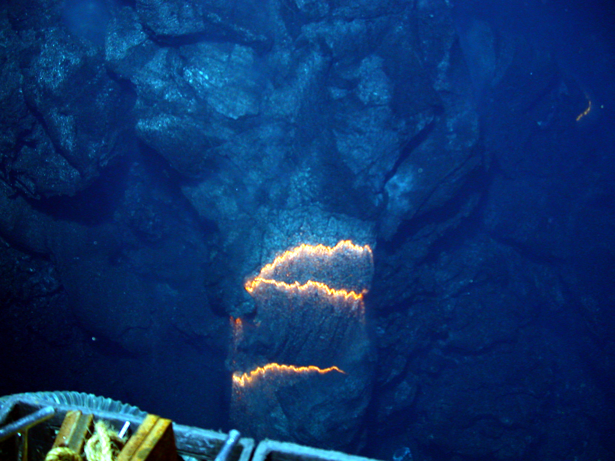
pillow_lava_long.jpg (.6MB) hadesj420-long-pillow.jpg (2.5MB) Bands of glowing magma, about 2,200 degrees Fahrenheit, are exposed as a pillow lava tube extrudes down slope. This image is approximately three feet across in an eruptive area approximately the length of a football field that runs along the summit. Image courtesy of NSF and NOAA. |
 |
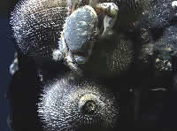
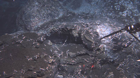
shrimp-summit.tif (12MB) shrimp-summit-lores.jpg (.34MB) Shrimp congregate near the summit of West Mata Volcano and may be the same species as those found at eruptive sites more than 3,000 miles away. This image is approximately nine feet across in an eruptive area approximately the length of a football field that runs along the summit. Image courtesy of NSF and NOAA. |
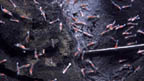 |
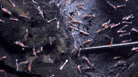
shrimp-summit-zoom.tif (12MB) shrimp-summit-zoom-lores.jpg (.35MB) A close-up view of the shrimp at the summit of West Mata Volcano, which may be the same species as those found at eruptive sites more than 3,000 miles away. Image courtesy of NSF and NOAA. |
For more information regarding the W. Mata eruption, contact:
Bill Chadwick, EOI Program Division Leader
Joe Resing, Expedition Chief Scientist
Bob Embley, Geologist
Susan Merle, Imagery/Maps