| Seismic Activity - East Pacific Rise at 1 45'N (June 7-9, 1997) | ||||
|
|
||||
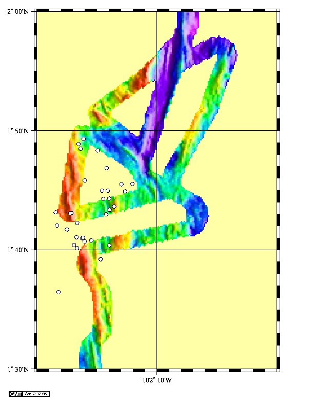 (click to enlarge) Detailed view of epicenter from the EPR near 1 45'N recorded 7-9 June, 1997. Bathymetry is from the URO compilation by Stacy Tighe. Mean position is 1.722N, 103.262W. Measured standard errors are .046 degrees latitude; .024 degrees longitude. 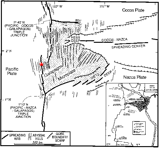 Regional view of event locations from the EPR at 1 45'N recorded 7-9 June, 1997. Bathymetry from SeaSAT altimetry. |
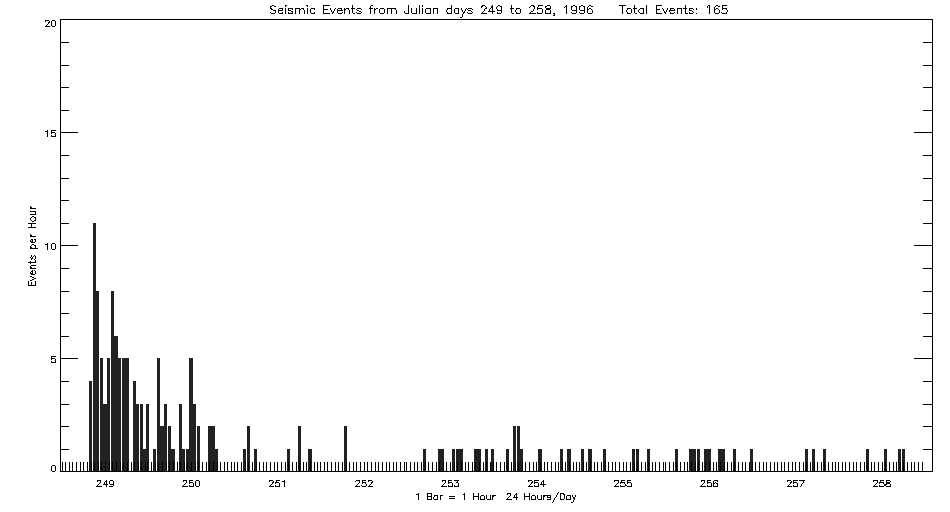
Beginning June 7, 1997 at 2237Z, the Autonomous Hydrophone Array deployed by PMEL in the Eastern Equatorial Pacific recorded what may be volcanic seismicity from the East Pacific Rise near 1-43'N and 102-16'W. The activity continued for 48 hours and includes 40 well-located epicenters. The sparse bathymetry from the site indicates a small inflated ridge segment and a relatively complex structural setting. The location is on the western boundary of the Galapagos Microplate, and the regional map below indicates complex structure. The character of the seismicity is very similar to that observed to the north at 3-20'N on the EPR one year earlier.
Listing of earthquake epicenters from the EPR at 22 S recorded September, 1996.
|
|||
|
Last
Updated: 01/05/01
Address inquiries to: Robert Dziak - Seismologist - robert.p.dziak@noaa.gov |
||||